Town Walk 2026 - Part 18 -
The Erewash Canal to Rutland Street
w/e 31 May 2026
All of this week's pictures were
taken with a Nikon D3300 camera.
This part equates to part of Stage 29 and all
of Stage 30 from the original Town Walk from 2004 and 2005.
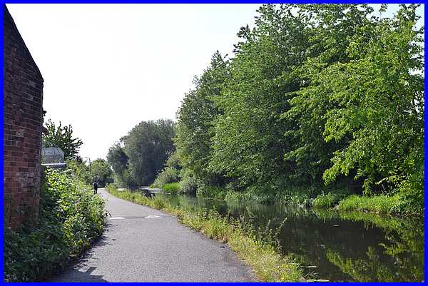
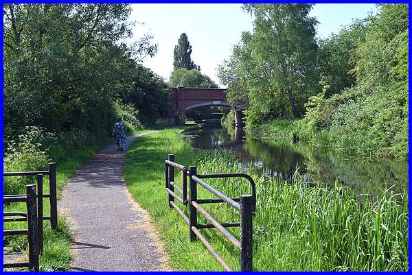
We ended Stage 29 of the original
Town Walk in December 2004 with a little history of the Erewash
Canal stating that it "was built in 1778/9 at a cost
of £21,000" and I commented that "it would
probably cost that much today to fill in the potholes along just
a short stretch of the canal!" Well that money must
have been found as the first half on the section of the canal
towpath has been transformed into a narrow tarmacked lane complete
with speed bumps. In its heyday the canal was "very successful
transporting coal, bricks and iron" but is now used
for leisure and recreational purposes.
|
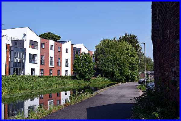
The second image in 2004 was a look back towards the Awsworth
Road canal bridge where "we can see the outbuildings
where horses that worked the canal towpath were stabled overnight"
at the rear of the Bridge Inn. The Bridge Inn, stables and
all have now been demolished and replaced by the Canal Vue Care
Home. Whilst this new modern building is a much needed, useful
and much appreciated facility, in some respects it is sad that
part of the canal's history has been lost forever.
|
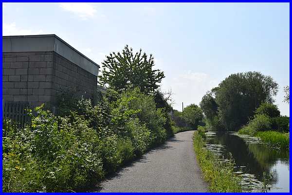
On the other hand we are fortunate that "the entrepreneurs
of the eighteenth century have left us a legacy that can still
be admired." In December 2004 "on a cold frosty
morning in December, with mist rising from the semi-frozen water
the views have a certain charm and beauty all of their own."
In May 2026, The hottest May on record, it is still a pleasure
to walk by the canal.
|
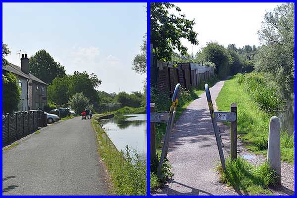
It was a few weeks later in January 2005 that we returned to
the Town Walk "a little further along the canal on a
much milder if somewhat windier day in January." In
May 2026 we continued under the scorching sunshine passing a
number of canal side properties to the end of the tarmacked surface
to the rest of the canal towpath.
|
We continued along the towpath to the next footbridge over the
canal and in 2005 passed "the remains of what was once
the railway bridge that carried the line into the Ilkeston Town
Station at the bottom of Bath Street". Those foundations
have now gone but a new road bridge carrying Millership Way now
crosses the canal in approximately the same place.
|
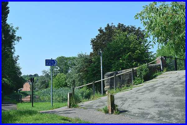
"Just beyond the remains of the railway bridge (now
Millership Way Bridge) we make a right turn to cross over
the canal.
|
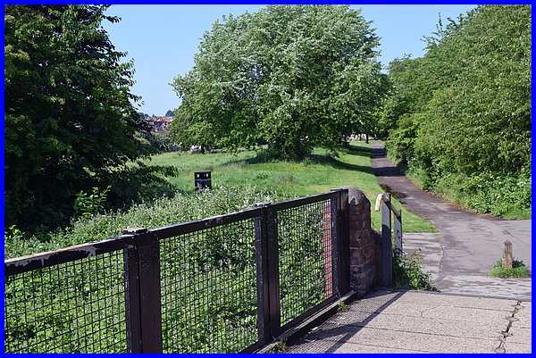
The view of the winter landscape was much more extensive in 2005
but 21 years later nature's growth obscures much of "the
recreational area known locally as Johnny's but more correctly
called Wash Meadow". The Town Walk leaflet describes
the path leading from the canal bridge as Slack Lane, "a
reference to the time when coal was carried by horsedrawn trains
to be loaded onto vessels at the coal wharf on the Erewash Canal"
although the name no longer appears on online maps and has
been forgotten, if it was ever known, by most Ilkestonians.
|
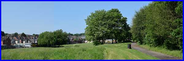
At this point on the original Town Walk I included a small panoramic
shot and included a reference to a new road that was soon to
be constructed "linking the Awsworth by-pass with Rutland
Street and Chalons Way". That road of course is Millership
Way but the panoramic photo did show the end of Rutland Street
and the old Gasworks on the corner of Belfield Street. This is
the closest I could get to repeating that panorama. I also included
a little history of the area with links to old photos on the
Picture
The Past site.
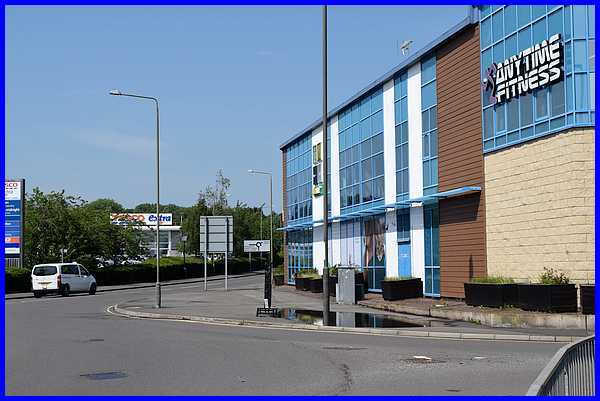
Millership Way now joins "Rutland Street here at the
entrance to Tesco's car park (left). For the supermarket to be
built, a number of small industrial units had to be demolished"
and since 2005 the Gasworks have also disappeared from the
landscape and Anytime Fitness now stands on the corner of Belfield
Street.
|
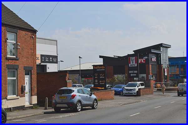
"Looking back from the side of the supermarket the large
building" that was the Gasworks now reveals more businesses
that occupy the site including McDonalds, Subway, Papa Johns
Pizza and KFC. I added a later note to the original Town Walk
that read "Demolition of the building began in November
2005 but has still not been fully completed as at April 2008"
but if you would like to know more about the history of the site
and the 1912 tragedy concerning a "domestic servant called
Matilda Gough" I would urge you to visit Stage 30 of the walk.
|
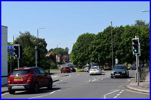
In 2005 I wrote "We are now approaching the final stages
of the Town Walk. All that remains is to walk up Bath Street
to return to our starting place at the Erewash Museum but to
attain Bath Street we have to circumnavigate the traffic island
at the end of Chalons Way." At that point the"Aldi
Superstore - the building on the right hand side of the view
above" and now obscured by the trees on the island had
just opened. Tesco's store, on the left in this image stands
 opposite
" the newly constructed premises of the Ilkeston Christian
Centre, The
Arena (right)." It's hard to believe that Tesco,
Aldi and The Arena will soon be celebrating a quarter of a century
in these buildings but they have become a part of the landscape.
There is still however "a reminder of the town's industrial
past" with "a wagon emblazoned with the word
"Stanton" .... - a reference to one of the former major
employers of the town's work force" on the traffic island.
We are now nearing the "end the 'Cotmanhay Loop' extension
of the Town Walk and" will soon pick up the main route
to the Erewash Museum. opposite
" the newly constructed premises of the Ilkeston Christian
Centre, The
Arena (right)." It's hard to believe that Tesco,
Aldi and The Arena will soon be celebrating a quarter of a century
in these buildings but they have become a part of the landscape.
There is still however "a reminder of the town's industrial
past" with "a wagon emblazoned with the word
"Stanton" .... - a reference to one of the former major
employers of the town's work force" on the traffic island.
We are now nearing the "end the 'Cotmanhay Loop' extension
of the Town Walk and" will soon pick up the main route
to the Erewash Museum.
|
