Ilkeston Town Walk - Stage 30 - Rutland
Street
w/e 16 January 2005
All this week's
pictures were taken with a Kodak DX6490
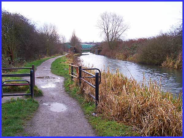
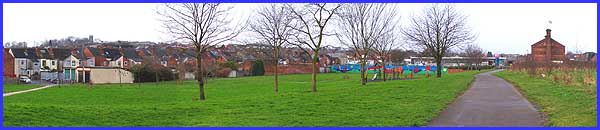
In Stage 29 of the Town Walk we joined the Erewash Canal at Awsworth
Road on a cold and frosty December morning. Now we resume just
a few weeks later a little further along the canal on a much
milder if somewhat windier day in January. Our immediate goal
is the bridge over the canal seen in the distance at the rear
of the green buildings that form the Station Road Retail Park.
|
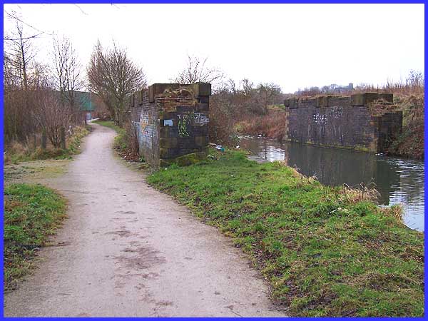
But before we reach our crossing point we must first pass the
remains of what was once the railway bridge that carried the
line into the Ilkeston Town Station at the bottom of Bath Street
(as opposed to Ilkeston North on Heanor Road). Despite its proud
history, like many other areas, it seems nowhere is safe from
the graffiti.
|
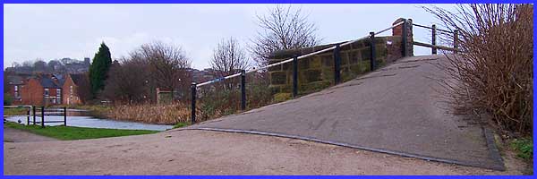
Just beyond the remains of the railway bridge we make a right
turn to cross over the canal.
From the bridge, the recreational area known locally as Johnny's
but more correctly called Wash Meadow stretches our before us
to the left. Immediately in front is the path that goes by the
name of Slack Lane. This is a reference to the time when coal
was carried by horsedrawn trains to be loaded onto vessels at
the coal wharf on the Erewash Canal for transportation to Nottingham
and beyond.
|
The area around the lower end of Bath Street and Rutland Street
has seen many alterations in recent years and the view across
Wash Meadow will soon be an addition to those changes as a new
road linking the Awsworth by-pass with Rutland Street and Chalons
Way is to be constructed across here. One of the leaflets used
as a the basis for this Town Walk series was published in 1993
and at this point, it refers to the old Adlington Flour Mill
to the right of Slack Lane saying that it is recognisable now
by the name of Ilkeston Metal and Waste painted on the wall.
Regrettably this is no longer true as the mill, built about 1877,
gutted by fire in 1912, rebuilt and used for various activities
before ending its life as a scrap metal depot, was demolished
in 2002. I cannot therefore show a picture of the mill here but
there are two excellent images on the Picture The Past site. Search for DCER000914
and DCER000027.
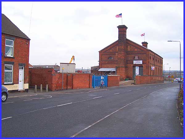
The proposed new road will join Rutland Street here at the entrance
to Tesco's car park (left). For the supermarket to be built,
a number of small industrial units had to be demolished along
with a council depot and an omnibus garage. These aforementioned
premises all occupied the site of the railway line and Town Station.
It was at this point at the side of the large building seen above
that the railway line crossed Rutland Street/Slack Lane. The
road off to the right is Belfield Street which was the scene
of a tragedy in 1912.
|
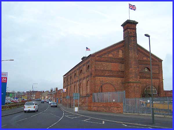
Looking back from the side of the supermarket the large building*
(sporting the Union Flag and the Stars and Stripes as a mark
of respect following 9/11) was once part of the town's Gasworks.
An even taller building stood in the gap between that building
and the house seen on the left of this picture. Another image
taken in 1962 (DCER000915) on the Picture The Past site shows not only the
Gasworks but also Adlington's Mill. The 1912 tragedy resulted
from three explosions at the Gasworks causing trains to overturn,
walls to collapse and homes to be flooded when water storage
tanks were ruptured. Only one person died as a result of the
accident and that was a nineteen year old domestic servant called
Matilda Gough. She was tragically drowned in the cellar of the
house in Belfield Street belonging to her employer, Mr Bostock,
a Rutland Street beer retailer. Both fires at the Gasworks and
Adlington's Mill occurred in the early part of 1912 and even
as recently as November 2004 there was another fire in the vicinity.
I suspect that there have been several more in the intervening
years and the callous among us would probably refer to the Rutland
Street area as one of the town's industrial hotspots!
* Demolition of the building began in November 2005 but has
still not been fully completed as at April 2008.
|
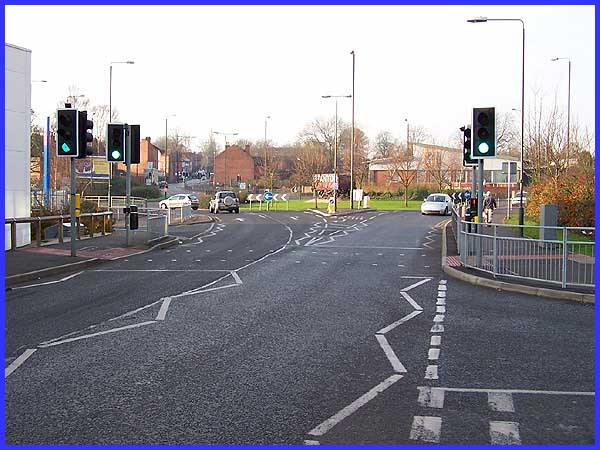
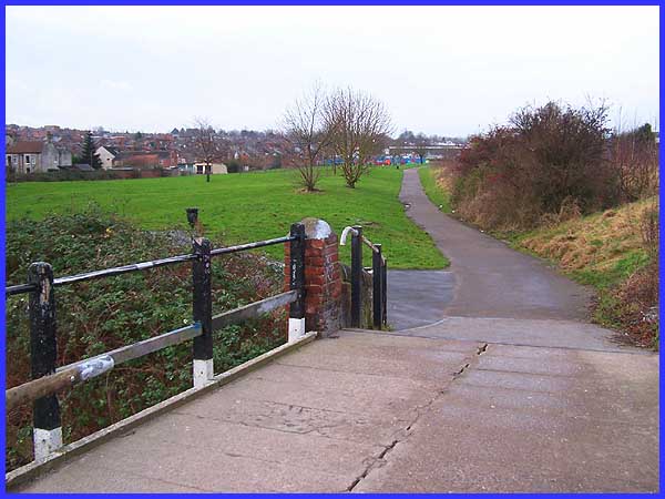
We are now approaching the final stages of the Town Walk. All
that remains is to walk up Bath Street to return to our starting
place at the Erewash Museum but to attain Bath Street we have
to circumnavigate the traffic island at the end of Chalons Way.
Any ex-Ilkestonian who has not been in the town for a number
of years would now find this area almost unrecognisable. Bath
Street has been foreshortened to end at Manners Road which joins
the island opposite the realigned Rutland Street. The site where
the Rutland Arms once stood on Bath Street is now occupied by
the just opened Aldi Superstore - the building on the right hand
side of the view above - 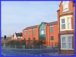 whilst
opposite the white building on the left of the picture (Tesco)
are the newly constructed premises of the Ilkeston Christian
Centre, The
Arena (small picture right). Amid all the new development
though, there is still a reminder of the town's industrial past.
In the middle of the island on a short length of railway line
stands a wagon emblazoned with the word "Stanton" (see
centre of main picture) - a reference to one of the former major
employers of the town's work force, until its demise towards
the end of the last century. This brings to an end the "Cotmanhay
Loop"extension of the Town Walk and in the next stage we
shall resume our walk back on the main route at the lower end
of Bath Street. whilst
opposite the white building on the left of the picture (Tesco)
are the newly constructed premises of the Ilkeston Christian
Centre, The
Arena (small picture right). Amid all the new development
though, there is still a reminder of the town's industrial past.
In the middle of the island on a short length of railway line
stands a wagon emblazoned with the word "Stanton" (see
centre of main picture) - a reference to one of the former major
employers of the town's work force, until its demise towards
the end of the last century. This brings to an end the "Cotmanhay
Loop"extension of the Town Walk and in the next stage we
shall resume our walk back on the main route at the lower end
of Bath Street.
|
