"Lock to Lock" .... & Beyond
Ilkeston - Stenson's to Cotmanhay
w/e 01 November 2009
All this week's pictures were taken
with a Kodak DX6490
We've now actually completed all the sections between
"Locks
on the Erewash Canal" on the eastern side of Ilkeston
but the canal still has a good distance to run before it exits
the Ilkeston boundary and continues northwards to the Langley
Mill Basin, hence this bonus part following the canal through
Cotmanhay.
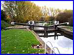
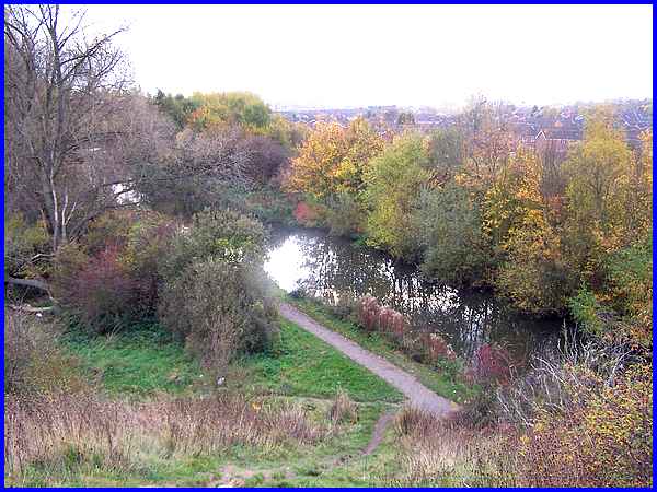
We pick up the route at Stenson's Lock where the canal passes
through some pleasant but seemingly unremarkable scenery. Beyond
the trees and hedgerows though lies a history of an industrial
heritage, a little of which will soon become apparent.
|
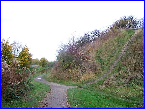
About two hundred yards from the lock the towpath makes a slight
detour around this embankment which marks the spot where the
Great Northern Railway (GNR) used to cross the Erewash Valley
on its east-west route between Nottingham and Derby.
|
Scrambling up the embankment provides a view back along the canal
and also sight of the Nelson Street housing development from
the second half of the twentieth century just beyond the trees
plus a hazy glimpse of the town centre on the distant horizon.
|
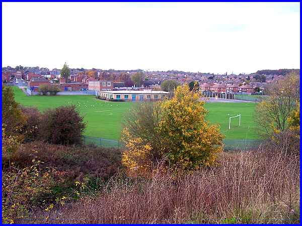
From the same position, the panorama across the canal (visible
bottom left) reveals from left to right, a view up Vernon Street
to Cotmanhay Road, the Bennerley Fields School complex, housing
at Cotmanhay with Cotmanhay Wood on the hilltop to the right.
|
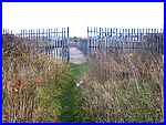 At the
top of the embankment the path levels off and leads through a
fence where presumably there used to be a gate (left) on to the
Bennerley Viaduct. It must be nigh on fifty years since I was
last on the viaduct and back then I was on board a steam train
with some schoolmates heading for some Christmas shopping in
Nottingham. If memory serves me correctly that would have been
in November or December 1959 when such a trip for unaccompanied
schoolboys not long out of short trousers was quite an adventure.
After Dr Beeching's axe fell in the 1960s steam trains ceased
to run over here and it closed to rail traffic in 1968. At the
top of the embankment the path levels off and leads through a
fence where presumably there used to be a gate (left) on to the
Bennerley Viaduct. It must be nigh on fifty years since I was
last on the viaduct and back then I was on board a steam train
with some schoolmates heading for some Christmas shopping in
Nottingham. If memory serves me correctly that would have been
in November or December 1959 when such a trip for unaccompanied
schoolboys not long out of short trousers was quite an adventure.
After Dr Beeching's axe fell in the 1960s steam trains ceased
to run over here and it closed to rail traffic in 1968.
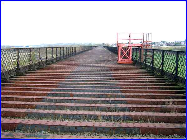
The viaduct built between May 1876 and November 1877 to a design
by the Chief Civil Engineer of the GNR, Richard Johnson, opened
in January 1878 and stretched nearly 500 yards (about 460m) across
the Erewash Valley. It is now a Grade 2 listed structure.
|
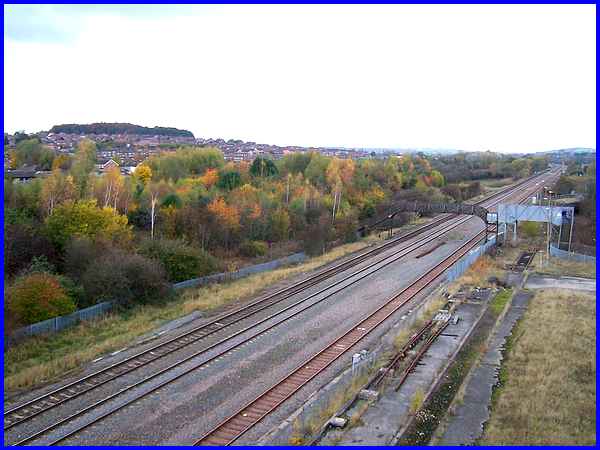
 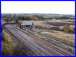 As
well as crossing the river in the valley, the viaduct also crosses
the Erewash Valley Line that still links Nottingham and Sheffield
and as can be seen above the line is running parallel to the
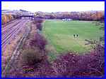
tree shrouded canal. To the south (left) Booth's Playing Field
(mentioned in Part 6) can be seen whilst the northern view (right)
overlooks the former Bennerley Junction that once served a colliery
on the site. As
well as crossing the river in the valley, the viaduct also crosses
the Erewash Valley Line that still links Nottingham and Sheffield
and as can be seen above the line is running parallel to the
tree shrouded canal. To the south (left) Booth's Playing Field
(mentioned in Part 6) can be seen whilst the northern view (right)
overlooks the former Bennerley Junction that once served a colliery
on the site.
Old maps can convey a lot of history and the 1887 edition of
the Ordnance Survey shows both the junction and the colliery
but by 1901 the colliery had become an iron works. This nomenclature
continued to at least the 1947 edition but my first memories
of the site date from the 1960s by which time it had become a
Coal Screening Plant. Roy Gregory (Guest Page 2), a good friend of Ilkeston
Cam who grew up in the town but now resides in the USA, once
described this area to me as his "playground" and even
sent me a couple of images which can now be seen on Ffion Taylor's site. One shows the Coal Screening
Plant in relation to the viaduct whilst the other is an aerial
view of the whole site. Both are valuable as reminders of the
area's industrial past.
|
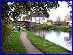
But it's time now to descend from the viaduct and continue along
the towpath where the Bridge Inn at Cotmanhay, not to be confused
with the similarly named pub on Awsworth Road near Barker's Lock,
soon comes into view. Any such confusion may soon be another
thing confined to history as the Awsworth Road pub is currently
closed and boarded up and in this economic climate, it may never
reopen.
|
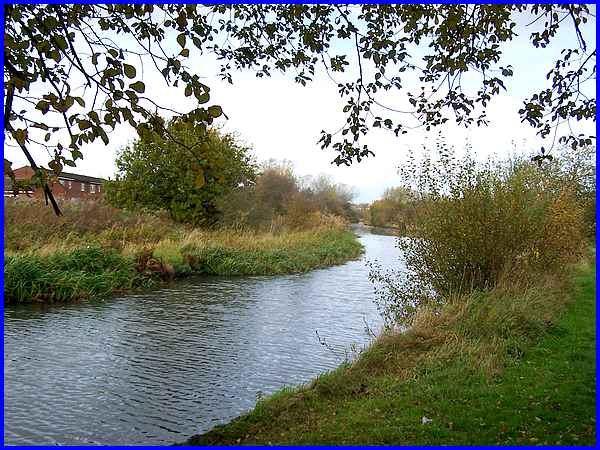
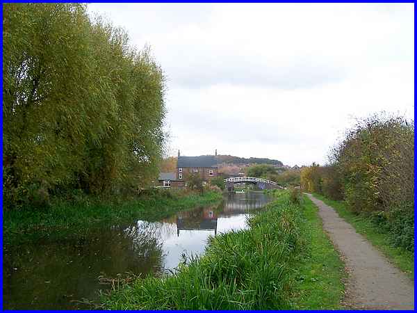
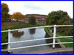 From the
canal bridge (left) at the Cotmanhay Bridge Inn the view along
the canal to the north is curtailed by a bend in its route but
from here on the western side is overlooked by the Hopewell Farm
housing estate, another development from the latter part of the
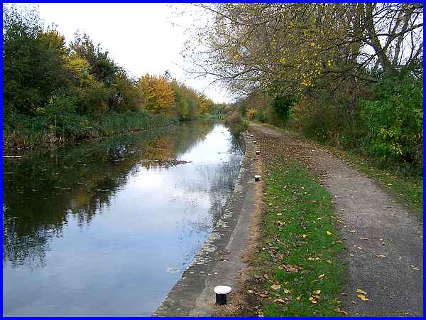
twentieth century. As the canal straightens out again (above)
and disappears into the distance, it continues along the boundary
of the estate towards Shipley and eventually its northern extremity
at the Langley
Mill Basin. Crossing the boundary just to the north of Cotmanhay,
the canal not only leaves the town behind but also leaves the
Borough of Erewash to enter the Amber Valley District. From the
canal bridge (left) at the Cotmanhay Bridge Inn the view along
the canal to the north is curtailed by a bend in its route but
from here on the western side is overlooked by the Hopewell Farm
housing estate, another development from the latter part of the
twentieth century. As the canal straightens out again (above)
and disappears into the distance, it continues along the boundary
of the estate towards Shipley and eventually its northern extremity
at the Langley
Mill Basin. Crossing the boundary just to the north of Cotmanhay,
the canal not only leaves the town behind but also leaves the
Borough of Erewash to enter the Amber Valley District.
This is as far as we go with this series though but there are
some more pictures of the Erewash Canal from Shipley Lock towards
Langley Mill from a 2003 walk here.
|
