Langley Mill - Canal Basin
w/e 06 July 2008
All this week's pictures were taken
with a Kodak DX6490
A settlement at Langelei with a church and a mill
was recorded in the Domesday Book and, situated at a crossing
of the River Erewash linking Heanor and Derby to the west with
Eastwood and Nottingham to the east, it became known as Langley
Bridge.
The Midland Railway Company opened a line on the western side
of the river in 1847 and this still exists today but the Great
Northern branch line on the eastern side of the river that opened
in 1875 closed in the 1960s and all remnants of it were lost
in 1982 with the construction of the A610 road extension. All
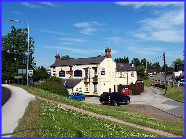
remnants that is, save for the name of the public house that
was renamed "Great Northern" sometime after 1875. It
was originally called "Junction Navigation".
|
Several large industries arrived with the Midland Railway line
and after 1847 many cottages were built to house the workers
and the name of the settlement was changed to Langley Mill. Prior
to the railways, it was the canals that had led to the industrial
development of the village and the Great Northern pub today boasts
a canal side garden sitting alongside as it does the start of
the Nottingham Canal. This canal is no longer navigable; in fact
much of it has been lost altogether due to opencast coal mining
but this small section that provides moorings for several narrow
boats at the side of the pub is now known as the Great Northern
Canal Basin.
|
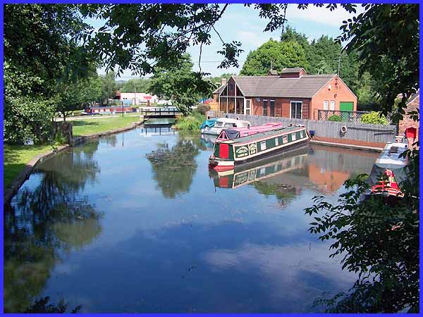
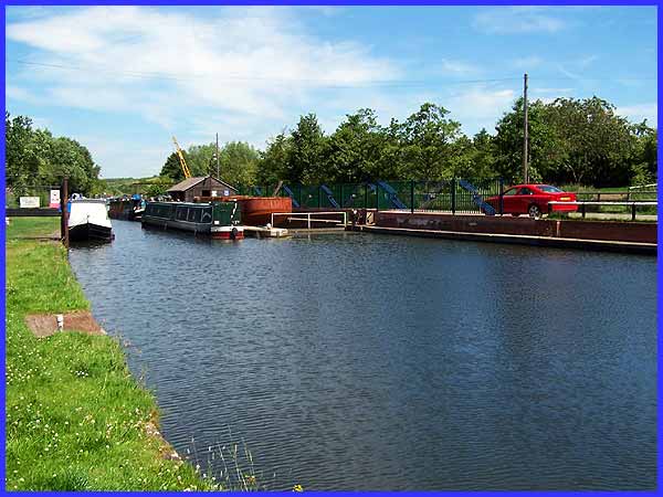
The Nottingham Canal was the last of the canals that meet at
Langley Mill to open. Opening in 1796, it joined the Erewash
(1779) and Cromford (1794) Canals making Langley Mill a unique
place in Britain being the only place where three canals meet.
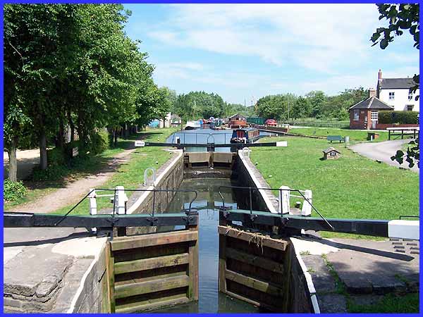
The image above shows the junction with the Erewash to the left,
the Cromford in front and the Nottingham to the right.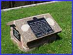 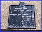 The
memorial stone shows that the Great Northern Basin was constructed
by William Jessop in 1796 and restored by the Erewash Canal Preservation
& Development Association (ECP & DA) between 1971 and
73. It also indicates mileages to several places including Cromford
(14½) to the north and London (171), Liverpool (182) and
Nottingham (22) via the Erewash Canal. These distances are much
longer of course than the direct routes as the canals follow
the contour lines. The
memorial stone shows that the Great Northern Basin was constructed
by William Jessop in 1796 and restored by the Erewash Canal Preservation
& Development Association (ECP & DA) between 1971 and
73. It also indicates mileages to several places including Cromford
(14½) to the north and London (171), Liverpool (182) and
Nottingham (22) via the Erewash Canal. These distances are much
longer of course than the direct routes as the canals follow
the contour lines.
|
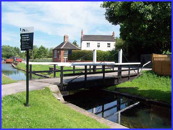
The entrance to the former Nottingham Canal is crossed by a swing
bridge and the sign provides operating instructions for the uninitiated.
|
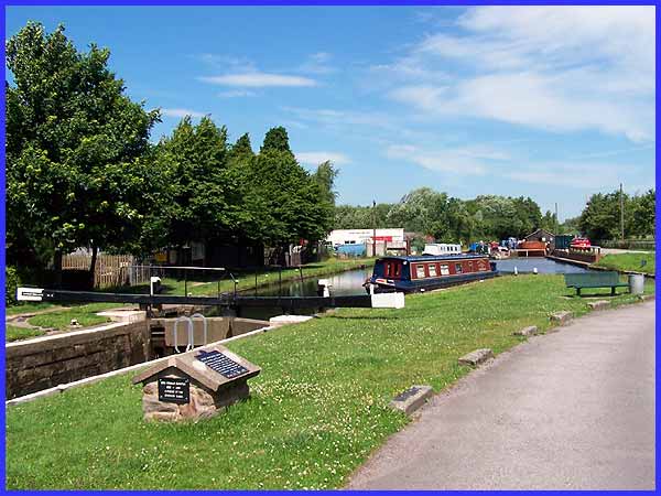
I've often put images of the Erewash Canal on this site but this
is the first time I've shown its northern extremity. Whilst this
lock is at the end of the Erewash, apparently it is actually
the first lock of the Cromford Canal. A plaque on the wall under
the road bridge (left) says that the Cromford Canal was engineered
by 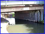 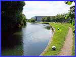 William Jessop and Benjamin Outram whilst
the white sign in the middle of the bridge welcomes boaters to
the Cromford Canal and the Great Northern Basin. Whilst many
of the large industrial concerns such as Aristoc and Vic Hallam
are no longer to be found in Langley Mill they have been replaced
by smaller industrial units with many visible alongside the Erewash
Canal to the south (right). William Jessop and Benjamin Outram whilst
the white sign in the middle of the bridge welcomes boaters to
the Cromford Canal and the Great Northern Basin. Whilst many
of the large industrial concerns such as Aristoc and Vic Hallam
are no longer to be found in Langley Mill they have been replaced
by smaller industrial units with many visible alongside the Erewash
Canal to the south (right).
|
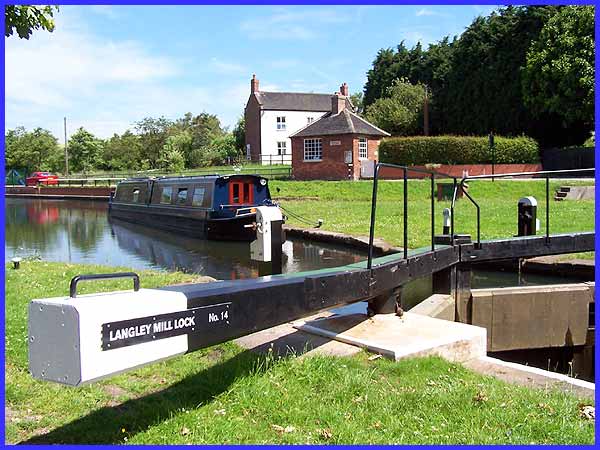
This is another view of the north end of the lock but the small
brick building in the centre is the Toll Office. Langley Mill
is often cited as a prime example of the rise and fall of an
industrial village during the last 200 years. Coal was one of
the main reasons for its growth as an industrial centre but the
demise of the coal industry inevitably led to a decline and the
last commercial boat to sail from here was in 1952. With the
current rising fuel prices and road congestion, the smaller businesses
that remain may well again be looking to the canals as an alternative
mode of transport. Even if a toll had to be paid it could well
turn out to be more economical.
|
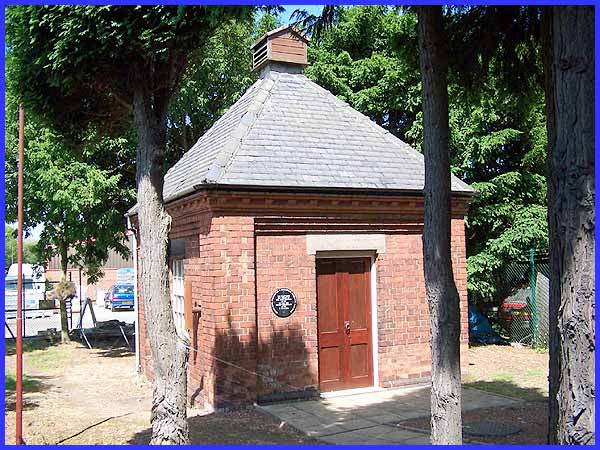
Another similar but smaller brick building almost opposite the
Toll Office on the other side of the canal was restored by the
ECP & DA and opened in 1993 on the 25th Anniversary of the
Association. This is the Pump House and it provides back pumping
for both the Great Northern Basin and the Cromford Canal.
|
From the junction of the three canals, the Cromford Canal runs
northwards for only about 600 yards providing a dry dock and
more narrow boat moorings. In total there are still about five
miles of the Cromford that are in water and there has long been
a campaign, which is ongoing, to restore the rest of it .
In preparing this page I have made extensive use of several web
sites and I would recommend visits to them if you would like
to know more about this area and its history:
ECP
& DA
Heanor and District Local History Society - Langley Mill - Canals - Railways
The
Friends of Cromford Canal
|
