Town Walk 2026 - Part 16 -
Manners Link to Charlotte Street
w/e 10 May 2026
All of this week's pictures were
taken with a Nikon D3300 camera.
This part equates to parts of Stages 25, 26 and
27 from the original Town Walk from 2004.
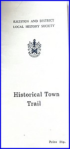 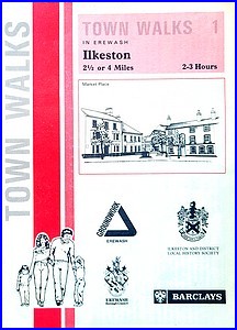 When
I devised the route of the original Town Walk in 2003, I based
it on two leaflets that featured different but overlapping routes
with some diversions and additions of my own. The older leaflet
(left) was a "Historic Town Trail" compiled and published
by the Ilkeston and District Local History Society and the later
one (right) was from a "Town Walks" series published
by Erewash Groundwork Trust in 1993. When
I devised the route of the original Town Walk in 2003, I based
it on two leaflets that featured different but overlapping routes
with some diversions and additions of my own. The older leaflet
(left) was a "Historic Town Trail" compiled and published
by the Ilkeston and District Local History Society and the later
one (right) was from a "Town Walks" series published
by Erewash Groundwork Trust in 1993.
The latter leaflet included a "Cotmanhay Loop" which
is the one we will be following. N.B. this is not the same, although
very similar, to the Cotmanhay
Loop in the Walking For Health section of this site.
When we walked this next part of the route in 2004, we found
it impossible to keep to the instructions in the 1993 leaflet
due to an impassable section between the Manners Link and Boweswell
Road. We had to take an alternative route to Heanor Road. For
this 2025/2026 repeat of the Town Walk I've often taken similar
images to those from earlier but now, for this next section,
we will aim to keep to the route as described in the later leaflet
and take photos as appropriate.
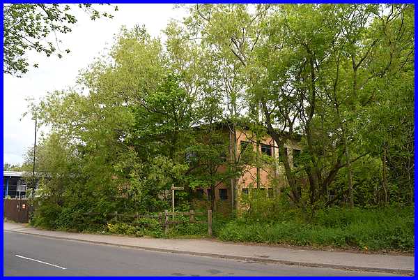
The Manners Link footpath runs
from the Rec to Heanor Road and this part from the start of the
section at Manners Avenue looks very similar to how it did in
2004 except for the 22 years of tree growth. In 2004 the largely
obscured building was occupied by the "headquarters of
the Travel Division" of the Ilkeston Co-Op travel agency
who also had "a branch within the Co-Op store in the
centre of town." Since then the town centre store closed
and this building became offices for the Derbyshire County Council.
In 2025 it was decided to consolidate the council offices elsewhere
and the future of the building at that point was unknown.
|
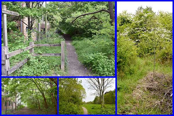
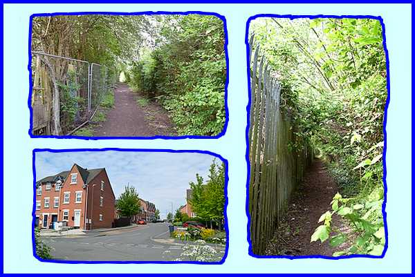
The Manners Link footpath follows "the course
of the former Great Northern Railway. Until Dr. Beeching wielded
his axe in the 1960s, steam engines hauled their carriages and
wagons along here between Nottingham Victoria and Derby Friargate.
The route has now returned to nature". The tunnel-like
path runs alongside two large buildings on the left (top and
bottom left) until it opens out into a grassy area on the right
(centre bottom). The old leaflet "mentions a pond on
the left hand side but there is no obvious sign of this."
I have walked this path several times and have never seen
the pond and a brief foray into the jungle (right) to the left
of the path still did not reveal it. In 2004 I stepped off the
path onto waterlogged ground. Now it is dry but the advice would
still be the same - " BE WARNED - stay on the path!"
|
Near the end of the path in 2004 there was a signpost, which
has now gone, and this was where we were supposed to turn left
but the path then was impassable. Instead we went right to pass
the Old Station Surgery built on the site of the Ilkeston North
railway station and the Police Station to reach Heanor Road.
The path to the left is now passable so we can now follow the
route as advised in the Town Walk leaflet.
|
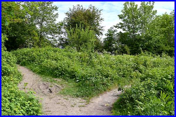
After a short distance the leaflet says to turn left again "along
a dirt track between allotments to Boweswell Road." A
new housing estate has been built on the former allotments and
there are several access points but we stuck to the instructions
and followed, with a little difficulty in parts, the dirt path
although in hindsight it would have been far easier to walk through
the estate roads.
|
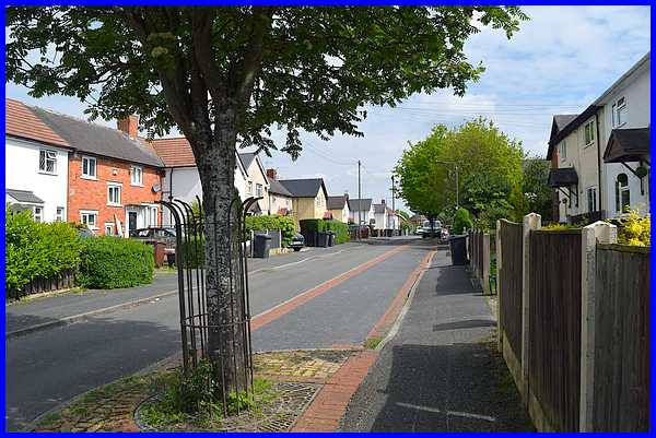
The path eventually leads to
Boweswell Road which "is typical of many housing
developments of the years between the two World Wars ."
|
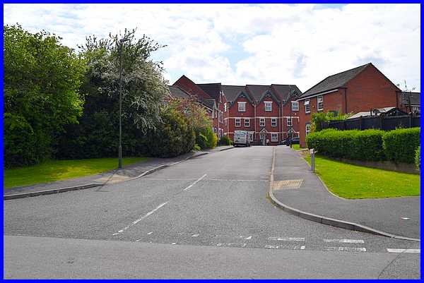
Shortly before meeting Heanor Road an access, Nether Slade Road,
has been constructed into the new estate. There is also a direct
access to the estate from Heanor Road but by following the described
route rather than the diverted route of 2004 we have by-passed
that.
|
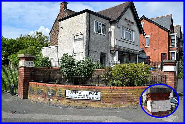
Where Boweswell Road meets Heanor Road
this was, in 2004, "the only vehicular access to the
estate which is officially called "Rutland" although
I believe the name is now very rarely used." Now the
roads through the new estate means that there are two vehicular
accesses. Pillars either side of the Heanor Road junction still
"bear initials and dates" of EBC (Erewash
Borough Council) and 1933, the date the estate was built.
|
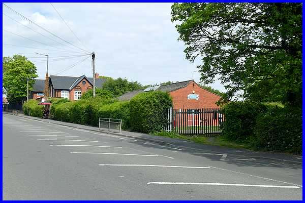
At this point the Town Walk leaflet continues "Cross Heanor
Road and go down the footpath at the back of the school ...."
but in 2004 I wrote "Heanor Road is one of the main thoroughfares
into Ilkeston and can at times be very busy. A much safer option
therefore, is to continue up Heanor Road as far as, and perhaps
even beyond, the school to use one of three pedestrian crossings".
This enabled us to get a closer look at Granby Junior School,
(seen above on the left), the former hospital, now a nursing
home and the former Ebenezer Church, now an arts centre. Now
though with a lull in the traffic, we can cross the road to the
footpath.
|
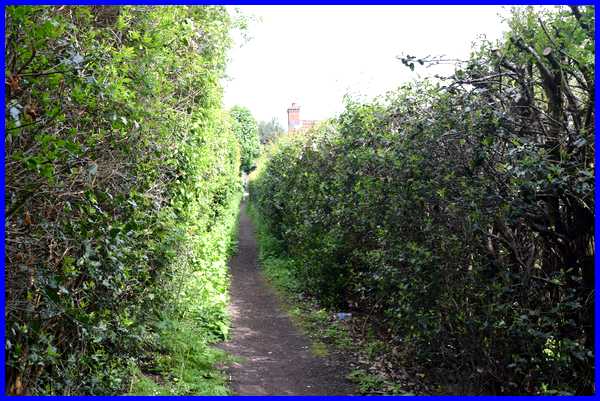
After a slight bend, the path runs for about 100 yards between
high hedges to Charlotte Street.
|

The path brings us out on Charlotte Street close to a small development
accessed by the road on the right which "used to lead
to Selby's Nurseries. The nurseries have now gone" and
the road is now called Haddon Nurseries. From here we will continue
to follow the Cotmanhay Loop as described in the Town Walk leaflet.
|
