Shipley Park - Miller-Mundy
Memories
w/e 04 March 2007
All
this week's pictures were taken with a Kodak DX6490
Part 3 - Mainly About The Railway
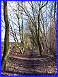
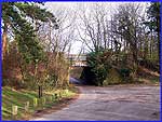  This third part deals
mainly with the railways that once served the collieries in what
is now Shipley Country Park and we resume our walk at Harmer's
Bridge to continue along the Nutbrook Trail towards the area
of Shipley known as The Field. The site of the former Newcastle
Colliery is disguised by the wooded area on the left of the Trail
which at this point is still following the route of the old railway
line. This third part deals
mainly with the railways that once served the collieries in what
is now Shipley Country Park and we resume our walk at Harmer's
Bridge to continue along the Nutbrook Trail towards the area
of Shipley known as The Field. The site of the former Newcastle
Colliery is disguised by the wooded area on the left of the Trail
which at this point is still following the route of the old railway
line.
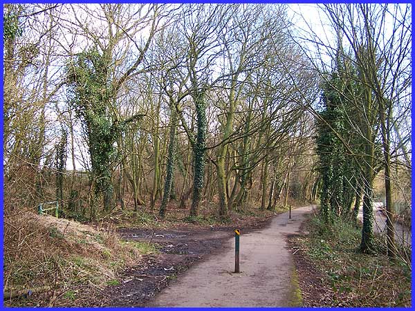
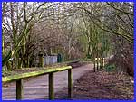
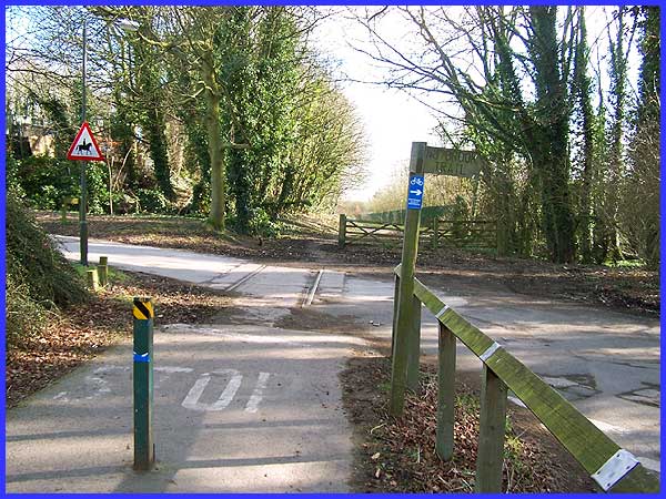
 About
half way between Harmer's Bridge and The Field the path is marked
by a couple of posts and it is here that we temporarily leave
the Nutbrook Trail and pass through the gate on the left to continue
on an almost parallel path in the same direction. This path too
follows the route of another old railway line. The Nutbrook Canal
which opened in 1796 transported coal and other goods for a time
but by 1840 the railway companies had started to expand and when
the lines were extended into the Shipley Estate, they took over
the transportation of the coal and eventually led to the decline
of the canals all over the country. The path we are now following
soon leads to a former railway station location. About
half way between Harmer's Bridge and The Field the path is marked
by a couple of posts and it is here that we temporarily leave
the Nutbrook Trail and pass through the gate on the left to continue
on an almost parallel path in the same direction. This path too
follows the route of another old railway line. The Nutbrook Canal
which opened in 1796 transported coal and other goods for a time
but by 1840 the railway companies had started to expand and when
the lines were extended into the Shipley Estate, they took over
the transportation of the coal and eventually led to the decline
of the canals all over the country. The path we are now following
soon leads to a former railway station location.
|
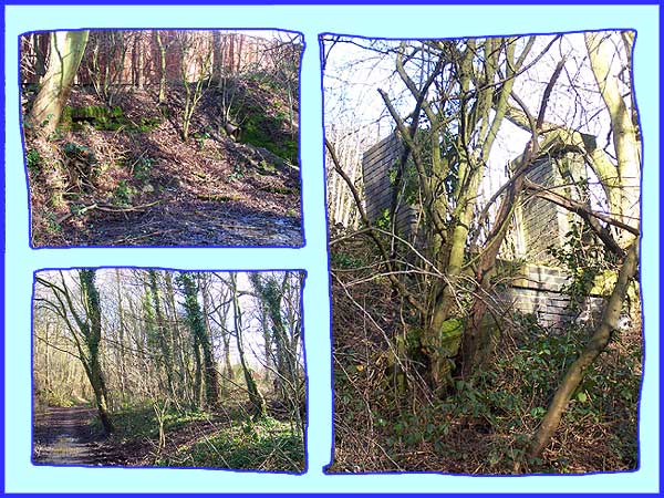
There is little of the station left to be seen but this composite
attempts to show what relics there are. Top left shows some brickwork
that marks the site of the signal box whilst almost opposite
this and seen bottom left is the raised area of land that was
the central platform of the station. A little further on and
high on the bank the remains of an old footbridge are visible
and are shown on the right above. Originally a private line from
Heanor Gate Station to Shipley Station it was later extended
to link with the GNR Station at Ilkeston near Pewit Carr. (Images
of the area near Pewit Carr can be seen in a three part walk
I completed in 2002 here, here and here.)
|
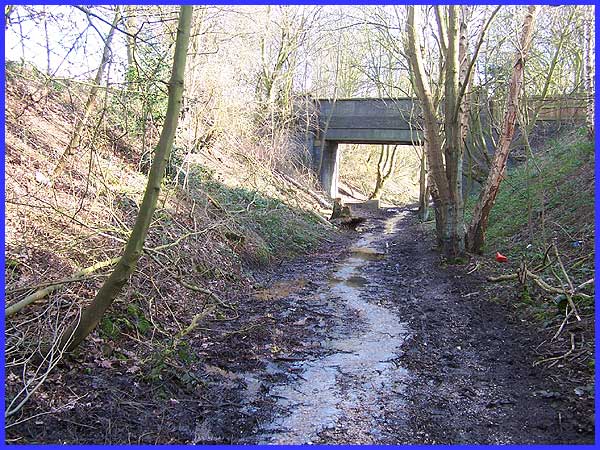
From the station we have a choice of routes. The longer one continues
along the former railway track and passes under this road bridge
at The Field. February/March though is probably not the best
time of year to follow this route as I found out to my cost.
As can be seen from the image above either side of the path was
cloying mud and the centre of it was submerged in two to three
inches of running water. Wellington boots would have been the
order of the day but by the time I had reached this point it
was too late to do anything about it!
|
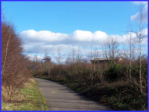
Persevering to the end of the path we must turn right and head
back towards the Nutbrook Trail but a look in the opposite direction
reveals the site of Woodside Colliery. The roof that can be seen
is on one of the original colliery buildings but the headstocks
have been erected as a memorial and although they are the original
winding wheels the structure itself is only one third of the
height of the original headstocks which were operational between
1847 and 1961 and were eventually demolished in 2000.
|
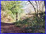 The alternative
shorter (and drier) route from the station is to cross the platform
and follow a narrow path through the woods. This passes the other
side of the footbridge seen in the composite earlier and allows
a view (left) of an old railway gate post and some fencing that
although now in a dilapidated state has survived from those early
railway days. If you know where to look, there are also some
old gas lamp fittings but unfortunately I didn't know where to
look and could not locate them. The path leads out onto this
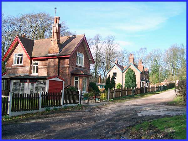
lane at The Field and descending the slope to this point we pass
the original Station House seen here on the left of the image
above. The alternative
shorter (and drier) route from the station is to cross the platform
and follow a narrow path through the woods. This passes the other
side of the footbridge seen in the composite earlier and allows
a view (left) of an old railway gate post and some fencing that
although now in a dilapidated state has survived from those early
railway days. If you know where to look, there are also some
old gas lamp fittings but unfortunately I didn't know where to
look and could not locate them. The path leads out onto this
lane at The Field and descending the slope to this point we pass
the original Station House seen here on the left of the image
above.
|
Both routes come together again here where the road from The
Field meets the Nutbrook Trail. Station House is to the immediate
left; Michael House School and some old colliery buildings are
ahead and to the left; directly in front is the track to Woodside
Colliery but here our route is to once again follow the Nutbrook
Trail to the right. Before we do so however it is worth noting
the railway lines in the road, a lasting reminder of the mineral
railway that served the mines and the pit manager's house.
Back to Part 2 -
To Harmer's Bridge ------ Forward
to Part 4 - From Coal To Cricket
Use the Quick Links below to access other pages.
|