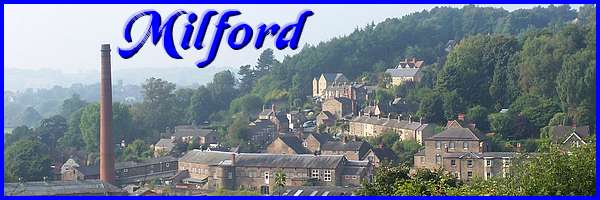
Milford Part 04 - East Milford continued
w/e 01 March 2015
All of this week's pictures were
taken with a Kodak DX6490
It is fair to say that a substantial number of properties
in Milford dating from the Strutts' industrialisation of the
valley are now Grade II Listed and we shall see more of them
in this second half of this Heritage Walk around the village
on the eastern side of the River Derwent.
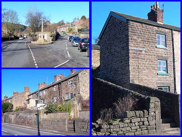
It goes without saying that the former Ebenezer Chapel, the King
William pub and the Holy Trinity Church that we saw in the first
part of the walk are all Grade II listed and it is outside Holy
Trinity where Hopping Hill splits off from the main Derby Road
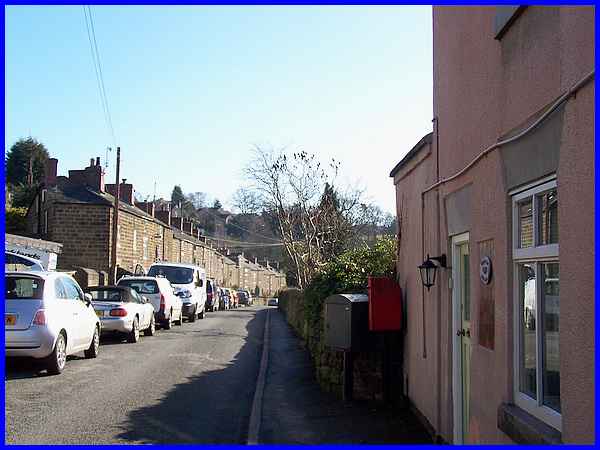
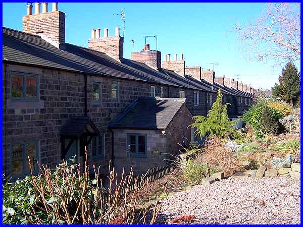
that we start this second part (top left). It was in 1818 that
the Strutts purchased the land from the Duke of Devonshire to
lay out the "new" road and build properties (bottom
left) on the wedge between it and Hopping Hill. These were constructed
between 1822 and 1823. As a result the terrace numbered 2 to
8 are named Duke’s Buildings (right) in his honour and are
also Grade II Listed.
|
The leaflet that we are following describing the route says that
here, opposite Duke's Buildings, the area alongside the river
and the weir is known as Hopping Mill. Neither the river nor
the weir are visible from Derby Road due to the intervening housing
from a later period and some industrial units but at one time
the area was the site of forges, mills gas works and among other
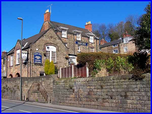
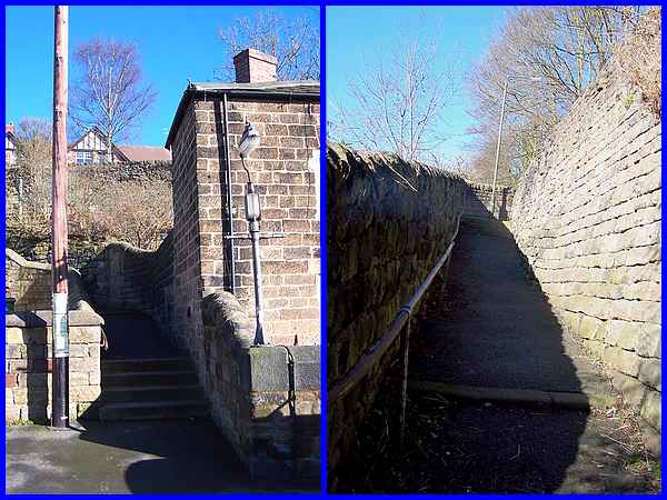
industrial enterprises, a foundry. The route from here though
is to mount the steps at the New Inn, built 1792, to reach Hopping
Hill.
|
Turning back at the top of the steps does reveal a glimpse of
the river down Foundry Lane where part of the site was purchased
by Jedediah Strutt in 1781 which enabled him to obtain the water
power to operate his mills further down the valley. This vantage
point also enables another view (over the modern industrial block)
of the Banks Buildings across the river that we first viewed
in the West Milford Walk.
|
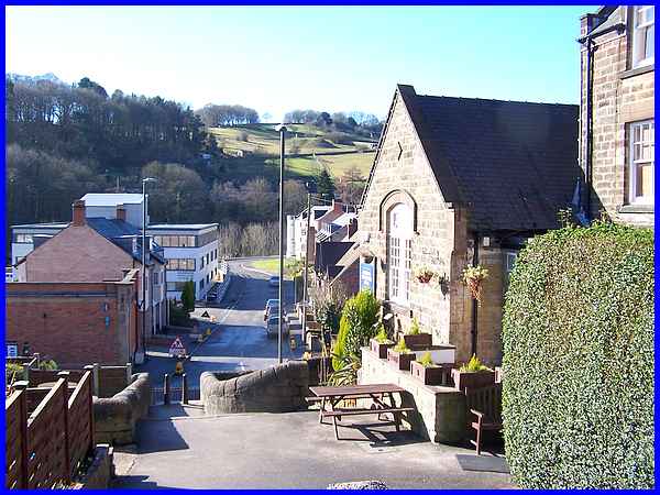
We now turn right at the top of the steps and see more of the
buildings on Hopping Hill.
|
Almost immediately though the route turns left between the rows
to climb a few more steps and along the jitty up to Shaw Lane.
|
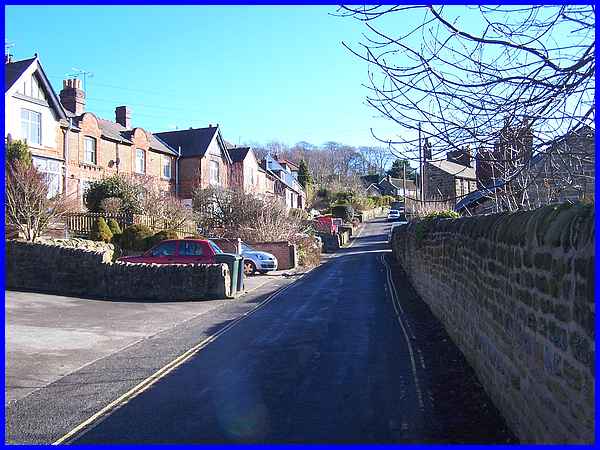
Turning right and continuing along Shaw Lane steadily upwards
we followed the road past the end of a Hopping Hill Terrace and
turned right into Bridge View and the other end of the said terrace.
|
From here there is another good view across the valley to Sunny
Hill that we climbed in the West Milford Walk and if you look
closely you will be able to pick out Stephensons' Tower at the
top of the hill.
|
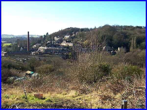
Having reached the highest point of this walk, the descent via
a footpath and steps takes us past the other end of Hopping Hill
Terrace. This is in fact two back-to-back terraces and as we
begin the descent we see East Terrace.
|
This quote from the Derwent Valley Mills website explains a little
about the terraces: "On the east side of the river the land
rises steeply, and the Strutts had little alternative but to
construct their cottages in terraces which follow the natural
contour and run parallel to the road and the river." Further
information in the walk leaflet states that "Most of this
ingeniously-designed block consists of two storey double-fronted
houses on its east side, interlocking with a larger number of
three-storey single-fronted houses facing across the valley."
They were built by the Strutts between 1818 and 1820 and need
I say are Grade II Listed.
|
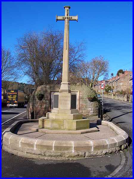
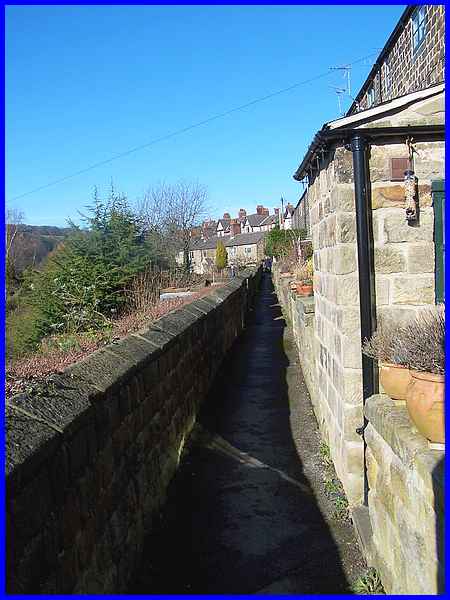
The steps twist and turn downwards to emerge as Church Steps
at the side of Holy Trinity and across the road from the War
Memorial and Roll of Honour where we began this second part of
the walk. At the end of the first part I said that this point
marked the midway point of the walk but that is not strictly
true. Whilst this image is the last in the second Heritage Walk
around Milford, to complete the walk we must retrace our steps
along Derby Road past the church, the former quarry, the cottages,
pub etc. and then cross over the bridge to the end of Chevin
Road for the start of the third and final walk.
|
