Milford Part 03 - East Milford
w/e 22 February 2015
All of this week's pictures were
taken with a Kodak DX6490
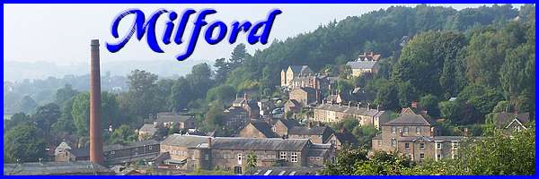
The second Heritage Walk around Milford described
in a leaflet that can be downloaded from the Derwent Valley Mills
website explores the part of the village that lies mainly to
the east of the River Derwent.
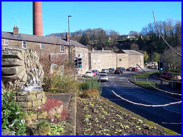
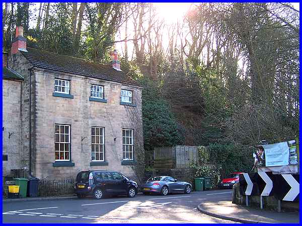
Like the other two walks in the series it begins at the interpretation
board on Chevin Road close to its junction with Derby Road which
can be seen here over the community garden opposite the Strutt
Arms public house. Initially the route is along Derby Road on
the left hand side passing Chevin Alley and the remaining Milford
Mill buildings to the northern side of the bridge over the Derwent.
|
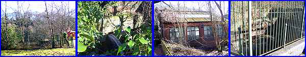
It is here that I take issue with the authors of the route description
for the next reference in the leaflet is to two wheel-pits either
side of the Mill House public house. Now the Mill House and the
pits lie to the south of the bridge between the rear of the Strutt
Arms and the river and in my opinion should have been included
in the third walk rather than this one. We did eventually discover
the pits and the small brick building between them where the
gentle hum of electricity generators could be heard.

The footprint of the original mill on the south side of the bridge
is no longer discernible and the wheel-pits are all that remain
to indicate its position. Through the railings surrounding one
of the pits the power of the water is still obvious and some
idea of the size of the construction can be gauged from my shadow
opposite.
|
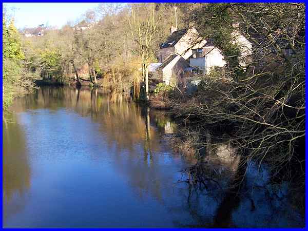
Gripe over, we returned to the northern side of the bridge where
this gentle scene belies the power of the water that is still
being harnessed to provide energy in the twenty first century
thanks to the Strutts' early industrial development.
|
As we crossed the bridge we were faced by a group of buildings
dating from 1791 after the enclosure of common land. Derby Road
turns sharply to the left to continue along the valley at the
side of the river and is joined as it leaves the bridge by Makeney
Road on the right which we will follow in the third walk. The
first building in the group is at the end of Makeney Road and
is the former Ebenezer Chapel which was converted in 1859 from
the Durham Ox beerhouse. The beerhouse had been built in 1846
by Henry Brassington.
|
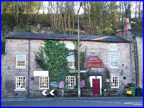
Sixteen years prior to the building of the Durham Ox, the King
William pub next door had been built in 1830 on land purchased
by John Hutton, a Belper surveyor and architect.
|
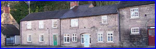
The group under the cliff is completed by two cottages.
Another adjacent group, like the first group sitting at the foot
of a cliff face, is identified as Quarry Cottages.
|
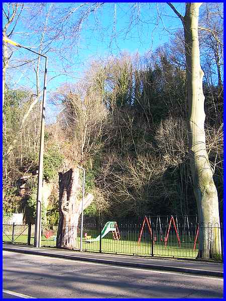
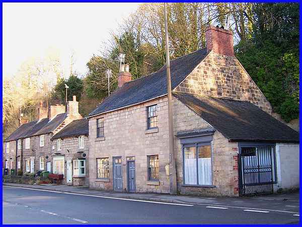
And next along the road is a small recreation ground which occupies
a piece of land that was worked as the said quarry until at least
1906.
|
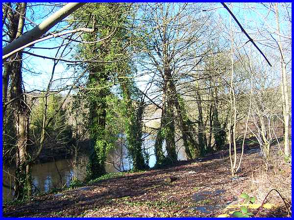
Further into the walk the leaflet says that the river and the
weir are to the left but at that point intervening housing and
industrial units as we shall see later obscure the view. So it
is here opposite the recreation ground that the best view of
the river is seen although the weir is further upstream.
|
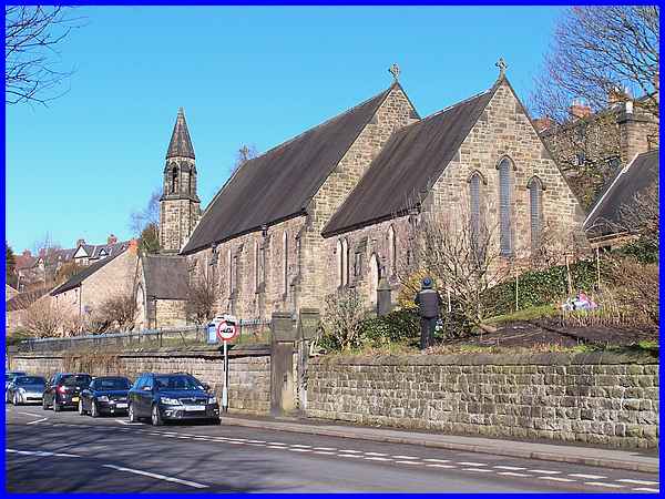
Shortly after the recreation ground is the Holy Trinity Parish
Church, unusual in that it is built in a north-south orientation
rather than the normal east-west. This is because of the constraints
of the site which was donated by the Strutt family. The east
window in fact, of the church built in an early English style
by H. Moffat and completed in 1848 commemorates George Herbert
Strutt who was actually born in Milford.
|
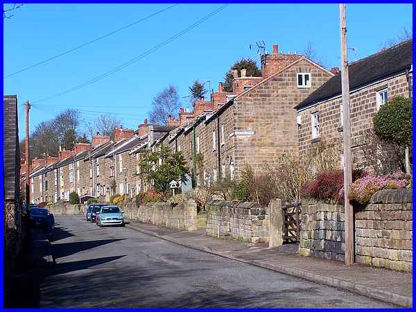
The church marks the approximate midway point of this walk and
just beyond Hopping Hill splits off from Derby Road rising gently
up the side of the valley. The name "Hopping" is derived
from two Old English words "hop" and "ing"
meaning "a small opening off a main valley" and "a
clearing" respectively. Hopping Hill was the former turnpike
road where Jedediah Strutt was responsible for the rows of cottages
that were built for his workers in the 1790s. The present main
road along the valley where we will continue in the next part
of this walk was laid out by the Strutts about thirty years later.
|
