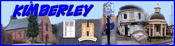
Kimberley - Part 01 - From The West
w/e 16 January 2011
All this week's pictures were taken
with a Kodak DX6490
Kimberley in South Africa is synonymous with diamonds
but the bedrock of Kimberley in Nottinghamshire could be said
to be an amalgam of coal, lace and beer. Like many of the other
towns and villages in the area much of the history of the town
is tied up with the mining and lace industries aided and abetted
by the coming of the railways. Kimberley in fact had two railway
stations in close proximity, one on the Midland line and the
other belonging to the Great Northern Railway and we shall see
both later. But its history goes back much further and the town
is recorded in the Domesday Book of 1086 as Chinemarelie, a settlement
where they main landholder on behalf of William Peverel was called
Grimketel. Peverel owned large swathes of land in Nottinghamshire
and Derbyshire.
Over the years the settlement at Kimberley has expanded to merge
almost imperceptibly into neighbouring towns and villages to
form an almost continuous urban landscape from Nottingham in
the east through Nuthall to Heanor and the towns of the Erewash
Valley to the west via such places as Giltbrook, Newthorpe, Hill
Top, Eastwood, Langley Mill and Aldercar. Only about six miles
from the centre of Nottingham, it is even closer to Ilkeston
being separated only by Cossall and Awsworth so it is perhaps
long overdue for a visit for this site.
 In
previous Town Walks and Village Trails that have been circular
in nature, I have followed various brochures and leaflets but
this exploration of Kimberley is a linear walk of my own making,
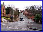
much of it falling within a Conservation Area. It begins on the
Eastwood Road at its junction with Church Hill (left) which leads
up to an area called Swingate. Since childhood when I visited
family at Swingate I have known Church Hill by the alternative
name of Kettle Bank and this name always puzzled me. Now that
I have discovered the eleventh century landowner, Grimketel,
I believe it is a derivation of his name that has transcended
the centuries. In
previous Town Walks and Village Trails that have been circular
in nature, I have followed various brochures and leaflets but
this exploration of Kimberley is a linear walk of my own making,
much of it falling within a Conservation Area. It begins on the
Eastwood Road at its junction with Church Hill (left) which leads
up to an area called Swingate. Since childhood when I visited
family at Swingate I have known Church Hill by the alternative
name of Kettle Bank and this name always puzzled me. Now that
I have discovered the eleventh century landowner, Grimketel,
I believe it is a derivation of his name that has transcended
the centuries.
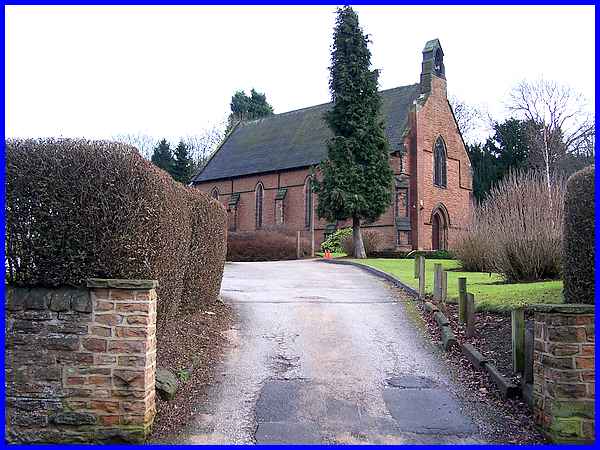
At the junction of Church Hill and Eastwood Road is Kimberley's
Parish Church. The Domesday Book mentions a chapel at Kimberley
that belonged to the mother church at Greasley which was one
of the largest parishes in Nottinghamshire. It was not until
1848 that Kimberley became a parish in its own right and the
church is now part of the Diocese of Southwell and Nottingham.
|
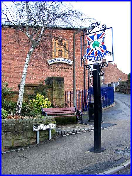
Across Eastwood Road from the church and the rectory is a short
street with the intriguing name of Nine Corners where the town's
coat of arms is proudly displayed against a backdrop of of one
of Hardys & Hansons' complex of brewery buildings.
|
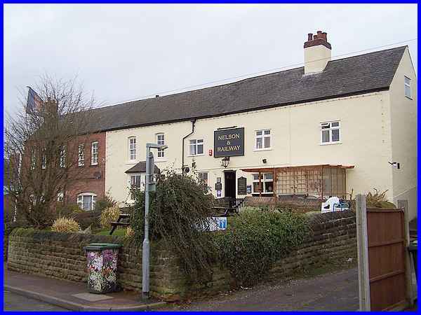
  Nine Corners leads to Hardy Street but by
continuing from Eastwood Road into Main Street (left) we can
ascend a flight of steps to reach Station Road (right) close
to the Nelson & Railway, a pub that stands within sight of
the brewery. The pub's name is derived from "The Lord Nelson,
Railway Hotel" which dates from the time when it stood between
the aforementioned competing railway companies. Nine Corners leads to Hardy Street but by
continuing from Eastwood Road into Main Street (left) we can
ascend a flight of steps to reach Station Road (right) close
to the Nelson & Railway, a pub that stands within sight of
the brewery. The pub's name is derived from "The Lord Nelson,
Railway Hotel" which dates from the time when it stood between
the aforementioned competing railway companies.
|
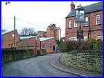
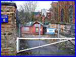 Heading from Station Road to Hardy
Street leads to the heart of the brewery complex where the derelict
Midland Railway Station (left) still stands and can be seen through
Gate E. The brewery has its roots back in 1832 when Samuel Robinson
converted an old bakehouse on the corner of Hardy Street. A site
almost opposite was purchased by Stephen Hanson in 1846 which
also started brewing beer a year later and the two breweries
operated side by side until 1857 when brothers William and Thomas
Hardy bought Robinson's brewery. Expansion allowed the brothers
to commission a new brewery in 1861. Heading from Station Road to Hardy
Street leads to the heart of the brewery complex where the derelict
Midland Railway Station (left) still stands and can be seen through
Gate E. The brewery has its roots back in 1832 when Samuel Robinson
converted an old bakehouse on the corner of Hardy Street. A site
almost opposite was purchased by Stephen Hanson in 1846 which
also started brewing beer a year later and the two breweries
operated side by side until 1857 when brothers William and Thomas
Hardy bought Robinson's brewery. Expansion allowed the brothers
to commission a new brewery in 1861.
|
The two breweries continued to operate separately for many years
and in the process purchased pubs as outlets for their products.
Thomas Hardy was one of the pioneers of the 'tied house' system
and his enterprise was quickly followed by Stephen Hanson but
by 1930 the companies decided to amalgamate and Hardys &
Hansons came into being. The bridge that links brewery buildings
across Hardy Street still bears the company's logo although beer
is now no longer brewed here.
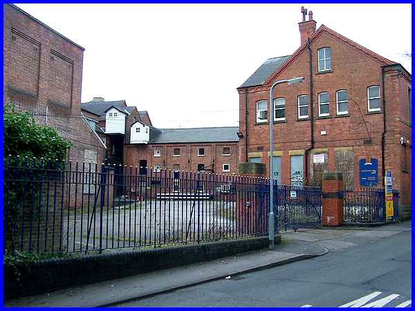
Many pubs in Kimberley and the surrounding area were tied to
the brewery and sold Kimberley Ales for the company but in 2006
the Kimberley site was acquired by the Suffolk based Greene King
plc who announced their intention to cease brewing here in December
of that year. As a result over 170 years of commercial brewing
came to an end and the site now stands empty and desolate.
|
A document has been produced to provide broad guidelines for
prospective purchasers as the iconic Maltings building on the
site has been granted Grade II listed status.
|
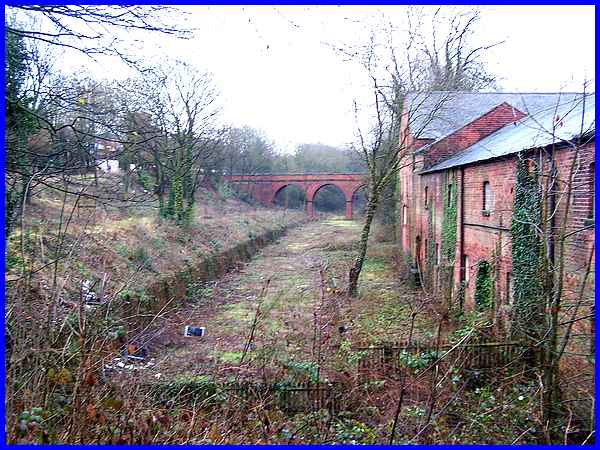
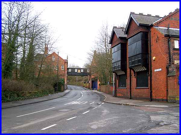
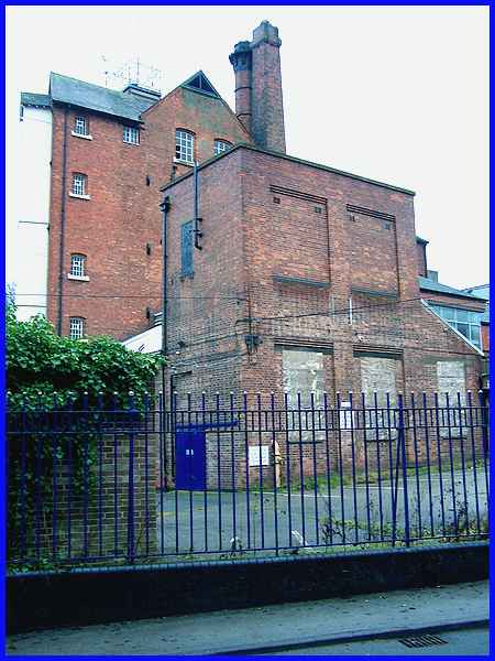
The Midland Railway line that ran through the breweries enabled
both the Hardys and the Hansons owners to construct sidings.
The station was opened in 1880 but the line closed in 1916 when
ten miles of double track was taken up as part of the war effort
in the battle for the Dardanelles and was never re-laid. The
line originally connected Bennerley and Bulwell and this disused
cutting as viewed from Hardy Street is now not only a Site of
Special Scientific Interest (SSSI) but also Site of Importance
for Nature Conservation (SINC) managed by the Nottinghamshire
Wildlife Trust with particular attention being paid to bats and
birds. The impressive three arch bridge now owned by Broxtowe
Borough Council was restored in 2009 and provides a valuable
link in the footpath network for local people. This is the view
from Hardy Street in the opposite direction to the previous image.
|
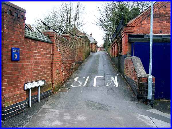
 Although the old brewery buildings,
and there are many in the Hardy Street area with access gates
at various points, all stand within the Conservation Area, future
development of the sites will have an impact but the status of
the Conservation Area should protect the narrow lanes that form
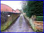
an integral part of the area. Our route continues to Edgewood
Road via the appropriately named Brewery Street and in doing
so will pass more narrow lanes such as Critch's Flats (right).
The brewery may be gone but the names of Hardy and Hanson will
join Grimketel and live in the memory long after the beer has
been drunk. Although the old brewery buildings,
and there are many in the Hardy Street area with access gates
at various points, all stand within the Conservation Area, future
development of the sites will have an impact but the status of
the Conservation Area should protect the narrow lanes that form
an integral part of the area. Our route continues to Edgewood
Road via the appropriately named Brewery Street and in doing
so will pass more narrow lanes such as Critch's Flats (right).
The brewery may be gone but the names of Hardy and Hanson will
join Grimketel and live in the memory long after the beer has
been drunk.
|
