First Impressions
No. 03 - Part 04 - Nottingham Road
w/e 14 February 2016
All of this week's pictures were
taken with a Kodak DX6490
Towards the end of the nineteenth century there were
two communities on Nottingham Road that were separated by open
fields. One was the area around the Gallows Inn which ended round
about the Little Hallam Lane road junction and the other was
further up the hill that was known as Hunger Hill - an area now
more commonly referred to as Kensington. In this part we look
at the infill development between the two communities.
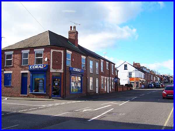
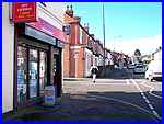
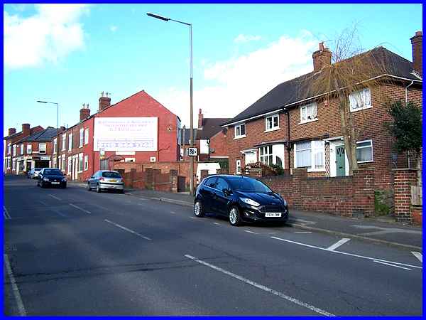
This area of Ilkeston harks back to when almost every street
corner had a shop on it and whilst many of the shops in other
parts of the town have closed, here at the bottom end of Nottingham
Road, most of the street corners still have business premises
although many like the Coral shop on the corner of Little Hallam
Lane now offer different products and services to that earlier
time period. The white painted building on the next corner, Stanhope
Street, is now the Wayfarer Store but for many years it was a
branch shop of the Ilkeston Co-Operative Society. At the time
of writing it is due to expand its services to include a Post
Office at the end of February 2016 when the existing Post Office
branch that we passed in Part 3 of this series closes its doors
for the last time.
|
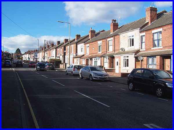
The 1880 OS map of the area shows fields on both sides of Nottingham
Road here and a stone engraving on the Wayfarer Store is dated
1884. By 1900 a similar map shows that the road had been lined
by terraced houses and was already beginning to resemble this
view minus the vehicles and satellite dishes of course!
|
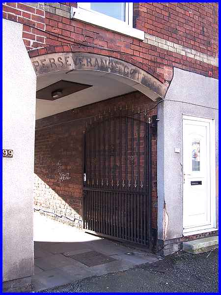
Whilst most of the properties are pretty similar in appearance,
one distinctive feature between Stanhope Street and Newdigate
Street is a gated archway with the words "Perseverance Cottage"
on the lintel.
|
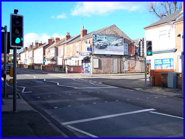
  As the
population grew so did the housing and a clay pit in a field
at the edge of the road on the 1880 map had been replaced by
housing some twenty years later. By the start of the First World
War in 1914, further development had taken place to create French
Street (on the right in the above photo), along with Shaw Street
and, on the other side of the road, Newdigate Street (left) and
Manners Street (right). As the
population grew so did the housing and a clay pit in a field
at the edge of the road on the 1880 map had been replaced by
housing some twenty years later. By the start of the First World
War in 1914, further development had taken place to create French
Street (on the right in the above photo), along with Shaw Street
and, on the other side of the road, Newdigate Street (left) and
Manners Street (right).
|

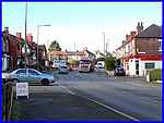
Cavendish Road did not appear on maps until the 1930s when it
linked the Little Hallam area of the town with Nottingham Road
running almost parallel with Little Hallam Lane. For many years
it formed a T-junction with Nottingham Road but more recently
a mini-island was painted in the road and more recently still
in 2014, the road junction was widened to make the island a more
permanent feature.
|
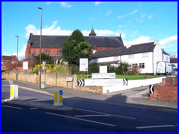
We've already established that in 1880 there was open countryside
between the two communities at Gallows Inn and Hunger Hill but
midway between them stood these cottages that now face Cavendish
Road. By the turn of the century the Church of St John the Evangelist
had been built next to the cottages.
|
The houses on the left as the hill begins to get steeper between
Cavendish Road and Hunger Hill date from the 1930s as do the
houses opposite and on the Ashdale Road development.
|
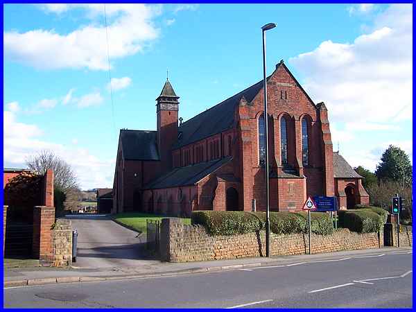
  It
is from between Cavendish Road and Ashdale Road that one of the
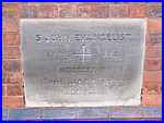
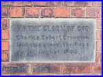
best views of St John's Church is obtained. I spotted two "foundation"
stones, one stating it was laid by Charles Robert Crompton on
August 1st, 1908. The church actually appears on the 1900 map
which is rather confusing as the other stone is dated April XIX,
MDCCCXCIII which in modern parlance translates to April 19th,
1893. It
is from between Cavendish Road and Ashdale Road that one of the
best views of St John's Church is obtained. I spotted two "foundation"
stones, one stating it was laid by Charles Robert Crompton on
August 1st, 1908. The church actually appears on the 1900 map
which is rather confusing as the other stone is dated April XIX,
MDCCCXCIII which in modern parlance translates to April 19th,
1893.
Clarification of this anomaly is provided by the Church of England's
A Church Near You website which states that "St.John's
is a brick structure built in the Early English style. Designed
by Currey of Derby, and initially built as a chapel of ease to
St.Mary's, the foundation stone was laid in 1893 and was dedicated
in 1894 by the Bishop of Southwell. Though not fully completed
until 1911, it became the parish church of the newly formed parish
of St.John's in 1912."
|
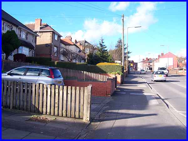
Above Ashdale Road more of the 1930s housing can be seen along
with the older properties in the Hunger Hill area.
|
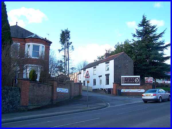
Opposite are some more old cottages which have stood since at
least the mid 1800s on one side of the entrance to the Kensington
Business Park whilst the large house on the left "Hillside"
is dated 1885. Back in the day, the entrance led to a Lace Factory,
the lace industry growing from and replacing the framework knitters
from the earlier part of the nineteenth century. In 1850 there
were six lace factories in Ilkeston and in 1900 the map makes
the one at Hunger Hill as the "Kensington Needle Works and
Lace Factory". Hunger Hill by the way is thought to have
been derived from the Anglo-Saxon word "hangra" meaning
a sloping wooded area while the name now used for the Kensington
area comes from the Lace Factory established in 1824 by William
Tatham and Co. After the Second World War other companies leased
the Kensington Works until disrupted by an event on October 15th
1963 - and I'll tell you more about that in Part 5.
|
