The Hallam Fields
Industrial Trail - Part 7 - Crompton Road
w/e 29 January 2006
All
this week's pictures were taken with a Kodak DX6490
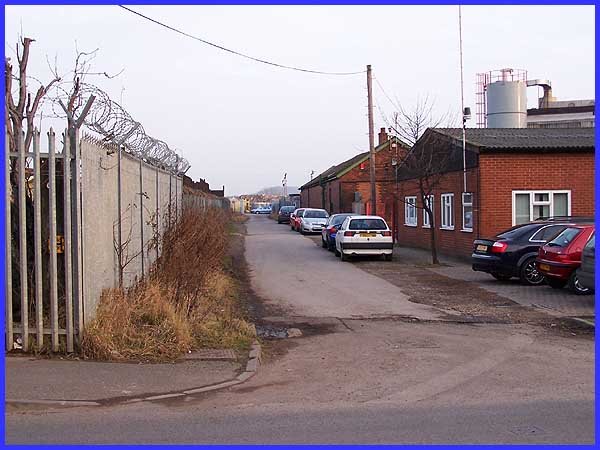
As we begin this last stage of the Industrial Trail, it is perhaps
a good opportunity to stop and look back along our route as we
shall also be looking back in time on Crompton Road. Many parts
of the route we have followed so far have changed with the passage
of time but perhaps none more so than here on Crompton Road.
|

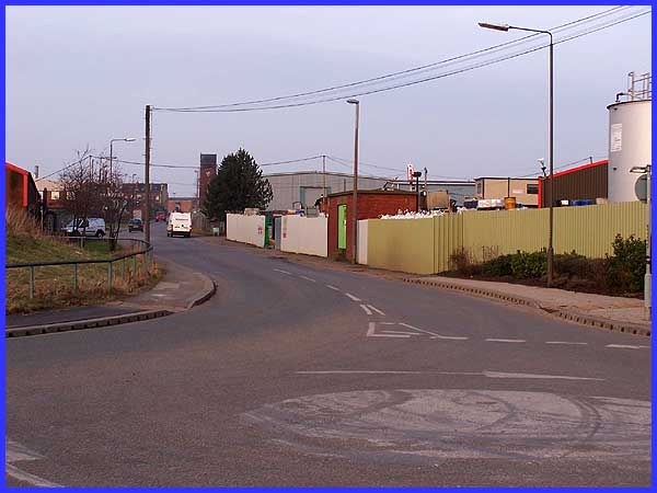
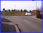 Having
passed along the narrow road that was once under a low railway
bridge we have reached a road junction where Crompton Road (to
the left above) meets the new Merlin Way that has been forged
through to the Quarry Hill Industrial Estate. In recent years,
many new industries have sprung up on Merlin Way and there is
still room for further expansion. From the position of the railway
bridge (small image left) the view is remarkably different from
that of some years ago. Then it would have been dominated by
the coke ovens that stood on the left of Crompton Street, ovens
using coal from Stanton collieries to produce coke for use in
the furnaces. Having
passed along the narrow road that was once under a low railway
bridge we have reached a road junction where Crompton Road (to
the left above) meets the new Merlin Way that has been forged
through to the Quarry Hill Industrial Estate. In recent years,
many new industries have sprung up on Merlin Way and there is
still room for further expansion. From the position of the railway
bridge (small image left) the view is remarkably different from
that of some years ago. Then it would have been dominated by
the coke ovens that stood on the left of Crompton Street, ovens
using coal from Stanton collieries to produce coke for use in
the furnaces.
|
The coke ovens which were built by Woodhall Duckham in 1938-39
also produced gas that was sold locally and for the national
grid. Crude tar, sulphate of ammonia and benzole were among the
by-products produced and as recently as 1953, the plant was extended
to cope with an increased demand. Now in 2006 all signs of the
ovens have completely disappeared but the 'constant bad egg smell'
that I was reminded of in a recent email still lives in the nostalgic
memories of all those who were around at the time. Another memory
from those years is the overflowing of the nearby Nut Brook when
filthy water often caused flooding in this part of Crompton Street.
In 1960 the flooding was so severe that the coke ovens were also
affected by the flooding.
|
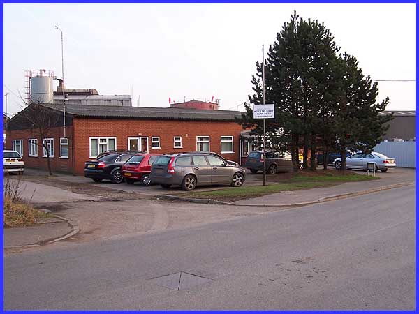
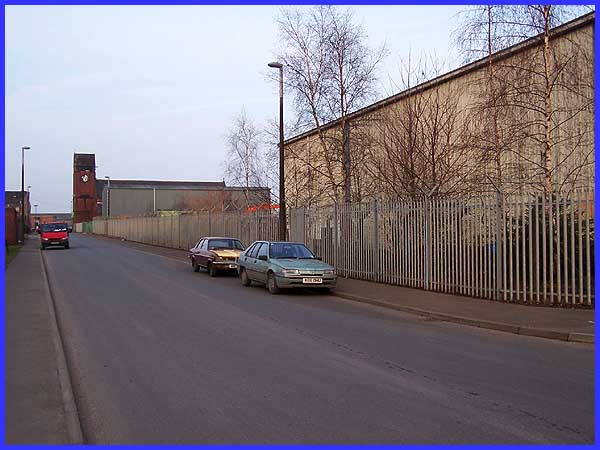
About a third of the way up Crompton Road (as it was renamed
in 1979) on the right hand side this single storey building has
now replaced the Stanton Hotel. The hotel was residential and
often had many radio personalities under its roof when "Workers'
Playtime" - a regular programme from the BBC - was broadcast
from Stanton. Presumably because of the shift working during
the First World War the hotel held a 24 hour licence - despite
the recent changes to the law it seems that all day drinking
is nothing new! The Stanton Hotel was also known as the New Pub
as it replaced the Railway Hotel which later became Mitchell's
grocery shop. Danny Corns whose memories are recorded in the
leaflet on which this series has been based, recalls "It
was not uncommon to see a furnace labourer carrying jugs of ale
hanging from a yoke around his neck, back to his colleagues on
the furnaces." That's yet another change from today when
any form of alcohol is banned on the premises of many companies
and businesses.
|
The side road north of the Stanton Hotel acquired the name Frog
Row due to the presence of giant frogs that took up residence
in the cellars of the terraced houses that stood here. About
half way along on the right hand side was the Rifle Range, home
of Stanton's Rifle Club that was formed in 1907.
|
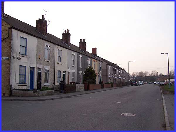
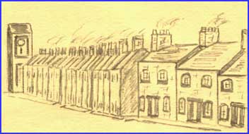 I
am once again indebted to Danny Corns for permission to use his
material for this series. One of his sketches (right) shows the
top end of Crompton Street with smoking chimneys on terraced
houses. With the aid of some digital manipulation and a degree
of artistic licence I have combined Danny's sketch with my image.
Roll your mouse over the image above to get an impression of
what it was like half a century ago. When the houses were demolished
in the 1960s many of the residents moved to new properties at
Kirk Hallam. I
am once again indebted to Danny Corns for permission to use his
material for this series. One of his sketches (right) shows the
top end of Crompton Street with smoking chimneys on terraced
houses. With the aid of some digital manipulation and a degree
of artistic licence I have combined Danny's sketch with my image.
Roll your mouse over the image above to get an impression of
what it was like half a century ago. When the houses were demolished
in the 1960s many of the residents moved to new properties at
Kirk Hallam.
|
At the top of Crompton Road we turn left to retrace our steps
along Hallam Fields Road in front of the remaining twenty four
cottages known as North View that were built in 1868 to house
early Stanton workers to our starting point at The Stute. For
all the new industry and small companies that have grown up in
the area and the cleaner environment due to the elimination of
the poisonous fumes, one thing that cannot be conveyed in these
images is the loss of community spirit. Any last vestiges of
it can only remain here on Hallam Fields Road but I'll close
this series on the Hallam Fields Industrial Trail with a quote
from Danny's leaflet which would make a fine epitaph.
"You have to imagine a thriving, busy, ironmaking community
at work and play. It was a caring community, somewhat remote
from Ilkeston, and in the early days speaking a strange dialect.
Life revolved around the Church, Friendship Groups and Sports
teams until the start of demolition in 1965."
If you would like to see more images of the area in its heyday,
I can recommend the Picture The Past site. A search there for
"Crompton" and "Ilkeston" will show a number
of images of the terraced houses and by using the "more
search options" button and then choosing the Stanton Ironworks
Company from the drop down menu under the "Search By Photographer"
option there are several hundred images to be seen of the Stanton
Works.
|
