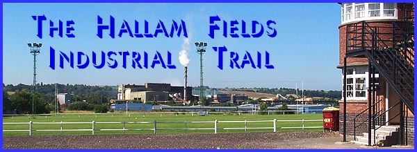
The Hallam Fields
Industrial Trail - Part 4 - The Canal Walk
w/e 16 October 2005
All
this week's pictures were taken with a Kodak DX6490
Part 4 will take us southwards along the Erewash Canal but first
a short detour eastwards towards Trowell.
|
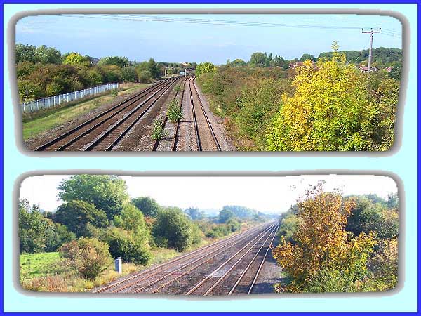
We resume this part of the Industrial Trail at Hallam Fields
Lock on the Erewash Canal but before we commence the southward
leg of the walk, we can continue eastwards towards Trowell Village
through a narrow strip of land between the canal and the Erewash
Valley railway line. The narrow strip of land is now part of
the Nutbrook Junction and Trowell Marsh Nature Reserve. The canal
and the railway run parallel to each other at this point and
a footbridge over the railway gives good views both north (top)
and south (bottom) along the line in the direction of Sheffield
and Nottingham respectively. The houses just visible in the northern
view are at Trowell and the former Trowell Station stood just
out of sight around the bend in the line.
|
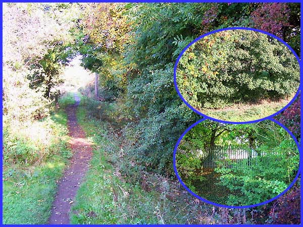
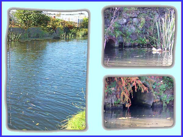
 The route we are
following for this walk is detailed in an excellent leaflet written
and illustrated for the Ilkeston and District Local History Society
by a local resident, Danny Corns. In it Danny says that a good
view of the Hallam Fields Sewage Works can also be had from the
footbridge but as the two insets both taken from the bridge in
the above picture show, this is not necessarily true at this
time of year. Even from the footpath to Trowell on the other
side of the bridge (main picture) it is not easy to see the works
but on reflection, some things are perhaps best left unseen.
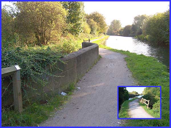
Returning to the towpath by the canal (left), we can now resume
on the main route of the trail. The route we are
following for this walk is detailed in an excellent leaflet written
and illustrated for the Ilkeston and District Local History Society
by a local resident, Danny Corns. In it Danny says that a good
view of the Hallam Fields Sewage Works can also be had from the
footbridge but as the two insets both taken from the bridge in
the above picture show, this is not necessarily true at this
time of year. Even from the footpath to Trowell on the other
side of the bridge (main picture) it is not easy to see the works
but on reflection, some things are perhaps best left unseen.
Returning to the towpath by the canal (left), we can now resume
on the main route of the trail.
|
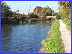
The opposite wall of the canal has a number of pipes and openings
from which hot water waste was deposited into the canal when
various foundries and furnaces lined the bank. In days gone by,
this part of the canal was known as Hot Waters and it was were
many local youngsters learnt to swim. Although the water is probably
cleaner these days despite a certain amount of litter floating
in it, I don't think it is a practice that would be advised.
|
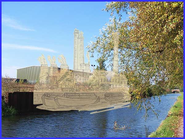
This picture is taken from a little further down the towpath
and I have superimposed one of Danny's sketches on to it. It
may not be to an exact scale but it does give an indication of
the scene when iron was king. As well as the aforementioned foundries
and furnaces, the canal side had a machine shop, a pattern shop,
a brass shop, a hydraulic building and the casting plant but
overshadowing them all were several tall chimneys. One of these
stood over 190 feet high and was erected in 1874. It is reported
that at the topping out ceremony, a dinner party served by three
waitresses for fifty people including management of the Stanton
Works was held at the summit. Hymns were sung, speeches made,
a loyal toast proposed and no doubt, a secret prayer or two made
by any acrophobia sufferers among the guests!
|
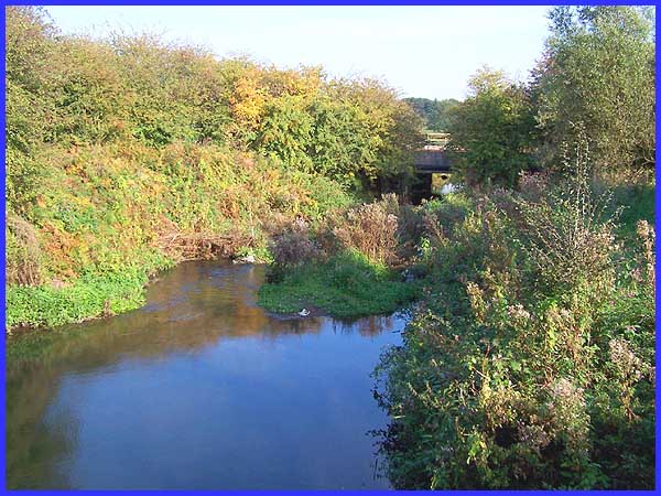
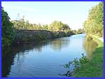
I never cease to be amazed by the ingenuity, expertise and resourcefulness
of those nineteenth century engineers and canal builders. Here
seen from both directions the canal and towpath continue across
a bridge over the Nut Brook - water crossing over water. This
is about midway between Hallam Fields Lock and the next one we
are approaching which is called Stanton Lock but was formerly
called Whitehouse Junction and is still often referred to as
simply Junction Lock.
|
 The bridge
carries the canal over the Nut Brook very close to where it flows
into the River Erewash. The brook is culverted under the Erewash
Canal and from this vantage point on the canal towpath another
bridge carrying the railway can also be seen. It is also a good
spot to view the full width of the Nutbrook Junction Nature Reserve.
A path running through the reserve from the footbridge we stood
on earlier actually emerges onto the towpath either side of the
Nut Brook before continuing southwards to rejoin the towpath
again nearer to Junction Lock. And that is where we will be heading
in the next part of the Industrial Trail. The bridge
carries the canal over the Nut Brook very close to where it flows
into the River Erewash. The brook is culverted under the Erewash
Canal and from this vantage point on the canal towpath another
bridge carrying the railway can also be seen. It is also a good
spot to view the full width of the Nutbrook Junction Nature Reserve.
A path running through the reserve from the footbridge we stood
on earlier actually emerges onto the towpath either side of the
Nut Brook before continuing southwards to rejoin the towpath
again nearer to Junction Lock. And that is where we will be heading
in the next part of the Industrial Trail.
|
