Part 06 - Back to the Mills
w/e 07 July 2013
All this week's pictures were taken
with a Kodak DX6490
This final part of the Heritage Walk number 1 takes
us from Crown Terrace along Bridge Street and back to the starting
point for the walk at the Derwent Valley Visitor Centre in Strutt's
North Mill.
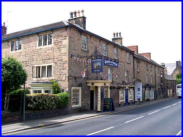
The first building of interest is reputedly one of Belper's oldest
pubs, the George and Dragon which dates from the late seventeenth
or early eighteenth century. Not only was this formerly a coaching
inn but it also took on the mantle of being an early post office.
It is of course a Grade II listed building.
|
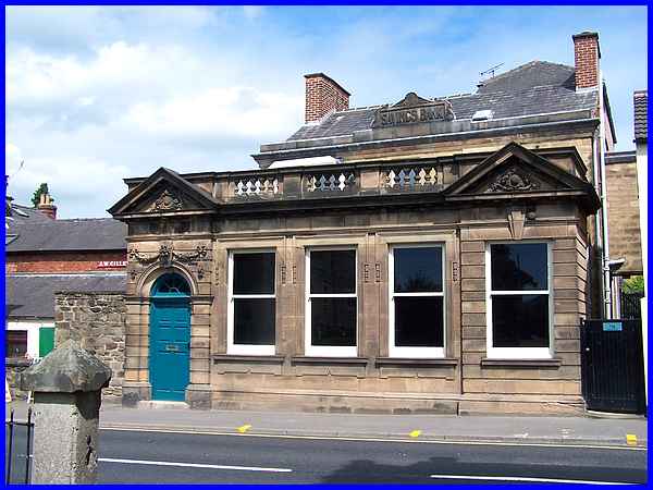
Also listed with the same grade is another building across Bridge
Street and opposite the George and Dragon. Although it currently
appears to be standing empty the words "Savings Bank"
can be seen at the top of the original building. The additional
ornate stonework front section was not added until 1910 whereas
the original building at the rear was established in 1818. It
was a member of the Strutt family, William, who was a founder
of the Savings Bank which moved into these premises in 1851.
It later became a TSB branch.
|
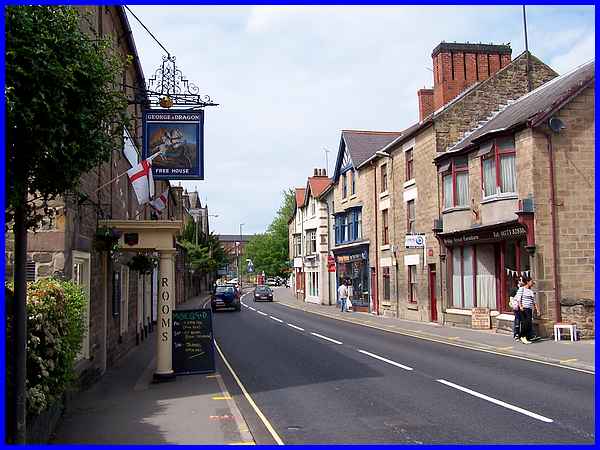
From here the route continues northwards along Bridge Street
until it becomes Matlock Road. This is the main A6 road through
the town following the line of the turnpike road of 1818 that
linked Derby and Manchester.
|
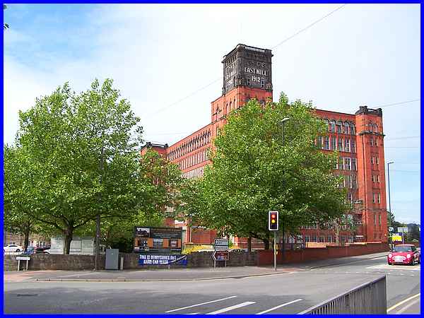
At the meeting with Matlock Road, a third road Bridge Foot, joins
from the left at The Triangle and heads off westwards towards
Ashbourne. The road junction is dominated like many more views
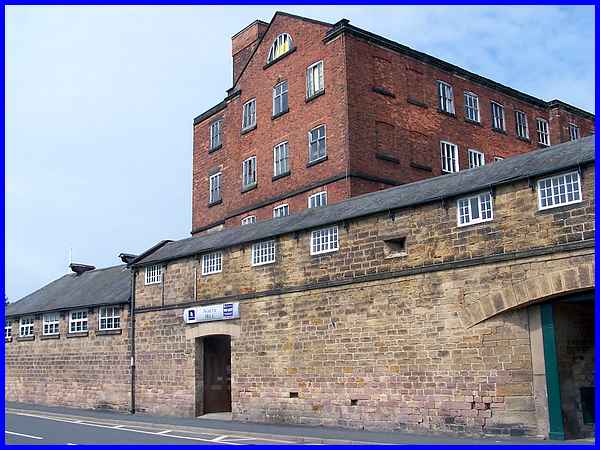
in Belper by the large East Mill which was built in 1912 after
Strutt's mills became part of the English Sewing Cotton Co. in
1897.
|
There are several pedestrian crossings across the main roads
but it is worth taking the one to The Triangle if only to view
the large information panel which contains many historical details
of the area and which also points out the locations of several
sites where former interesting buildings once stood.
|
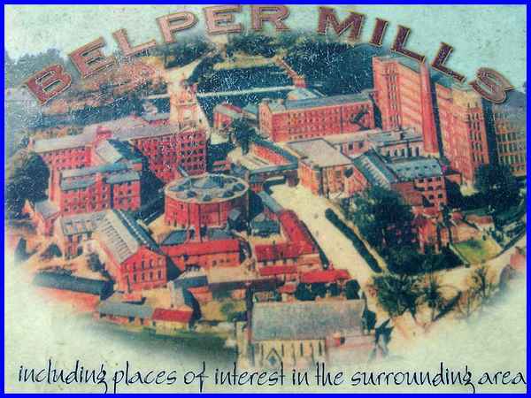
Not least amongst those demolished buildings is the West Mill
seen here on the left hand side of this illustration which graces
the centre of the information panel. Christ Church can be seen
at the bottom of the illustration next to The Triangle with the
East Mill and North Mill on the right with the Gangway spanning
the road in the middle. Note too the tall chimney adjacent to
the East Mill.
|
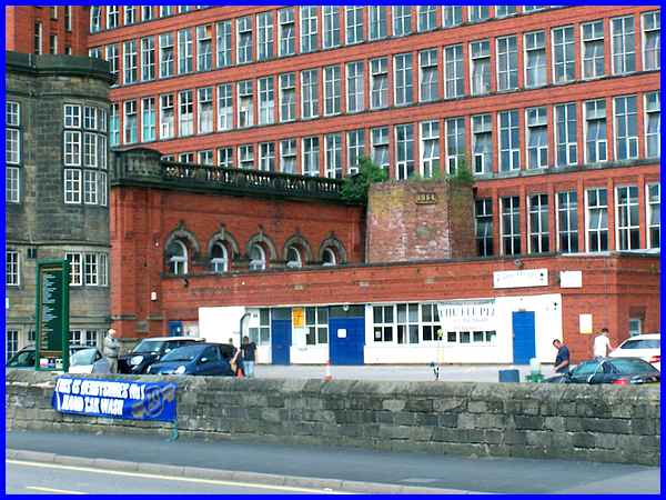
The chimney was built in 1854 when the mills began using steam
power but only the stump alongside the engine house remains in
the mill yard. The date 1854 can still be seen in the stump but
it is water power and elbow grease that currently are at work
in the yard as it is the site of a car cleaning business.
|
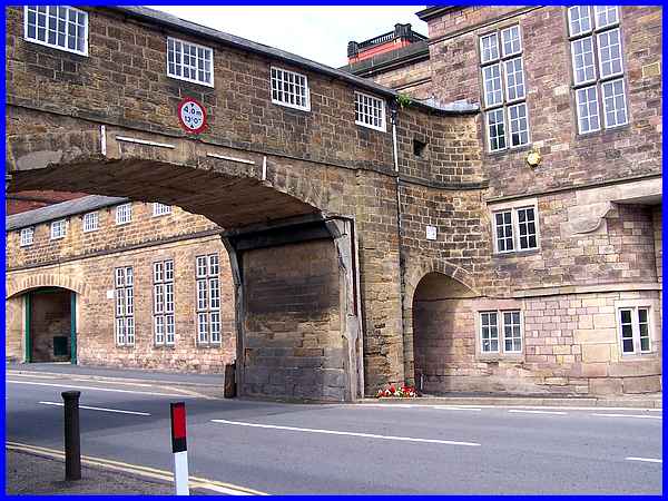
The Gangway seen in the illustration still exists across Bridge
Foot even though the West Mill has now been demolished. It built
in 1795 to connect the West and North Mills.
|
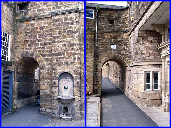
Detail of each side of the Gangway shows the holes that were
created in 1810 from where muskets could be fired at troublemakers
- one way to make sure there was no "trouble at t’ mill"and to keep
the workers in line but I don't think it would go down too well
with the Unions today!
|
So quickly passing through the Gangway before arousing the ghosts
of the musketeers we completed the walk back at the North Mill
and the Heritage Centre.
Even allowing for an extended walk around the Riverside Gardens,
the total length of this Heritage Walk No. 1 is something under
a mile and a half but even in that short distance there is a
large amount of historical interest. A second Heritage Walk (which
we are planning to follow shortly) will reveal even more of the
history but to see an aerial view of this first route click here.
|
