Part 03 - Matlock Road & Long Row
w/e 14 April 2013
All this week's pictures were taken
with a Kodak DX6490
We chose another fine day for this third part of
the Heritage Walk 1 in Belper and parked once again at the River
Gardens from where we followed the route along Matlock Road and
into Long Row.
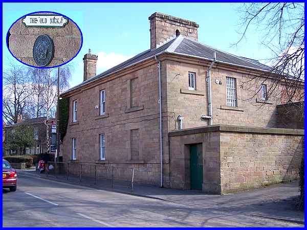
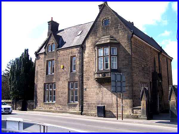
Across Matlock Road from the entrance to the River Gardens is
this solid looking building so it is no surprise to learn that
it was the former Police Station and was built in 1847. Now somewhat
disparagingly known as "The Old Nick" the name by the
door is accompanied by a circular plaque (inset) that shows that
it is also "An English Listed Building". When the Derbyshire
Constabulary was formed in 1857 the building served as its headquarters
for the following two years.
|
Twenty years after the formation of the Derbyshire Constabulary,
three police houses were built in 1877 alongside "The Old
Nick" which now overlook the pedestrian crossing by which
we crossed Matlock Road.
|
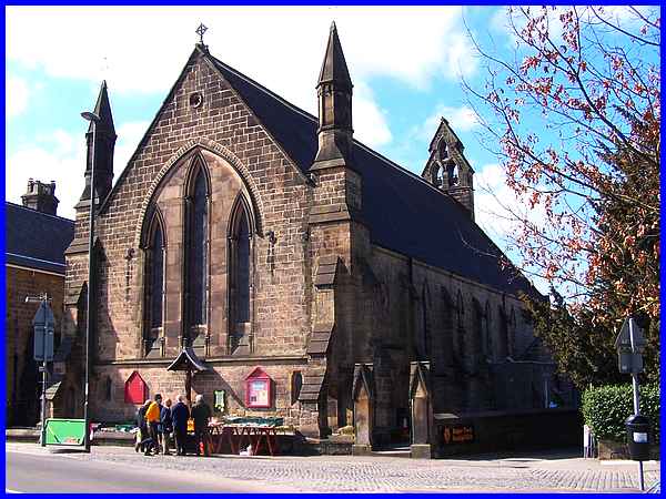
Where Matlock Road becomes Bridge Street the 1849/50 building
on the right is Christ Church and the drive to the right of the
church marks the entrance to Belper Town Football Club. The club
is nicknamed "The Nailers", a reference to nail making
that began in the town back in Middle Ages. At that time Belper
was the site of a hunting lodge for John of Gaunt and in a later
part of this walk we will pass the remains of a nineteenth century
Nail Shop.
|
To the left of Christ Church is another substantial building
of the same date and this is the vicarage. A major contributor
to the cost of the church and the vicarage was Jedediah Strutt
II, a grandson of the first Jedediah.
|
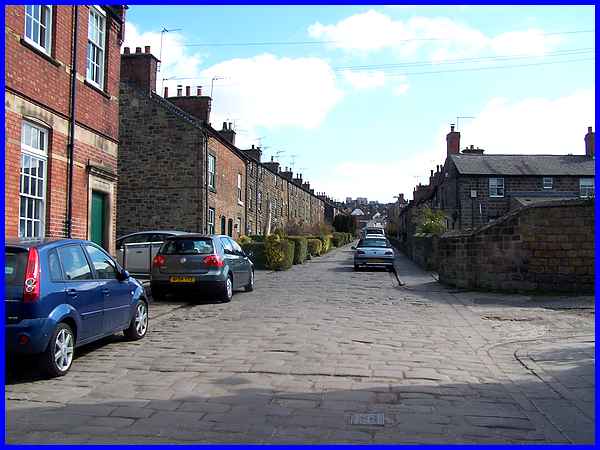
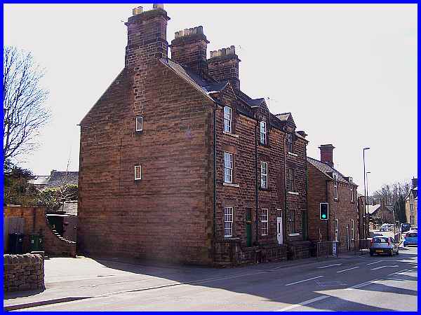
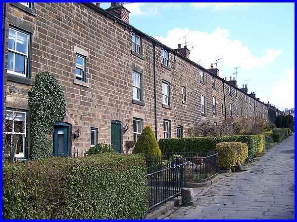
Opposite the vicarage is Long Row and the first thing to notice
is the road surface, much of which must date back to the original
development of the area. Long Row was the second phase of housing
built around 1790 for the workers in their mills by the Strutt
family. Whilst the road surface may have been a vast improvement
on the muddy tracks of the eighteenth and nineteenth centuries
it now provides a severe test of the suspension of modern vehicles
but its historic relevance makes it worth preserving.
|
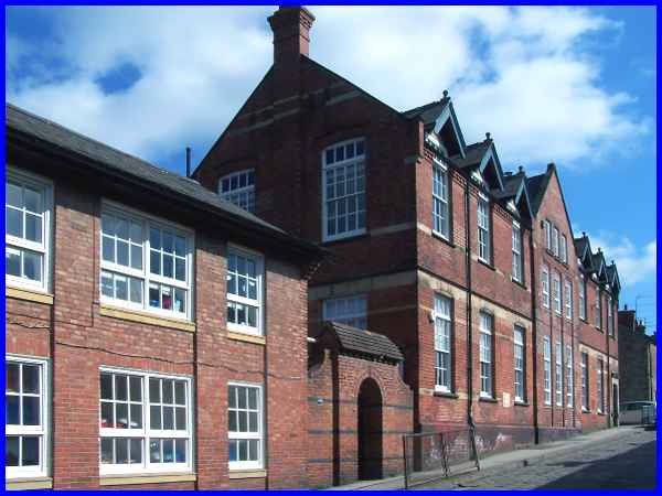
At the bottom of street on the left hand side is the Long Row
Primary School and Nursery. The original schoolroom was built
about 1818 but was later rebuilt and enlarged, a project that
required the demolition of a number of houses.
|
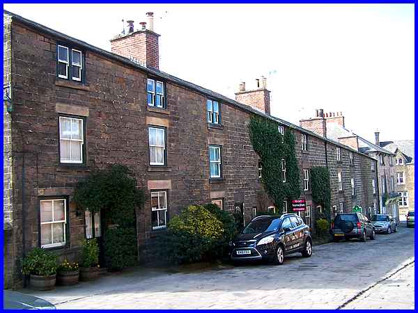
On the right hand side of Long Row, opposite the school, a feature
worthy of note on this row of old house is the continuous roofline.
|
This feature is also repeated on the houses above the school
on the left hand side and both those on the right and these on
the left are built of gritstone.
|
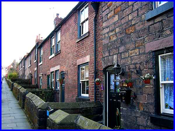
On the right hand side however, the construction changes part
way up the street to brick built houses which are in stepped
pairs. These also have only two storeys whereas the gritstone
buildings accommodate a third storey beneath the continuous roofline.
We are advised by the leaflet describing this walk that all the
houses have "ample gardens" at the rear.
|
The railways came to Belper between 1838 and 1840 which involved
the building of eleven bridges in a one mile stretch as the North
Midlands Railway cut through the town. It also necessitated the
demolition of four or five houses in the rows on each side of
Long Row about halfway along its length to accommodate the cutting.
With the recent announcement of the proposed route of the high
speed rail line HS2 through the East Midlands which will also
destroy many homes, it seems we have learned nothing since the
1830s about the art of communication and the impact such decisions
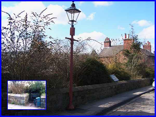
made in high places have on the population in general (see link). A recess over this bridge (inset)
on Long Row now houses a hopper for grit to be used on the road
in icy weather but originally the walled area was known as the
"dirt hole". This was where the residents emptied their
ashes which would be collected later by the ash cart.
An information board on the bridge contains a potted history
of the Strutt legacy giving details of some of the buildings
we have already seen and also of more yet to come. It is from
here that we will continue in Part 04.
|
