Part 01 - By Strutt's Mills
w/e 10 February 2013
All this week's pictures were taken
with a Kodak DX6490
Belper is about ten miles to the west of Ilkeston
and a similar distance north of Derby. It lies within and is
part of the Derwent Valley Mills World Heritage Site whose website
includes a number of walks at various points between Derby and
the northern extremity of the Heritage Site near Matlock Bath.
Two of those walks are at Belper and leaflets are available on
the site to download so if you want a heads up of the route we
will be following in this series, you can view the leaflet by
clicking this link.
I was recently given a couple of books in The King's England
series edited by Arthur Mee, first published in the 1930s and
reprinted several times during the following decade. The whole
series of books with a tag line of "A New Domesday Book
of 10,000 Towns and Villages" amounted to 41 volumes and
each book was devoted to a county in England . The books I was
given cover Derbyshire and Nottinghamshire and I remember poring
over these particular volumes as a child at my grandmother's
so I was delighted to be reacquainted with them although many
things have changed during the last fifty or sixty years. Much
of the historical information contained within the pages though
is still correct. The entry for Belper begins "The Derwent
has made it into a busy little town, for it was its water power
that moved Jedediah Strutt to build his cotton mills here"
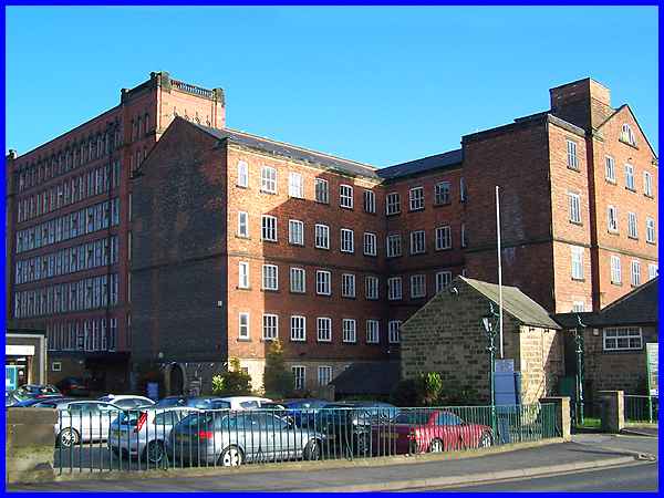
and it is at Strutt's North Mill that we begin this Heritage
Walk. The mill, centre right of the image above, was rebuilt
in 1804 after a fire had destroyed the original 1781 mill.
|
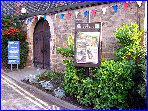
To be precise the walk begins at the Derwent Valley Visitor Centre
reception which is situated inside North Mill. According to the
notice board outside it is open at weekends between 1pm and 5pm
during the winter (November to February) and at the same times
in the summer from Wednesday to Sunday plus Bank Holiday Mondays.
|
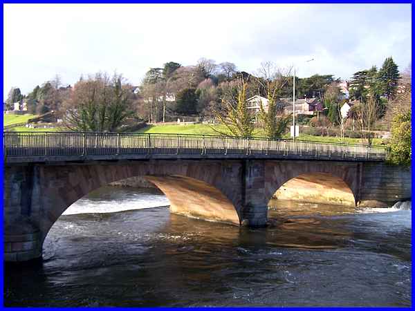
The Visitor Centre is accessed from Bridge Foot which leads to
Bridge Hill and the Ashbourne Road out of Belper. Bridge Foot
spans the Derwent by means of, quoting from The King's England
again, "a fine stone bridge of 1795, replacing the old one
washed away by a flood." Another snippet in the book is
that at the time of writing in the 1930s, original timbers from
the foundations of the only viaduct by George Stephenson had
been found in the river bed. It also states that they were as
good as new despite being immersed in the water for 94 years.
|
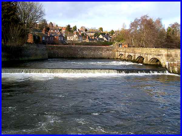
Just upstream from the bridge is where Jedediah Strutt built
retaining walls, sluices and floodgates to control the water
needed to power his mills. On the north side of the river the
structures also provided a walkway to the central part of the
river and an impressive crescent shaped weir.
|
That crescent shaped Horseshoe Weir of 1797 became necessary
when Strutt needed more power for the West Mill which was built
in 1795. The two earlier mills, North and South, had been served
by a simple weir across the river but with the addition of the
West Mill a greater volume of water was required. The weir was
modified in 1819 and again in 1843 to increase the height and
thus retain more water which by 1820 already covered some 5.8
hectares.
|
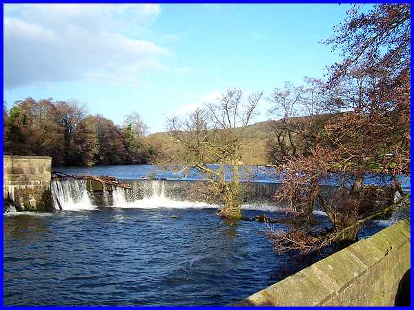
Water gushing through another sluice on the south side of the
river illustrates just how much power is created by the constructions
from two centuries ago. All the structures across the river are
now Grade II* listed.
|
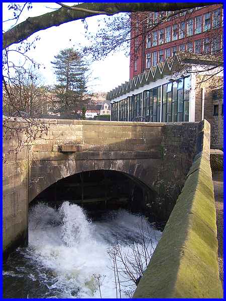
A walkway between the mills and the river passes close to the
sluice gate and provides a pleasant view across the water to
the Riverside Gardens.
|
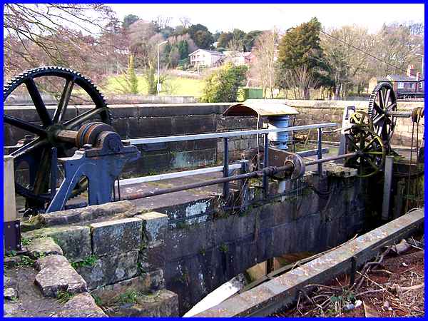
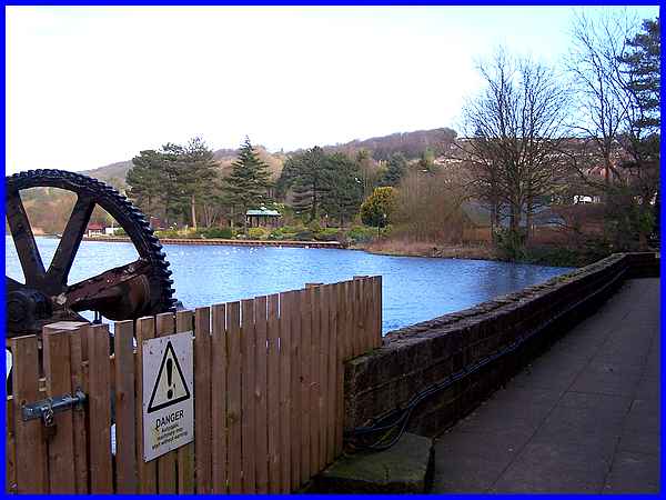
The walkway also allows closer inspection of the mechanism that
operates the sluice.
|
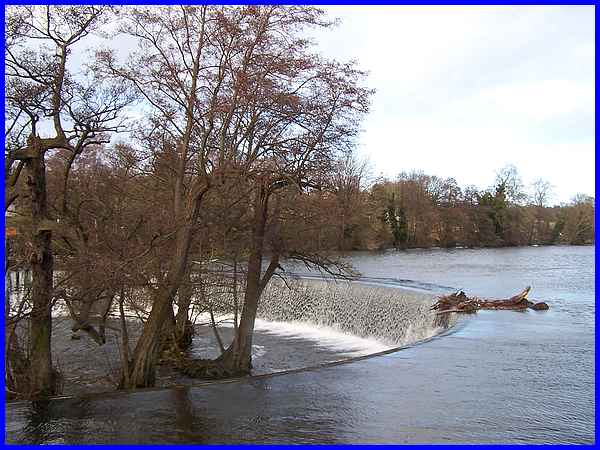
The symmetry of the Horseshoe Weir is also visible from the walkway
showing how it acts as a barrier to the water, thus creating
a reservoir which could be controlled to power the cotton spinning
machines.
|
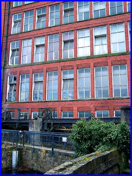
The walkway continues past the East Mill which is also a listed
Grade II building. Seven storeys high and best seen from a distance
to appreciate its size, it was built by the English Sewing Cotton
Company in 1912. Constructed around a steel frame, it can claim
to be a forerunner of methods developed to build skyscrapers.
|
