Bennerley Loop - Part 02
w/e 25 May 2014
All of this week's pictures were
taken with a Kodak DX6490
It was another fine sunny day when we returned to
Barker's Lock to resume a little bit more of the Bennerley Loop
by repeating another section of the "Lock to Lock"
series along the towpath of the Erewash Canal. (link)
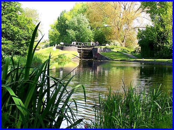
That section of towpath took us past the Nelson Street housing
development on the other side of the canal and a coal distribution
centre and Booth's Playing Field on the near side before a bend
in the canal opened up a favourite view of Stenson's Lock.
|
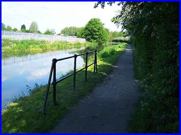
  Rising up a level at the lock we continued
along the towpath passing an embankment that marks the end of
the Bennerley Viaduct. A post at the foot bears a "Private
Property - Keep Out" notice although the well-worn path
up the slope is testament to its ineffectiveness. I don't recollect
the notice from our previous visit (link) but a little further along the
towpath, railings mark a footpath on the right. Rising up a level at the lock we continued
along the towpath passing an embankment that marks the end of
the Bennerley Viaduct. A post at the foot bears a "Private
Property - Keep Out" notice although the well-worn path
up the slope is testament to its ineffectiveness. I don't recollect
the notice from our previous visit (link) but a little further along the
towpath, railings mark a footpath on the right.
|
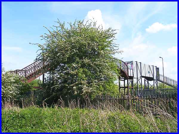
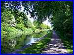
Turning away from the canal we followed the path made narrow
by the growth of trees and bushes on each side until it opened
up to reveal a footbridge over the railway. It appears that at
some time it its history the bridge was extended to carry foot
traffic over an additional railway line.
|
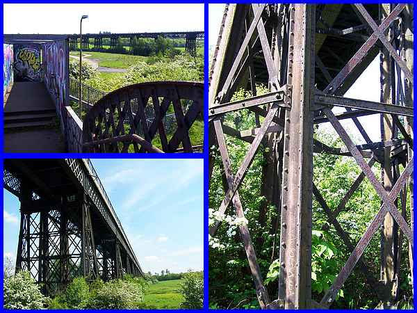
From the extended bridge (top left) there are many opportunities
to view most of the almost 500 yard length (460m) of the impressive
wrought iron lattice work Bennerley Viaduct that was built to
S Abbot's design by Richard Johnson in the late 1870s. The path
from the footbridge leads almost directly to the viaduct and
we crossed underneath (bottom left) for a closer view (right)
at its method of construction. If memory serves me correctly
I believe I was told that it was unique in that it was built
in the manner of a wooden bridge and riveted together, a means
of construction that proved difficult to demolish after the railway
line that it carried ceased to operate in 1968. This eventually
led to it being listed as a Grade II structure.
|
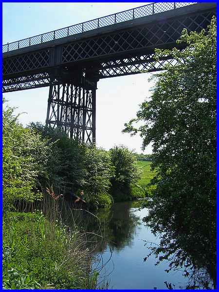
The viaduct carried the former Great Northern Railway Derbyshire
and Staffordshire line across the valley of the River Erewash
between Awsworth in Nottinghamshire and Ilkeston in Derbyshire
with freight services operating for some 90 years between 1878
and 1968. Passenger services began a few months after freight
and ceased in 1964. I still have vivid memories of crossing the
viaduct some 60 feet above the river with school friends on a
Christmas shopping trip to Nottingham about 1960.
|
Crossing a road bridge over the river we entered Nottinghamshire
in what is a rather desolate landscape but was once a hive of
industry. By 1880 Bennerley Colliery that operated from here
was already disused but Awsworth Iron Works and a Brick Yard
were in full swing and by the early 1900s the site was known
as Bennerley Iron Works. Now levelled the site to my way of thinking
is, like many more similar sites in the country, ripe for redevelopment.
We are often being told that there is a shortage of housing in
the country and I would much rather see brown field sites such
as this be deveoped before any green field sites are even considered.
|
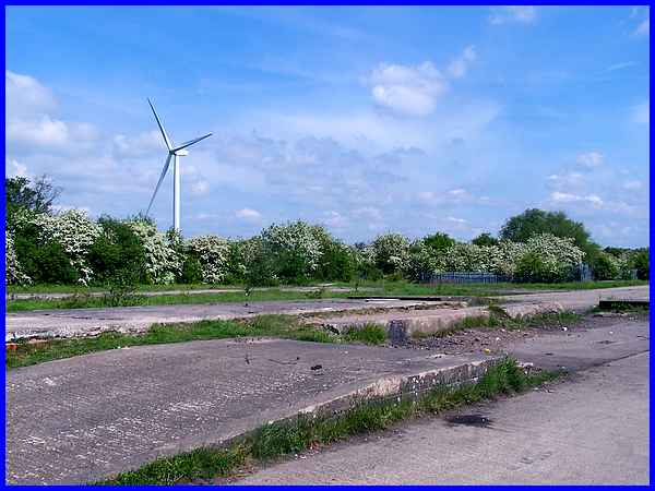
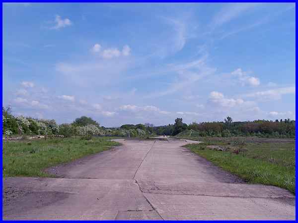
In the mid 1950s Tarmacadam works were on the site and railway
lines from Bennerley Junction which was just north of the footbridge
we crossed earlier ran along the hedgerow seen here and were
known as Bennerley Sidings. Later the site became the Bennerley
Coal Screening Plant and the remains of what appear to be the
weigh bridge sit in the middle of the concrete road that runs
through the site. A new addition to the landscape constructed
in 2013/14 is Windy Winston, a wind turbine so named by
children from a local school. The turbine is at Severn Trent
Water's Newthorpe Sewage Works. It is an optical illusion but
with little to compare it against the turbine does not seem as
big from here as it does from the surrounding area. It is in
fact 130m from ground level to blade tip which is about seven
times higher than the more elegant viaduct nearby.
|
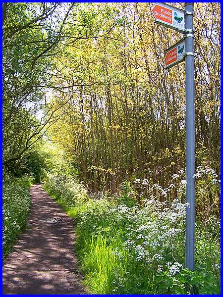
We left the former industrial site and entered a small wooded
area picking up the Erewash Valley Trail. The Trail is a 30 mile
circular route linking Langley Mill in the north with Sawley
in the south along both sides of the Erewash Valley. It was created
by linking various towpaths, bridleways and footpaths etc to
create a route enjoyed by both walkers and cyclists. In fact
the first part of this Bennerley Loop walk along the Erewsh Canal
is also part of the Erewash Valley Trail on the eastern side
of the valley but passing through the trees we began to head
southwards along the western side.
|
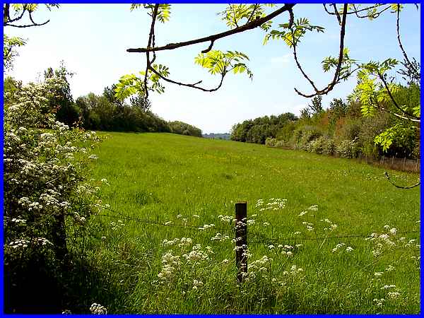
The Trail continues through the wood and past a green finger
of grassland on the right which offers a distant view of Ilkeston
in the far distance.
|
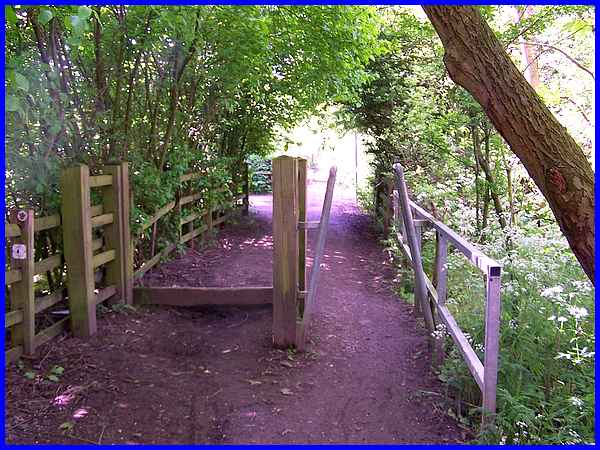
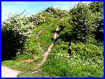
A liitle further on after walking along another shady tree-lined
path, the Trail picks up the disused Nottingham Canal just beyond
the squeeze stile seen here and that is where we will start the
next part on the "Top Cut".
|
