Autumn Footprints 2015 - Week Two
w/e 27 September 2015
All of this week's pictures were
taken with a Kodak DX6490
The first week of the Autumn Footprints Walking Festival
had passed with weather that was changeable and although Monday's
walk had been damp, Saturday's was like a hot summer's day. The
second week looked set to continue in the same changeable way.
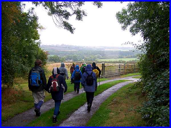
Monday's walk at the start of the second week was again damp
- in fact it was wet! It rained and drizzled all day and only
cleared up when I had returned home after a "Ramble Round
Ripley" with a small but intrepid group of walkers led by
Gary and Ben from Groundwork CAM (i.e. Creswell, Ashfield &
Mansfield).
|
  The walk took us on a circular route to Upper
and Lower Hartshay, then on to Butterley. Gary led us into two
nature reserves close to Ripley that he is involved in maintaining
towards the end of the walk. With landscape views somewhat limited
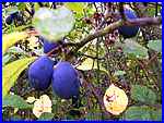
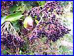
by the weather, it was a good opportunity to photograph the autumn
fruits on the trees and in the hedgerows. We spotted 4 or 5 different
berries and fruits growing together in one hedge and the damsons
were lovely. The walk took us on a circular route to Upper
and Lower Hartshay, then on to Butterley. Gary led us into two
nature reserves close to Ripley that he is involved in maintaining
towards the end of the walk. With landscape views somewhat limited
by the weather, it was a good opportunity to photograph the autumn
fruits on the trees and in the hedgerows. We spotted 4 or 5 different
berries and fruits growing together in one hedge and the damsons
were lovely.
Click this link
for more photos plus a route map of the Ripley walk.
|
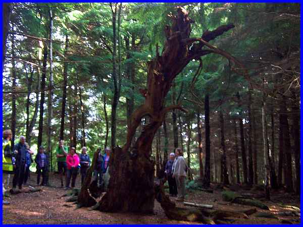
  The weather was
much better on Tuesday but the majority of the "Betty Kenny
Walk" through Shining Cliff Wood and Peat Pits Wood at Ambergate
was in the shade. Early in the walk we passed through the interesting
industrial architecture of the disused Wire Works (left) and
later stopped at a large yew tree (right). The Betty Kenny tree
(above) was also a yew tree and it was here that Betty and her
family of eight children lived with her husband in a hut whilst
they worked as charcoal burners. Most of the Betty Kenny tree
today looks as though it succumbed to a fire and perhaps became
a victim of the charcoal trade's success - but I'm only guessing
at that. The weather was
much better on Tuesday but the majority of the "Betty Kenny
Walk" through Shining Cliff Wood and Peat Pits Wood at Ambergate
was in the shade. Early in the walk we passed through the interesting
industrial architecture of the disused Wire Works (left) and
later stopped at a large yew tree (right). The Betty Kenny tree
(above) was also a yew tree and it was here that Betty and her
family of eight children lived with her husband in a hut whilst
they worked as charcoal burners. Most of the Betty Kenny tree
today looks as though it succumbed to a fire and perhaps became
a victim of the charcoal trade's success - but I'm only guessing
at that.
You can read more about Betty and her life at the Crich Parish website.
|
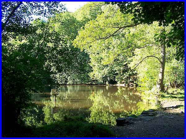
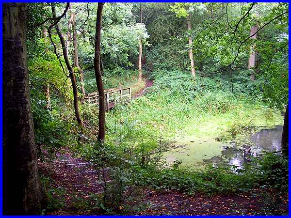
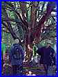
After visiting the tree we continued through Shining Cliff Wood
and into the adjacent Peat Pits Woods where a brook runs down
the hillside. At a clearing in the wood the brook spreads out
to form a delightful little pond in the midst of the trees where
we spent a few minutes watching dragonflies over the water. If
you study the two main pictures above you will notice a distinct
difference in appearance but it was not until Ben pointed out
to the group that one is a natural wood and the other is a plantation
that we appreciated the difference.
Click this link
for more photos plus a route map of the Betty Kenny walk.
|
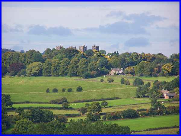
  Wednesday brought another fine day with a light
haze that I really didn't notice until looking at the images
I captured. We started "Walking The Northern Fields Of Amber
Valley" from Lea and had a distant view (above) of Riber
Castle which we were to pass much closer both before and after
(left) our lunch break. Before lunch though we had to ascend
a hillside (right) that caused the walk to be graded strenuous.
This part pictured by the wall was the easy bit! Wednesday brought another fine day with a light
haze that I really didn't notice until looking at the images
I captured. We started "Walking The Northern Fields Of Amber
Valley" from Lea and had a distant view (above) of Riber
Castle which we were to pass much closer both before and after
(left) our lunch break. Before lunch though we had to ascend
a hillside (right) that caused the walk to be graded strenuous.
This part pictured by the wall was the easy bit!
|
After the climb up the grassy hill the route continued as a narrow
steep rocky path through the tree, fern and bramble covered hillside
that left me gasping at the top but it was well worth the effort
for the view over Matlock Bath. Here we could see the chair lift
up to the Heights of Abraham operating opposite whilst we sat
on a wall or among the ferns to eat our picnic lunches.
Click this link
for more photos plus a route map of the Lea walk.
|
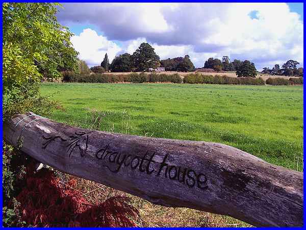
The landscape around Draycott is lower than the hills around
Matlock and the climbs over the undulating sides of the Trent
Valley much gentler but that's not to say there are no views
to enjoy. The Thursday walk was an "Ockbrook, Hopwell, Risley
Circular" and started over the low lying fields passing
Draycott House on the way where we saw this carved log. The house
itself is hidden behind the bush to the left and is now an Equestrian
Centre, hence the horse motif also carved on the log.
|
It was yet another fine day but as we reached the higher ground
around Hopwell it was quite breezy. We stopped for lunch though
in a sheltered hollow where it was warm sitting on the grass
in the sunshine.
Click this link
for more photos plus a route map of the Draycott walk.
|
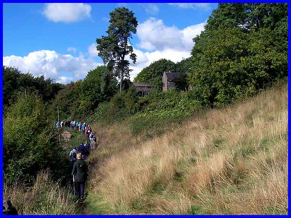
It was back to a more hilly landscape on Friday as I travelled
to Holbrook for the "Holbrook and Derwent Valley Walk".
Richard, who leads the Holbrook walks on behalf of the Parish
Council for the Autumn Footprints Festival, has four routes that
he rotates over the years and this route was one I had followed
previously. It starts on the high ground at Holbrook and passes
over Duffield Bank to drop down to the Derwent Valley, passing
below Eaton Bank and then rising up again through an area of
woodland known as The Dumble before a final steep climb up Stony
Lane into the village.
Click this link
for more photos plus a route map of the Holbrook walk.
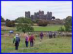
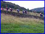
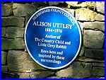 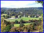 Saturday, and like the previous Saturday was another
glorious day on this the penultimate day of the Walking Festival.
It was also the day I returned to Lea where Wednesday's walk
had started from. This walk though was the "Alison Uttley
& Canal Walk" which took a large group to the childhood
home (above) of the author probably most famous for her "Little
Grey Rabbit" book. The farm is not open to the general public
although a blue plaque (left) on the wall near the farm gate
states that she was "inspired by these surroundings"
some of which (right) we enjoyed as we continued through the
fields to Cromford. Saturday, and like the previous Saturday was another
glorious day on this the penultimate day of the Walking Festival.
It was also the day I returned to Lea where Wednesday's walk
had started from. This walk though was the "Alison Uttley
& Canal Walk" which took a large group to the childhood
home (above) of the author probably most famous for her "Little
Grey Rabbit" book. The farm is not open to the general public
although a blue plaque (left) on the wall near the farm gate
states that she was "inspired by these surroundings"
some of which (right) we enjoyed as we continued through the
fields to Cromford.
|
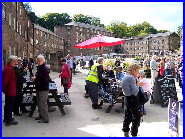
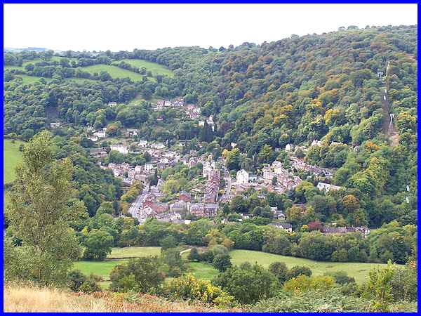
And it was in the Cromford Mills complex that we stopped for
lunch and a look round the businesses and shops that appeared
to be doing a good trade on this busy Saturday afternoon.

We returned to Lea along the towpath of the Cromford
Canal (above) where a narrow boat, swans and other waterfowl
and children splashing about in canoes all added to the interest
as we passed many more people using the towpath. The sun had
certainly helped make Cromford a magnet for visitors on the September
afternoon.
Click this link
for more photos plus a route map of the Alison Uttley walk.
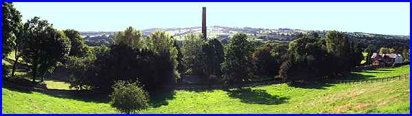
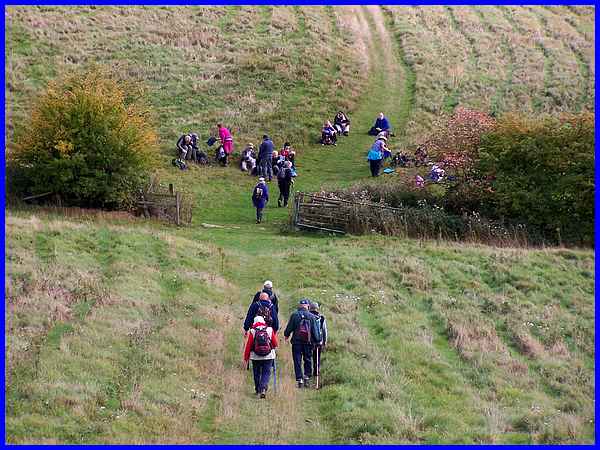
And so to Sunday, the final day of the Festival and the final
walk. This was a 4 mile walk "Along The Derwent To Duffield".
We started in Little Eaton and walked along the river valley
to a nature reserve in Duffield returning via the Blue Mountain
Cottages in Little Eaton from where this panoramic view across
the valley with the Peckwash Mill chimney in the centre was taken.
A fitting view to mark the end of the 2015 Festival. The 2016
Festival has already been pencilled in for the 10th to the 25th
September.
Click this link
for more photos plus a route map of the Duffield walk.
On 15th November 2015, I added a fuller account of the Duffield
walk with even more photos- click
here to view.
|
