Autumn Footprints
2010 - Week One
w/e 03 October 2010
All this week's pictures were taken
with a Kodak DX6490
The Walking Festival in Erewash and Amber Valley
was held over a couple of weeks in the middle of September and
featured over thirty guided walks or organised events. It would
have been impossible for any one individual to participate in
all of them due to the conflicting start times of the walks which
ranged from one to twelve miles. Personally, other commitments
also played a part and I was only able to take part in three
walks in each week but they all proved very enjoyable. A selection
of images from the first three walks can be seen below and the
three from the following week are on a second page (linked
below).
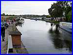
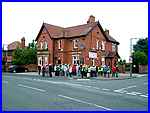  With my wife, I joined about sixty more walkers
at the Railway Inn (left) at Sawley for an "Extended River
& Canal Walk" with the Sawley Walking For Health Group.
Health walks are normally over about three miles but for the
Festival the group had combined two walks to produce a circular
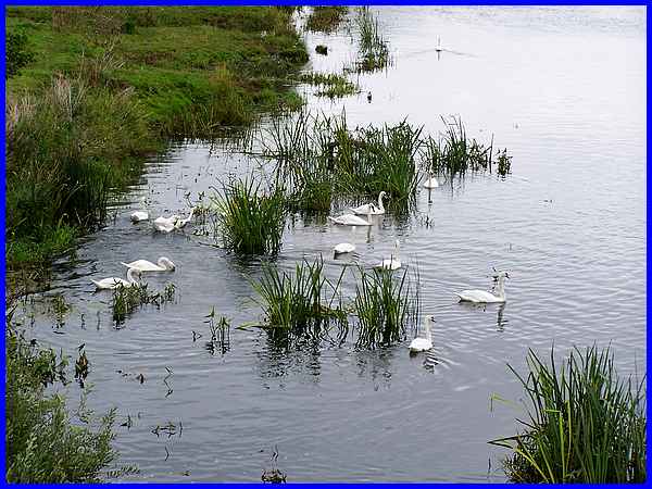
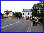
five mile walk. We left Sawley via Tamworth Road (right) and
headed for the bridge over the River Trent and a cluster of swans. With my wife, I joined about sixty more walkers
at the Railway Inn (left) at Sawley for an "Extended River
& Canal Walk" with the Sawley Walking For Health Group.
Health walks are normally over about three miles but for the
Festival the group had combined two walks to produce a circular
five mile walk. We left Sawley via Tamworth Road (right) and
headed for the bridge over the River Trent and a cluster of swans.
|
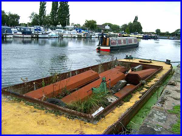
 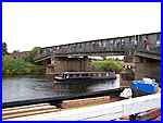 After
crossing the river we turned along the towpath of the Sawley
Cut (left) which bypasses a weir on the river and passing Sawley
Marina continued to the lock where the canal rejoins the
Trent. Here we once again crossed the river using a footbridge
at the side of the railway bridge (right) and then followed the
path between the river and the Trent Lock Golf Centre to pick
up the Erewash Canal. After
crossing the river we turned along the towpath of the Sawley
Cut (left) which bypasses a weir on the river and passing Sawley
Marina continued to the lock where the canal rejoins the
Trent. Here we once again crossed the river using a footbridge
at the side of the railway bridge (right) and then followed the
path between the river and the Trent Lock Golf Centre to pick
up the Erewash Canal.
|
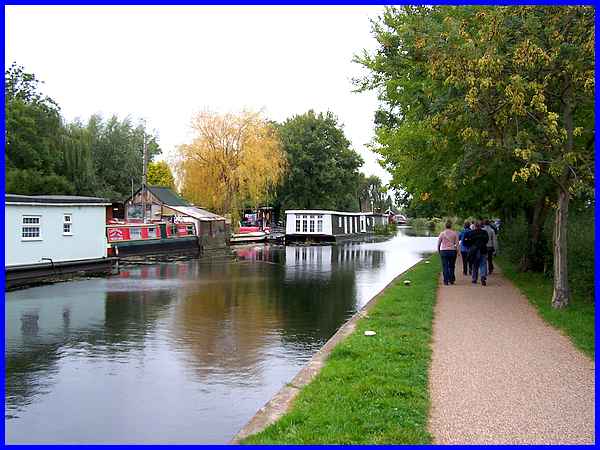
We followed the Erewash Canal as far as Tamworth Road at Long
Eaton leaving the towpath to follow Tamworth Road back to the
starting point at Sawley.
|
I said that I had taken part in three walks during the first
week but that is not strictly true as an emergency visit to the
vets meant that we did not arrive at the Midland Railway Centre
for the second walk until nearly half an hour after the starting
time. However we were informed at the Centre that we were only
twenty minutes behind the group so pointed in the right direction
we set off for a bit of speed walking to try and catch up. Our
efforts were in vain for although we reached the Country Park
we neither saw nor heard anything of the group so these images
were all captured as we retraced our steps back to the Railway
Centre at a more leisurely pace.
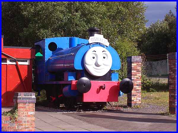
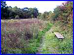 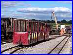 Our speed walk had taken us through a
wooded area in the Country Park to a clearing (left) and it was
here that we decided to return. At one of the entrances to the
Railway Centre we were greeted by one of Thomas the Tank Engine's
friends, Oswald, and we were able to walk through the rest of
the site and see all types of rolling stock (right). Our speed walk had taken us through a
wooded area in the Country Park to a clearing (left) and it was
here that we decided to return. At one of the entrances to the
Railway Centre we were greeted by one of Thomas the Tank Engine's
friends, Oswald, and we were able to walk through the rest of
the site and see all types of rolling stock (right).
|

There are also several buildings on the site that have been restored
including stations and signal boxes that easily transport you
back to the golden age of railways.
|
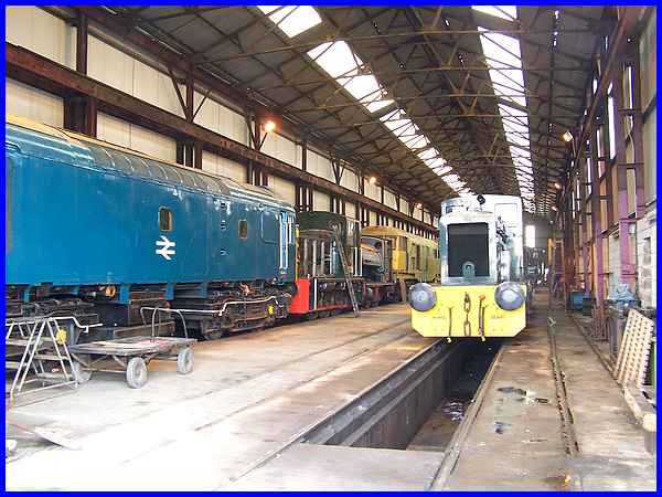
It's not only buildings that are restored and the large engine
sheds provide an ideal environment to work on the engines and
rolling stock.
|
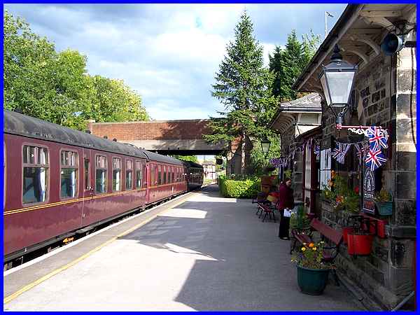
We had not taken part in the organised walk and no doubt missed
out on some interesting information as previous walks with the
appointed leader had always been very revealing about the area
but we had enjoyed a good walk nonetheless and the station at
the Midland Railway Centre evoked memories of
times past. Entrance to the site is free but train rides operate
at various times and are of course chargeable.
|
 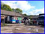 The final
walk of this first week was at "Stanley Village & Surrounds"
much of which has been covered in the Stanley Village Trail but on this occasion,
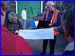
special permission had been obtained to enter the Nibby Pit yard
(right) and to examine a site plan of the West Hallam Storage
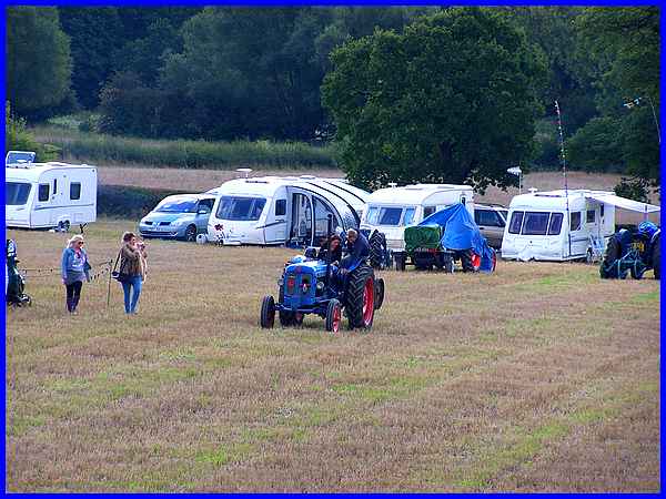
Depot (left). Continuing into Stanley, we passed a field where
a competition for old tractors was taking place. The final
walk of this first week was at "Stanley Village & Surrounds"
much of which has been covered in the Stanley Village Trail but on this occasion,
special permission had been obtained to enter the Nibby Pit yard
(right) and to examine a site plan of the West Hallam Storage
Depot (left). Continuing into Stanley, we passed a field where
a competition for old tractors was taking place.
|
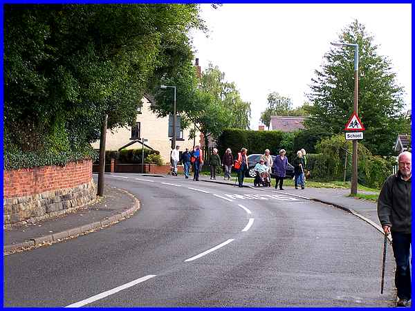
This walk was in two distinct parts, the first following the
main road through Stanley and part of the group is seen here
on Station Road as they approached the White Hart.
|
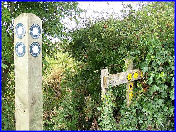
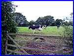 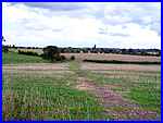 At the pub a right turn took us up Morley
Lane and Common Lane to return to the start over the fields to
the north of the village. Cattle (left), sheep and geese were
among the many farm animals to be seen along with the open countryside
views (right) and at the boundary hedge line that separated three
fields, a surfeit of circular signs pointed in all directions
but our guide led us safely back. At the pub a right turn took us up Morley
Lane and Common Lane to return to the start over the fields to
the north of the village. Cattle (left), sheep and geese were
among the many farm animals to be seen along with the open countryside
views (right) and at the boundary hedge line that separated three
fields, a surfeit of circular signs pointed in all directions
but our guide led us safely back.
|
