Ilkeston - Above The
Rooftops
w/e 06 August 2006
All
this week's pictures were taken with a Kodak DX6490
Life is full of ups and downs but you could certainly
say this was the high point of my week as I climbed to the top
of St Mary's Church tower to survey the surrounding district.
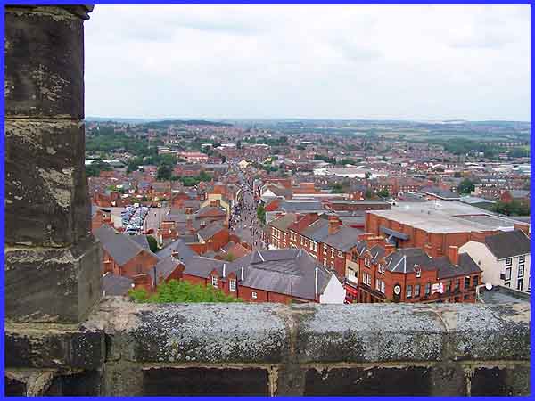
This is the view looking to the north and is directly down the
hill that is Bath Street. From this height the slope is not readily
apparent but in the middle distance the trees of Cotmanhay Wood
rise above the rooftops on another piece of higher ground. Back
in my childhood, I was told that Ilkeston was built on the last
hill at the southern end of the Pennines and St Mary's stands
on the top of that hill. The River Erewash runs through the valley
to the right and forms the border with neighbouring Nottinghamshire.
The river is crossed by the listed Bennerley Viaduct which can
be seen at the right edge of the picture.
|
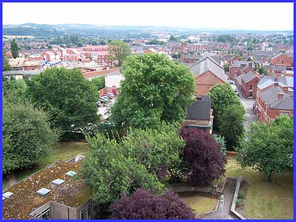
In the opposite direction the view is over the Cantelupe Centre
and Memorial Gardens in the foreground to the southern part of
Ilkeston and beyond. From the left we can see the footbridge
over Ilkeston's inner relief road, Chalons Way and the new housing
development on the site that previously housed several schools.
Just right of centre is the former Rutland Garments factory and
almost in line with it is St Thomas' Roman Catholic Church beyond
which are the white buildings of the South East Derbyshire College
of Further Education. Market Street is the road on the right
of the picture.
|
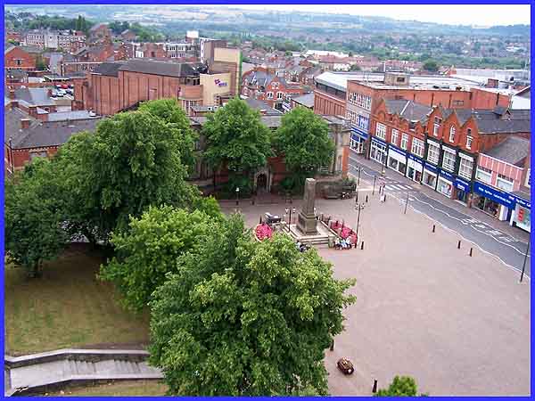
The rest of the images on this page are towards the west, panning
around the Market Place from the south to the north starting
with this view of the Cenotaph. Behind the memorial and shrouded
by the trees is the Carnegie Library and behind that is the Ritz
Bingo Hall, formerly one of four cinemas in the town. Toll Bar
House can be seen in the top left hand corner whilst most of
the buildings fronting on to South Street and the Market Place
on the right belong to the Ilkeston Co-Operative Society.
|
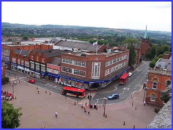
Wharncliffe Road runs from the Market Place between the Co-Op
and the Town Hall and the church with the green spire that is
visible on the Ilkeston skyline together with St Mary's tower
from afar is the United Reformed. Directly above the flag on
the Co-Op it is just possible to make out the training tower
at Ilkeston's Fire Station whilst the housing in the distance
is at Kirk Hallam.
|
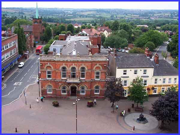
Now looking almost due west over the Town Hall towards West Hallam
and Stanley, the controversial new building on the Rutland Recreation
Ground can plainly be seen and further to the right is a roof
at Ilkeston School (formerly the Grammar School). In the foreground
the ornamental fountain sits in front of the Sir John Warren
public house.
|
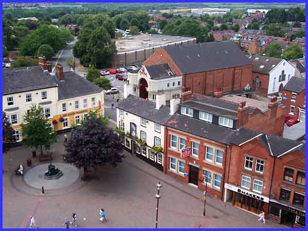
The Warren and the fountain are also visible here as is the Moon
and Sixpence behind which is the easily recognisable Scala cinema
- the last surviving picture house in the town. It has been featured
in several television programmes including 'Shine On Harvey Moon'.
Old cottages used to stand where the car park at the side of
the Scala is and the flat topped building is a major Severn Trent
Water Authority pumping station. The industrial units towards
the top right are on the site of the former Manners Colliery
and the Independent Chapel on Burns Street immediately behind
the Scala has now been converted into flats. In fact the Scala
was built on the burial ground.
Continued on
Page 2
|
