Ilkeston - Kirk Hallam
w/e 15 January 2006
All
this week's pictures were taken with a Kodak DX6490
Mention locally of the words 'Kirk Hallam' these days will probably
conjure up images of the housing estates that have been built
up both north and south of Ladywood Road but this has not always
been the case. It's not so very long ago that it was a self contained
village consisting of a Church, a Hall , a School and a few cottages
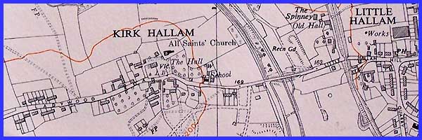
scattered either side of the road. The extract from the old Ordnance
Survey map below from about the middle of the last century shows
all these features and also the beginnings of the St Norbert's
Drive development to the south. There is still no sign of Godfrey
Drive to the north of Ladywood Road (compare today's map).
The name Kirk Hallam has evolved over the years from when it
appeared in the Domesday Book in 1086 as 'Halum' later to become
'Burkhalum' meaning 'the cottage in the nook'. 'Burh' is Old
English for cottage and halh for 'nook or corner'. The Old Norse
'kirkja' and Old English 'cirice' gave rise to the 'Kirk' part
of the name following the building of the church and to differentiate
the settlement from others in the neighbourhood that are today
known as West Hallam, Little Hallam and Hallam Fields.
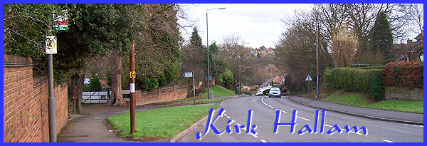
 In the
late 1950s the realignment of Ladywood Road (see title image
above) resulted in some old cottages near the church being demolished
but it was not until 1973 that the Hall met the same fate. The
Hall stood to the left of the access drive and was acquired by
the parish in 1932. Previously it had served as an academy for
young ladies in the early 19th century and then as the home first
to a local miller and then to a solicitor. The 1932 rebuilding
of the Hall reduced its size by 40% and resulted in the demolition
of the East wing. It lasted in this form until 1973 when it was
completely demolished to be replaced by a purpose-built vicarage. In the
late 1950s the realignment of Ladywood Road (see title image
above) resulted in some old cottages near the church being demolished
but it was not until 1973 that the Hall met the same fate. The
Hall stood to the left of the access drive and was acquired by
the parish in 1932. Previously it had served as an academy for
young ladies in the early 19th century and then as the home first
to a local miller and then to a solicitor. The 1932 rebuilding
of the Hall reduced its size by 40% and resulted in the demolition
of the East wing. It lasted in this form until 1973 when it was
completely demolished to be replaced by a purpose-built vicarage.
|
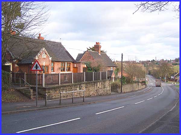
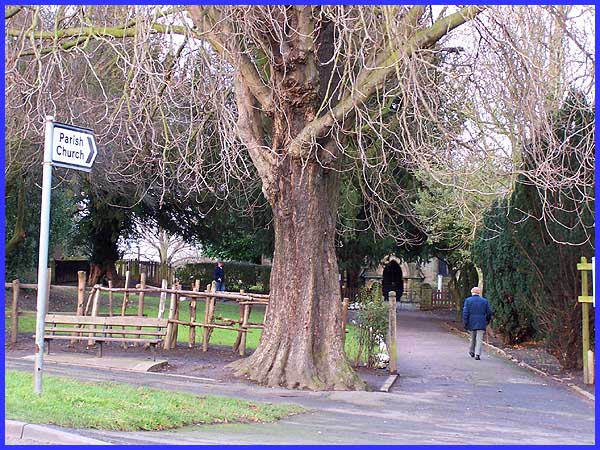
Going down the hill from the church, the old school building
(left in the picture above) is identified by a name plate on
the wall but today it is a private residence. Nowadays, Kirk
Hallam boast four schools - Dallimore and Ladywood for younger
children and the Community School and St John Houghton for seniors.
Both the senior schools are on the northern side of the estate
off Godfrey Drive seen here on the left at the bottom of the
hill.
|
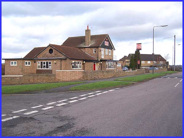
About halfway along Godfrey Drive which rejoins Ladywood Road
at the Cat and Fiddle Inn (see here) there is a green open space where water
birds are a common sight by and on the adjacent lake.
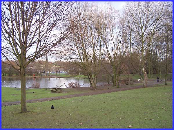
One of the schools mentioned earlier, the Community School, is
reached by an access road by the side of the lake and can be
seen here through the trees. Care has to be taken when driving
along Godfrey Drive not only because of the presence of schoolchildren
but also because there is often a parade of swans and ducks visiting
the bungalows opposite in search of a titbit or two.
|
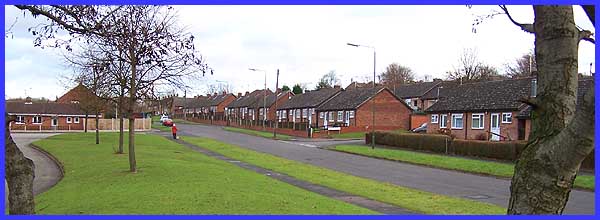
But it was the south side of the estate that was developed first
where many of the residents found employment at the nearby Stanton
Ironworks (later British Steel). Although the industrial area
is still visible from the top of Depedale Avenue, a twin as opposed
to dual carriageway with a wide central reservation in the middle
of the southern half of the estate, the population has long had
to look for alternative means of employment since the demise
of the iron and steel making industry. There is though, perhaps
a lesson to be learned by the town planners of today who seem
intent on cramming as many properties into as small an area as
possible from this picture. When Kirk Hallam estate was laid
out it included several areas of green open space with consideration
to the future wellbeing of the residents.
|
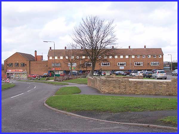
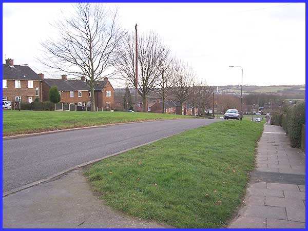
It was also near the top of Depedale Avenue that the planners
created a new 'village centre' with room for a small shopping
precinct, a doctor's surgery and a community hall.
|
Not forgetting of course, the Hillcrest Elderly Persons Home
in the distance and the essential for any village centre, a public
house. In this case it is the Nottingham Castle. The prompt for
this page came as a result of an email I received just before
Christmas from a young man serving his country in Iraq. He referred
to Kirk Hallam as 'the village time forgot' and admitted that
he was feeling somewhat homesick with very little to be found
on the internet. I don't think it was forgotten as such, just
swallowed up by the surrounding development but I hope these
images redress the balance a little and I have no doubt on his
return home, he'll enjoy recounting his experiences in the Forces
with some of the regulars of the Nottingham Castle.
|
