Shardlow Part 07 - London Road continued
w/e 28 August 2016
All of this week's pictures were
taken with a Kodak DX6490
It's been nearly six months since our last visit
to Shardlow but as we return for this, the final part of this
Village Trail, we pick up the route again on London Road close
to its junction with Aston Lane.
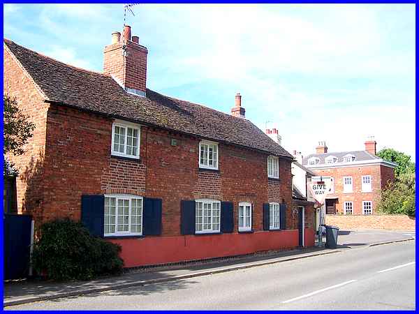
There are a cluster of Grade II Listed Buildings at the junction.
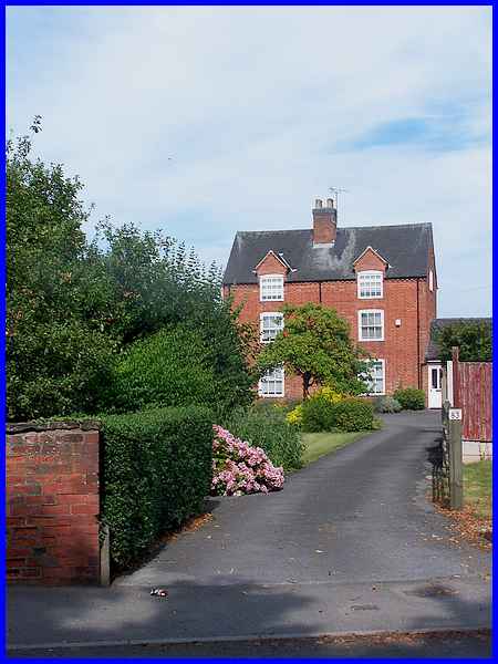
Opposite and to the right is number 83 London Road. This is a
late eighteenth century farmhouse with later alterations and
additions.
|
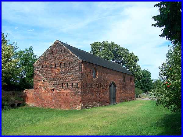
Left of 83 stands another late eighteenth century building -
a threshing barn with attached cowshed. This too has undergone
later alterations but the rows of slit breathers on the south
wall and the nineteenth century circular pitching holes on the
east wall that are a feature of the building are clearly visible.
|
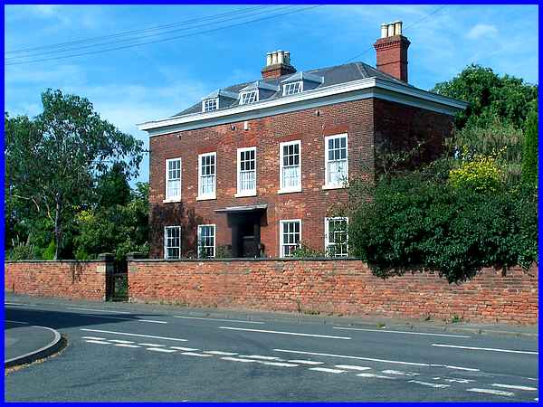
Further west, next to the barn and as a complete contrast to
it, is the imposing structure of the Dower House at 81 London
Road. A dower house is legally available for the widow of the
owner of the estate and this Georgian property, a late eighteenth
century building dates from about 1750. As well as the impressive
outward appearance it has several interesting internal features
including an original Adam style fireplace which would no doubt
have been appreciated by Italian officers housed here during
the Second World War.
|
Stepping briefly off London Road into Aston Lane highlights the
difference between the rich and the poor in the late eighteenth
century. Dating from then is number 4 Aston Lane. Although now
one house, originally this was a pair of cottages and whilst
the difference with the Dower House, seen here on the right across
London Road, is obvious they are now on a par as both are Grade
II Listed.
|
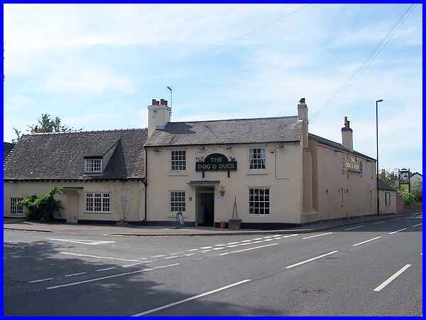
Between the cottage and the Dower House, the Dog and Duck Inn
stands on the corner of Aston Lane and is the last of the Listed
Buildings around the road junction. Comprised of a cottage and
house the pub is also thought to be the oldest building in the
village dating from the seventeenth century and is possibly timber
framed.
|
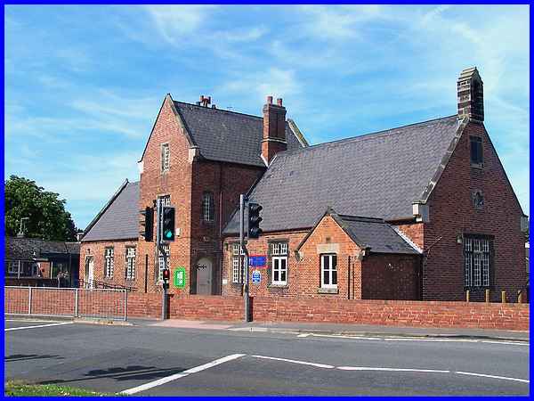
Moving about 300 yards along London Road is the next point of
interest and the next Listed Building. Also Grade II this is
Shardlow Primary School and it is situated at another road junction,
the one with Ambaston Lane which heads north to the hamlet of
the same name. The school was built in the Tudor style in 1834.
|
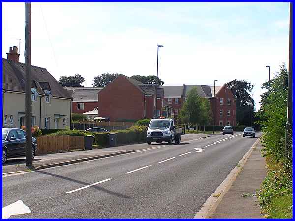
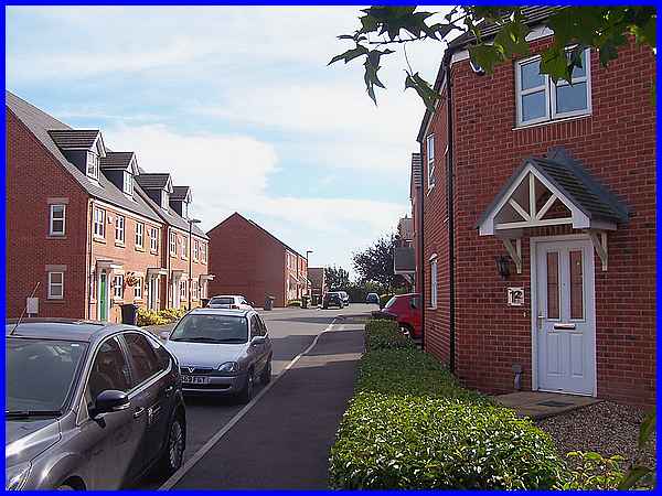
In approximately the same distance from the school there should
be three more Listed structures but the site of the housing estate
at the corner on the left is not one of them.
|
I remember the housing estate being the site of the Grove Hospital
but before that, it was the Shardlow Union Workhouse. The history
of the Shardlow Workhouse makes for some interesting reading
and can be seen at the workhouses.org,uk website. The Grove Hospital
which catered for elderly patients closed in 2005 but the subsequent
demolition to allow the construction of the housing estate did
not go without a hitch as this Daily Mail article records. I imagine that
many of the residents living on Cheal Close now commute into
Derby and the surrounding area to earn a crust and it is in fact
a dormitory development.
|
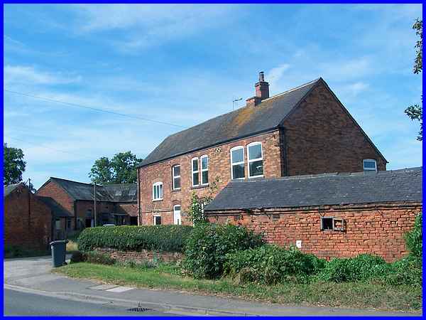
 Opposite
the estate is Moor Farm and I took the photo above thinking it
could be one of the two Moor farm Cottages that are recorded
in the Grade II Listings. The entries describe the cottages as
Moor Farm Cottage (South) and Attached Outbuilding: "Mid
C18 with C19 alterations. Rendered red brick on stone plinth
with plain tile roof ...." and Moor Farm Cottage (North):
"C17 with C19 alterations. Rendered red brick on stone plinth
with plain tile roof ...." Opposite
the estate is Moor Farm and I took the photo above thinking it
could be one of the two Moor farm Cottages that are recorded
in the Grade II Listings. The entries describe the cottages as
Moor Farm Cottage (South) and Attached Outbuilding: "Mid
C18 with C19 alterations. Rendered red brick on stone plinth
with plain tile roof ...." and Moor Farm Cottage (North):
"C17 with C19 alterations. Rendered red brick on stone plinth
with plain tile roof ...."
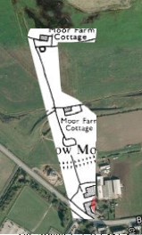
Further investigation when I returned home and plotted the given
grid references of the cottages onto a map proved that the Moor
Farm photograph above is neither of the two listed buildings.
I had however seen nothing else on site that corresponded to
the descriptions and satellite images of the area showed nothing
either. So I searched old maps and found an early Ordnance Survey
edition that showed the location of the said cottages enabling
me to produce the combined image on the left. It became obvious
therefore that despite their listed status, the cottages no longer
exist.
|
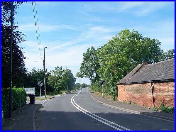
I said there were three more Listed structures but have determined
that the first two are no longer there and if the third one is,
it is so well hidden I couldn't find it. As London Road turns
the corner at Moor Farm and heads off along the long straight
stretch towards Derby, it passes a small Business Park on the
left. Just beyond the entrance to the Park is supposed to be
a Grade II Milepost. Approximately three feet in height it showed
that London is a hundred and twenty miles from here whilst Derby
is just six. Made of cast iron it was inscribed "Harrison,
Derby" but like the cottages, I believe it is nowhere to
be found. Unfortunately this is rather a disappointing way to
bring this Village Trail through Shardlow to a close but there
is still much to see and enjoy in the rest of the village as
I hope the previous parts in the series looking at this historic
inland port have already shown.
|
