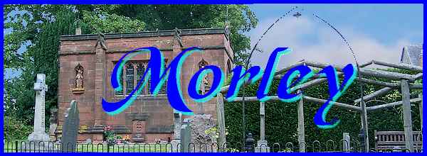
Morley - Part 01 - Around The Church
w/e 10 August 2014
All of this week's pictures were
taken with a Kodak DX6490
Introduction and a Word of Explanation
Over the last decade I have walked many of the highways and byways,
footpaths and bridle ways on Morley Moor, either alone or as
part of an organised group with a walk leader. Each time the
route has been a circular one beginning and ending at a designated
place but during all that time I have been unable to find a route
that covers all the points of interest without some backtracking
or doubling back over ground already covered. The official guide
book to Erewash states that the "village" of Morley
is comprised of a series of ancient settlements. These are identified
as Brackley Gate, The Croft, Morley Smithy, Morley Moor and Church
Lane but there are several other isolated places that also fall
within what is generally referred to as Morley. Various sources
will be used to gather information for this series not least
of which will be a 1994 leaflet published by Erewash Groundwork
Trust that details seventeen points of interest. The leaflet
adds that the places may be visited in sequence or in any order
but does not attempt to define a circular route. Faced with the
same problem and for the same reasons, I shall be adopting a
scatter gun approach for this "Village Trail" and be
looking in turn at each of the settlements and various other
places in between. Whilst most of the images will be new ones
I will from time to time include others from those earlier walks
to illustrate specific places.
So to set the scene let me quote from that 1994 leaflet which
states "It is a very tranquil and picturesque village despite
being just four miles from Derby city centre. Its main geographic
feature is the moor on which it is situated - a plateau area
which rises to 450 feet." It adds that the "name means
clearing on the moor" and to kick off the series we'll begin
just off Church Lane and look at the area "Around The Church".
When I first started work with EMEB in 1966, my duties included
travelling around the area with colleagues to various sites and
we got to know the district quite well. We referred to at least
three sites by the name of "Donkey's Hollow" adding
the suffix of a village name. Whether they were official nicknames
(if that's not a contradiction in terms) or just something we
devised to help us quickly find our way around I'm not sure,
but one of those descriptions was applied to Church Lane at Morley.
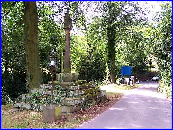
And off Church Lane is a drive that leads up past the Village
Cross. This is one of two crosses that stood in the vicinity.
The other one was just the shaft of a cross that stood near the
vestry door at the church and to which a sundial was added in
1762. Sadly that cross disappeared overnight (for "disappeared"
read "was stolen") in February 2014. (Link to local newspaper report)
The Butter or Barter Cross pictured above suggests a market or
trading place but this is only speculation although it stands
on what was once the village green. It is thought to be of fourteenth
century origin and was restored by Mr H Topham of Morley Hall
in 1916 when the figures of Our Lady and Child were added to
the top.
|
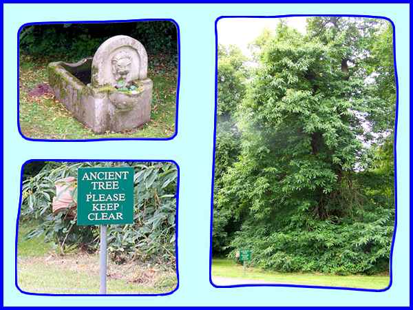
Just beyond the cross is an unusual cradle shaped water trough
and an ancient tree, the trunk of which is almost completely
obscured by the leaves on the low branches. Both trough and tree
were also on the village green.
|
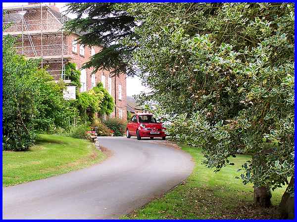
The drive continues to the Rectory, a large house of 1740 built
when the old parsonage was burnt down. It was extended in 1846
and behind it, there are still the remains of some old farm buildings.
Bagshaw's "History and Gazetteer" of that year records
that the "mansion was undergoing considerable alterations"
and the scaffolding presently on site suggests further restoration
or maintenance is taking place. It underwent significant alterations
after it became the Diocesan Retreat and Conference Centre in
1959.
|
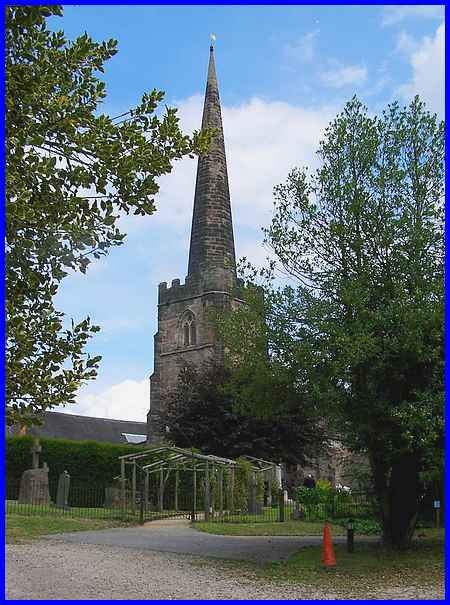
Opposite the Butter Cross is a small car park serving St Matthew's
Church. Standing on the site of a Saxon building parts of the
church date from the thirteenth century. My Derbyshire volume
of the 1937 edition of "The King's England" reveals
that "the tower, with a turret and a lofty spire, comes
from a great restoration of about 1400." Work on the nave
revealed original arcades that could be dated to the time of
either Stephen or Henry II. The church is now a Grade I listed
building and contains many historical and interesting features,
details of which can be found on the British Listed Buildings website.
|
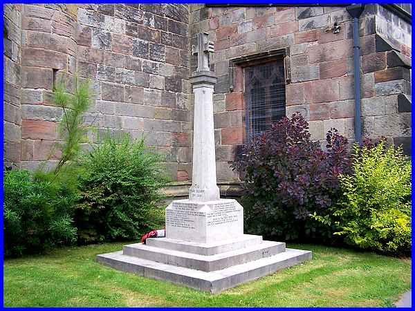
Near the church entrance is something else of historical significance
of a more recent vintage although this year is marking the centenary
of the event it was erected to commemorate. The War Memorial
originally erected to honour the men of the First World War from
the village who lots their lives in that conflict now has the
names of Second World War losses inscribed too.
|
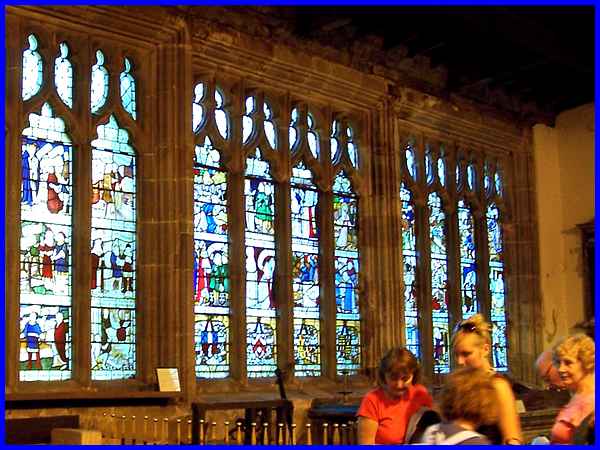
It is inside the church though that most of the historic treasures
can be viewed and it is noted for its memorial brasses, mediaeval
tiles and of course its stained glass windows. Several local
prominent family names are recorded in the memorials including
Stathum, Sitwell and Wilmot and there is also a mausoleum in
the churchyard for the Sacheverell Bateman family which will
feature in Part 02 of this series. The mediaeval windows in the
North Chapel were rescued from the refectory at Dale Abbey at
Henry VIII's Dissolution of the Monasteries in the 1530s. The
church is usually open on Saturday afternoons between April and
September for viewing but the image of the North Chapel window
seen above depicting the story of Sir Robert of Knaresborough
was captured during one of those earlier guided walks.
|
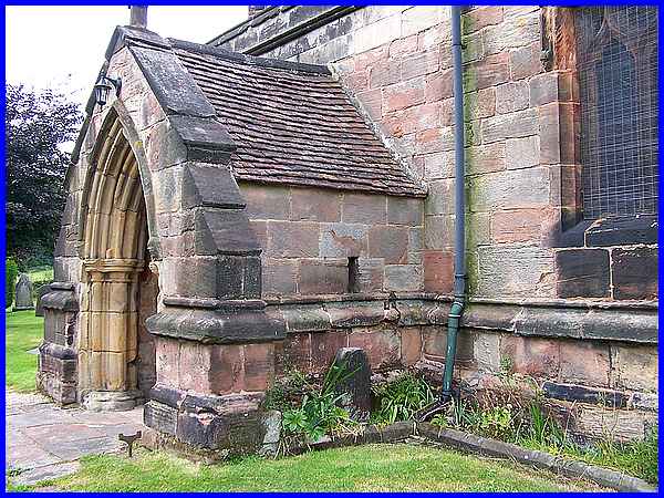
Another link to Dale Abbey is thought to be the cross over the
porch at the south door of the Church. Stonework from the Abbey
can be found in buildings all around the area and puts paid to
the theory that recycling is a modern phenomenon.
|
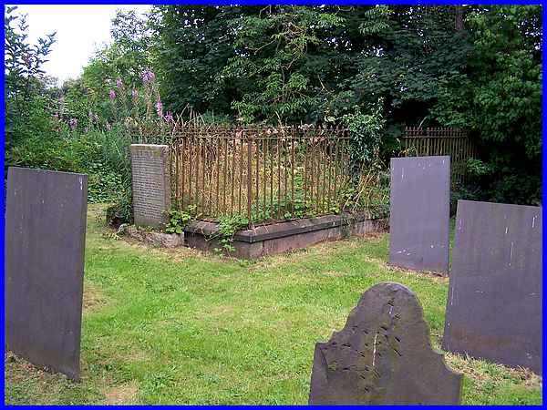
Among the many old headstones in the churchyard are the graves
of the Schwind family of the Broomfield Estate and also of botanist
Joseph Whittaker who went to Australia in the 1800's as gardener
to the Governor but the most obvious is the nineteenth century
railed vault of the Sitwell family beyond the eastern end of
St Matthew's.
|
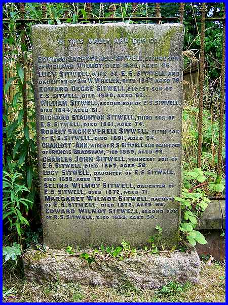
An inscribed stone at the vault gives details of all the members
of the Sitwell family buried within the vault.
|
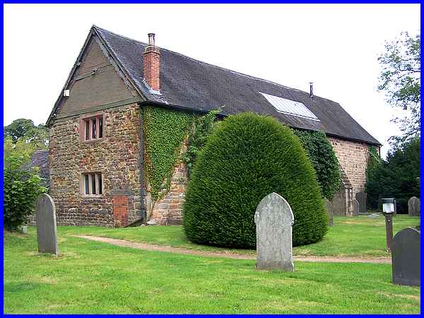
On the northern side of the church is a residential building
that is a conversion of the original tithe barn and dovecote.
As well as a grain store, the seventeenth century barn was also
used as a coach house being part of the outbuildings of Morley
Hall when occupied by the Sacheverell family. Later the upper
storey became a venue for social events held by the villagers.
Alterations to the building in 1965 resulted in the unfortunate
loss of the dovecote when the pigeon holes were destroyed.
|
