A Sentimental Journey
- No. 05 (also No. 06)
Ilkeston To Cossall - Part 3
w/e 10 February 2008
All
this week's pictures were taken with a Kodak DX6490
Gonna take a Sentimental Journey, Gonna set my
heart at ease.
Gonna make a Sentimental Journey, to renew old memories.
Our sentimental journey so far has taken us in two parts
from Ilkeston Market Place to Park Cemetery and then from the
cemetery to Potter's Lock. Now we pick up the route again and
continue towards Cossall as far as the Nottingham Canal following
the route suggested by Derek Thorpe (up Monks Walk to the
Top Canal) and also described in similar fashion by Joanne
Apergi (the train bridge, up to the first swing bridge).
If you want to start the walk again from the Market Place before
proceeding from here, click
here.
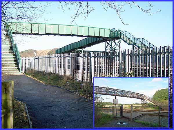
 Leaving
Potter's Lock and the Erewash Canal behind us we must first cross
a small bridge (left) over the River Erewash, passing at the
same time from Derbyshire into Nottinghamshire as the river marks
the boundary between the two counties. As well as the river,
the railway also runs along the valley and the train bridge that
Joanne referred to can be seen in the inset above. That picture
was taken in October 2000 but in 2002/3 it was removed and replaced
by a far less aesthetically pleasing structure (that's putting
it politely - I usually call it a monstrosity) that includes
ramps as well as steps on each side of the tracks. Leaving
Potter's Lock and the Erewash Canal behind us we must first cross
a small bridge (left) over the River Erewash, passing at the
same time from Derbyshire into Nottinghamshire as the river marks
the boundary between the two counties. As well as the river,
the railway also runs along the valley and the train bridge that
Joanne referred to can be seen in the inset above. That picture
was taken in October 2000 but in 2002/3 it was removed and replaced
by a far less aesthetically pleasing structure (that's putting
it politely - I usually call it a monstrosity) that includes
ramps as well as steps on each side of the tracks.
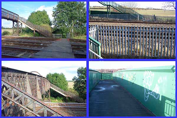
I can appreciate the need for the ramps and the health and
safety aspects of the new bridge but I still find it difficult
to find any redeeming features in the structure itself. Back
in 2000 and for many years previously it had also been possible
to cross the tracks via a wooden walkway (top left). Health and
safety in those days was addressed by little more than a "Stop,
Look, Listen" sign but now fences (top right) prevent access
to the lines. Joanne wrote that her brother was a train spotter
back then and no doubt he pursued his hobby from the rusting
cast iron bridge (bottom left) but on the new structure the graffiti
splattered sides (bottom right) are too high to see over and
as they are solid, you cannot see through them either. Oh, for
the good old days!
|
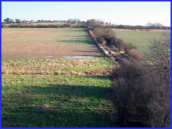
At least the vantage point offered from the top of the steps
on the bridge gives a good view of Mill Lane up the hill to Cossall
Village on the hilltop. The hedgerow running across from left
to right marks the position of the Nottingham Canal or "Top
Cut".
|
 As
was mentioned in the previous part, Potter's Lock was previously
called Ilkestonmill Lock due to the proximity of the mill that
stood by the river. The mill was also responsible for the name
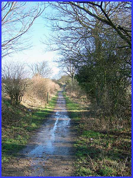
of the lane but unlike the lock, the lane's name has stuck. This
view up Mill Lane brings back those dreaded memories of cross
country runs whilst at school. In those days I was unaware of
the significance of the large stone slabs on the left of the
path but now know them to be part of the Monk's Way. They are still there but hidden
beneath the undergrowth. Views left and right of the lane are
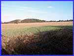
across pretty unremarkable farmland but the distant hill to the
left is the former slag heap at Cossall Colliery. As
was mentioned in the previous part, Potter's Lock was previously
called Ilkestonmill Lock due to the proximity of the mill that
stood by the river. The mill was also responsible for the name
of the lane but unlike the lock, the lane's name has stuck. This
view up Mill Lane brings back those dreaded memories of cross
country runs whilst at school. In those days I was unaware of
the significance of the large stone slabs on the left of the
path but now know them to be part of the Monk's Way. They are still there but hidden
beneath the undergrowth. Views left and right of the lane are
across pretty unremarkable farmland but the distant hill to the
left is the former slag heap at Cossall Colliery.
|
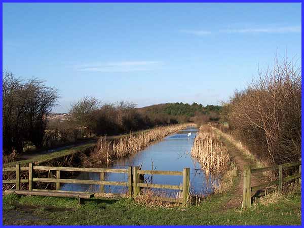
On reaching the canal we can look along its length towards the
former tip and in March 2007 we actually followed the towpath
through to Station Road (click here to view). The canal opened in
1796 to link Eastwood with Nottingham but like many others suffered
as a consequence of the success of the railways and by 1937 it
had been abandoned. Parts of the route of the waterway have disappeared
altogether due to opencast mining among other reasons so it is
no longer navigable but other parts, like here off Mill Lane,
have become nature reserves.
|
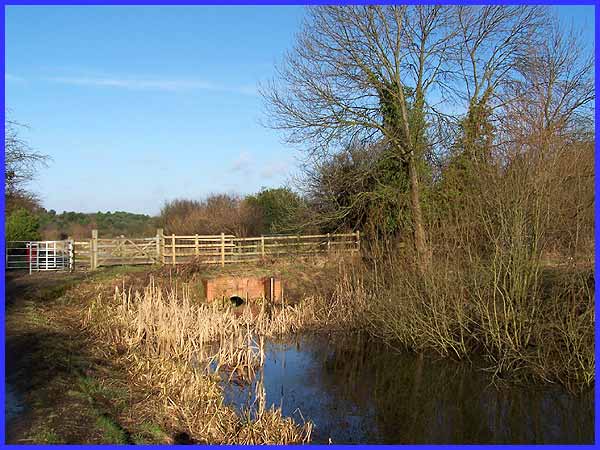
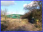
A large pipe now passes under Mill Lane to carry the water but
previously the canal was crossed by a swing bridge. Click here to see a photo of the bridge in
1966 at the Picture The Past website from a similar position
to the above. It is here that we must bid a temporary farewell
to Joanne as her route now follows the towpath on the left of
this image towards Trowell. We will return in Sentimental Journey
No. 6 to pick up that route.
|
From here on though we are about to continue with Derek's route
up Mill Lane into Cossall Village which we will see in Part 4.
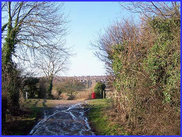
Before proceeding further up Mill Lane, a look back over the
Nottingham Canal and across the Erewash Valley shows Ilkeston
in the distance with the tower of the Roman Catholic Church of
St Thomas prominent on the skyline just to the left of centre.
Cue song:- Never thought my heart could be so yearny. Why
did I decide to roam?
Gotta take that Sentimental Journey, Sentimental Journey home.
Click here to continue
along Derek's route to Cossall in Sentimental Journey No. 05
Part 4
Click here to follow Joanne's route along
the Nottingham Canal in Sentimental Journey No. 06 Part 4
|
