Autumn Footprints 2019 - Week One
w/e 22 September 2019
All of this week's pictures were
taken with a Kodak DX6490
It is impossible for any one person to participate
in all of the walks in the annual Autumn Footprints Walking Festival
as some of them run at similar times on the same day or are at
different parts of the area making it impossible to get to the
start of one walk after the end of another. It's a matter therefore
of selecting walks when time and other commitments permit which
is precisely what I did during the first week of this year's
event.
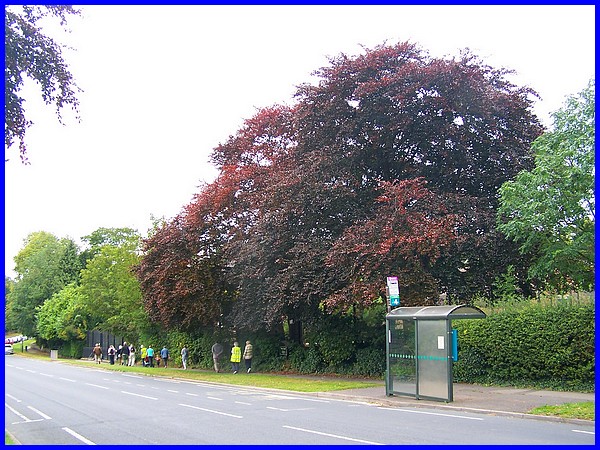
Sunday afternoon provided the opportunity for a leisurely stroll
around Risley looking at some Historic Trees. These included
trees that had been planted to mark certain historic events such
as the Coronations of Queen Elizabeth II (planted 1954) and King
George VI (1937), the marriage of Prince Charles to Diana, Princess
of Wales (1981) and many other significant events. Three Copper
Beeches on Derby Road (above) were among several more in the
village that were planted by Teresa Hooley after WW1 in memory
of the dead of that war. These included her brother Major Basil
Hooley who died of influenza in 1918.
|
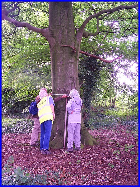
The route also included a walk through a private wood (owned
by the walk leader) where we were able to measure the girth of
some trees at pre-determined heights, multiplying the results
by certain factors to determine the approximate age of the trees.
The walk ended at the cottage behind the Parish Church where
refreshments were served. It was a cloudy afternoon but there
are far worse things you can do on an autumn day in September.
Route Map
|
Monday was one of those days when I was otherwise engaged but
on Tuesday I took a ride out to Crich for a walk with the Crich
Walking For Health (WFH) group. I have walked with the group
in previous years but this was a new route to me, one I hadn't
walked before. Although generally WFH routes are on level ground
with no stiles and no more that three miles in length, the Crich
group push the boundaries a bit on several of their walks. This
route included a downhill stretch towards Whatstandwell and of
course a necessary uphill part (with stiles) to return to the
starting point in the village centre. It was however only about
two miles in length.
|
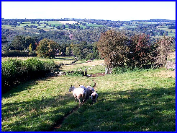
We were promised some good views by the walk leader and the return
via The Tors delivered the same from where we could see for miles
around over Crich on a bright and clear sunny day.
Route Map
|
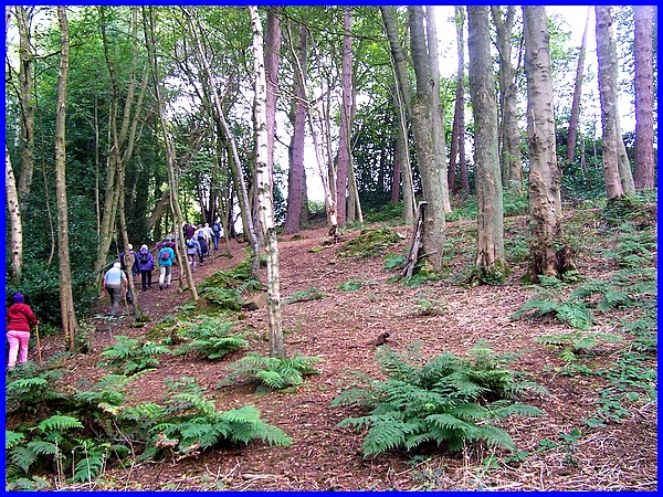
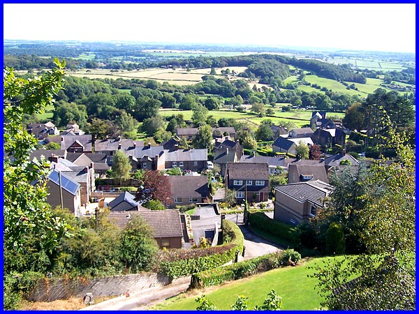
The fine weather continued all week and it was a similar day
on Wednesday when I joined another WFH group at Holloway for
a walk through Lea, Dethick and Riber returning via Hearthstone.
Once again the boundaries were pushed for which I admire them,
and the elongated route included climbs and stiles and stretched
for over five miles. This view from near the start was in Patchett
Wood at Lea after crossing the Lea Brook.
|
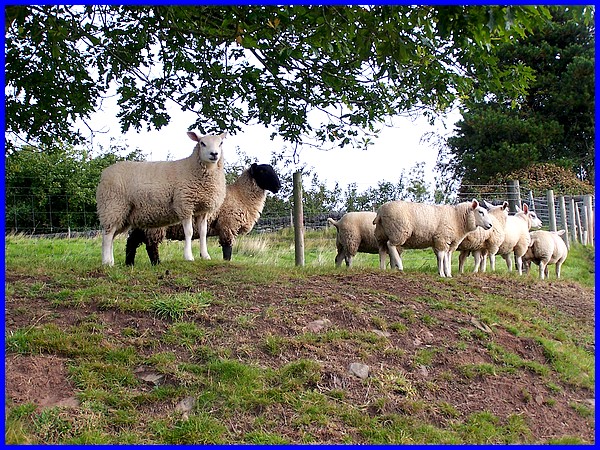
As we climbed the hill toward the church at Dethick several of
the locals had a watching brief. I could have selected any of
a number of shots of the landscape on this walk which again had
many wonderful views in countryside similar to the previous day's
walk at Crich but suffice it to say that it was another very
enjoyable walk. (I may revisit the route again later and share
some more photos.)
Route Map
|
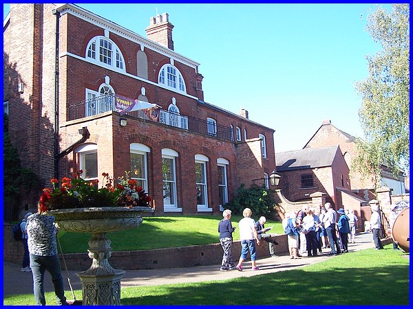
On Thursday I took "A Step Through Time" here at home
in Ilkeston. Although this walk was over an area I know well
I joined the group led by an Erewash Museum volunteer for a short
walk in the town centre. This was a very similar walk to the
one I did last year looking at the history of some of the buildings
in the town but then it poured with rain but this time it was
much better and more informative for visitors who had come from
out of town.
|
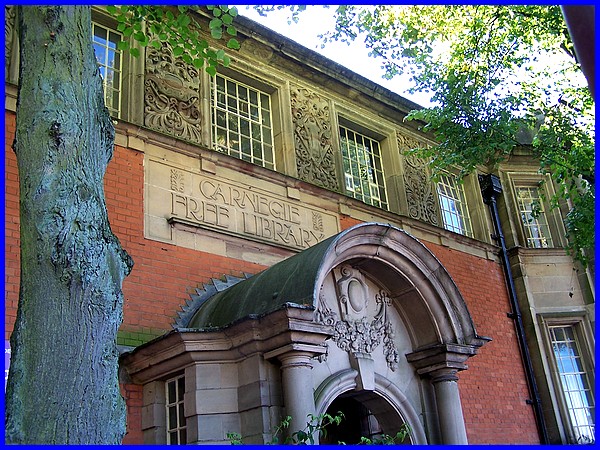
The walk took us down Burr Lane, along Chapel Street and up Bath
Street for a look around St Mary's Church before continuing to
look at buildings around the Market Place including the Church
Institute, Scala and Rirz Cinemas, Town Hall and the Carnegie
Library.
Route Map
|
On Friday I again headed off towards Crich and Holloway but stopped
at Ripley for a four and a half mile walk with the Amber Valley
Ramblers. This was titled "Ripley via Waingroves" and
took us out of the town over the fields to Marehay and on to
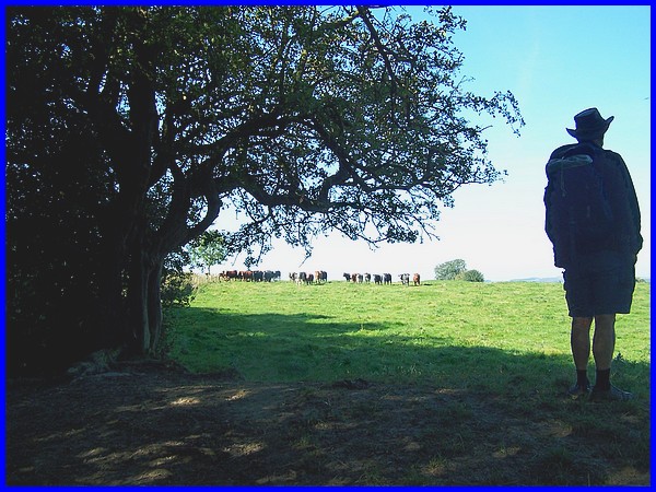
Waingroves. One of the fields had a herd of lively bullocks that
were quite interested in the walking group especially as there
were a couple of dogs with us but they were ushered away and
a lone lookout kept them at bay until we had all crossed the
field boundary.
|
At Waingroves we spent a little time in the Community Wood which
has been created on the former site of Waingroves Mine. In the
wood where a shaft was sunk about 1859 a memorial has been erected
to remember the nine boys and men who lost their lives in the
mine. Aged between 14 and 45 most of them perished in roof falls
but a plaque on the memorial also indicates that many more were
badly injured and died later. Employing 230 people at one point,
the mine was shut down for six months after a strike by the miners
in 1921 during which time it flooded. Unable to be drained it
was abandoned and capped in 1924.
Route Map
That brought an end to the first week but there's still more
than half the Festival to go. With the weather forecast to change
we shall have to see what the second week will bring.
|
