The Whittlestone Walk - Part 03a (formerly Mapperley - Castle and Brook)
w/e 11 May 2008
All
this week's pictures were taken with a Kodak DX6490
Although this page and the images date from May 2008,
the route followed along the bridleway from Brook Farm actually
constitutes the fourth mile of the five mile Whittlestone Walk,
a circular route from Ilkeston to Mapperley Village and back.
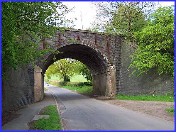
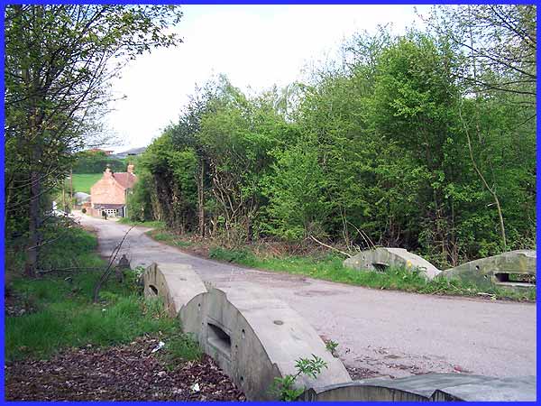
Last September we joined a group of people on a short heritage
walk in Amber Valley and Erewash Walking Festival's "Autumn
Footprints" programme. It took us along Mapperley Lane from
the West Hallam crossroads to Mapperley Church and at the lowest
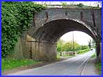
point of the lane we passed under this former railway bridge.
Our guide pointed out the substantial amount of iron work that
has been added to strengthen the bridge and also showed us where
the brickwork is in need of repair. Since the demise of the railway
the only transport to pass over the bridge are farm vehicles
that use it for easy access to the fields. With this in mind,
should the bridge deteriorate further, it seems unlikely that
it will ever be repaired.
|
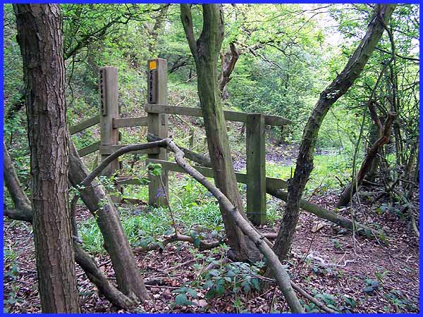
 As
we returned from Mapperley, our guide had asked if any of us
would like to see Mapperley Castle. Now the fact that there had
been a castle built at Mapperley came as a surprise to most of
us but we followed a path on the Mapperley side of the bridge
into a wooded area at the foot of the railway embankment. A little
way into the wood we came to a stile emblazoned with the words
"Mapperley Castle" but if we were expecting a turreted
stone building we were in for a disappointment. When the railway
was first constructed the embankment had been built right through
the site of the moated castle and all that remains to be seen
is a muddy patch where the moat had been. I believe it had been
a motte and bailey construction and the only other remains are
on private farmland on the West Hallam side of the embankment. As
we returned from Mapperley, our guide had asked if any of us
would like to see Mapperley Castle. Now the fact that there had
been a castle built at Mapperley came as a surprise to most of
us but we followed a path on the Mapperley side of the bridge
into a wooded area at the foot of the railway embankment. A little
way into the wood we came to a stile emblazoned with the words
"Mapperley Castle" but if we were expecting a turreted
stone building we were in for a disappointment. When the railway
was first constructed the embankment had been built right through
the site of the moated castle and all that remains to be seen
is a muddy patch where the moat had been. I believe it had been
a motte and bailey construction and the only other remains are
on private farmland on the West Hallam side of the embankment.
|
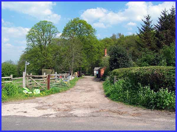
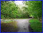
 On
this occasion we returned to Mapperley Lane, passed under the
bridge again and headed up the hill towards West Hallam (left).
The lowest part of the valley between West Hallam and Mapperley
is also where Mapperley Brook flows and a bridleway and footpath
runs parallel with, but a little away from, the brook towards
Ilkeston. Just inside the bridleway is Brook Farm and although
the area now displays a rural countenance, in the 1850s it was
a much different industrial outlook as several small collieries
operated along Mapperley Brook eastwards towards the Nutbrook
Canal and Ilkeston. On
this occasion we returned to Mapperley Lane, passed under the
bridge again and headed up the hill towards West Hallam (left).
The lowest part of the valley between West Hallam and Mapperley
is also where Mapperley Brook flows and a bridleway and footpath
runs parallel with, but a little away from, the brook towards
Ilkeston. Just inside the bridleway is Brook Farm and although
the area now displays a rural countenance, in the 1850s it was
a much different industrial outlook as several small collieries
operated along Mapperley Brook eastwards towards the Nutbrook
Canal and Ilkeston.
|
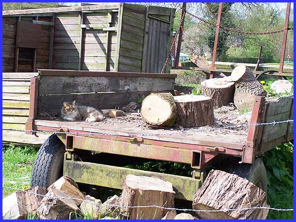
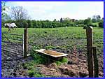
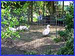 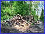 That
rural appearance is greatly enhanced by these three views just
a few steps onto the bridleway. There are geese in the farmyard
(left), a large wood pile following felling work in the wood
(right) and the farm cat lying in the shade from the sun on the
back of a farm trailer (above). Although not to be seen or heard
here, there was also a cockerel crowing in one of the nearby
chicken sheds. That
rural appearance is greatly enhanced by these three views just
a few steps onto the bridleway. There are geese in the farmyard
(left), a large wood pile following felling work in the wood
(right) and the farm cat lying in the shade from the sun on the
back of a farm trailer (above). Although not to be seen or heard
here, there was also a cockerel crowing in one of the nearby
chicken sheds.
|
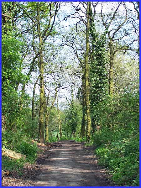
  After
passing the farm buildings the bridleway continues towards Ilkeston
through alternate shady and clear patches. Although in close
proximity to built up areas it's easy to think you are deep in
the countryside. We saw a hare, horses in the fields, magpies
on the path, a rabbit, and with forget-me-nots growing wild among
the trees there were, no doubt, numerous other creatures all
around. After
passing the farm buildings the bridleway continues towards Ilkeston
through alternate shady and clear patches. Although in close
proximity to built up areas it's easy to think you are deep in
the countryside. We saw a hare, horses in the fields, magpies
on the path, a rabbit, and with forget-me-nots growing wild among
the trees there were, no doubt, numerous other creatures all
around.
|
Eventually the bridleway is crossed by a lane leading down to
a number of properties collectively known as The Brook sitting
alongside as they do, Mapperley Brook. We could have followed
this lane and continued into Mapperley Village or turned right
and followed the lane uphill to the High Lane adjacent to the
Newdigate Inn. But on this occasion with the sun shine beating
down on us (not that we were complaining) we opted to retrace
our steps back to Mapperley Lane along the shady bridleway.
|
