Beeston Rylands Circular - Part 02
w/e 30 June 2013
All this week's pictures were taken
with a Kodak DX6490
This second part of the walk took us from the Beeston
Canal to the bank of the River Trent which we followed back to
the canal at Beeston Lock and then along Canal Side. The whole
route can be seen in this aerial view.
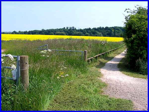
We turned our backs on the Beeston Canal where the former steps
had crossed the wall and followed the footpath through the fields
where the rapeseed was flowering brightly. The trees in the distance
mark the extent of the path and also the position of the River
Trent.
|
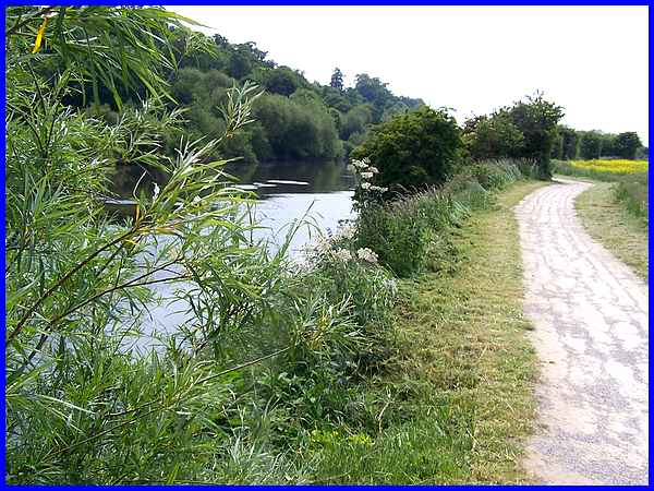
On reaching the Trent we turned right to follow the path by the
river which has recently been resurfaced, fields of rapeseed
now on the right.
|
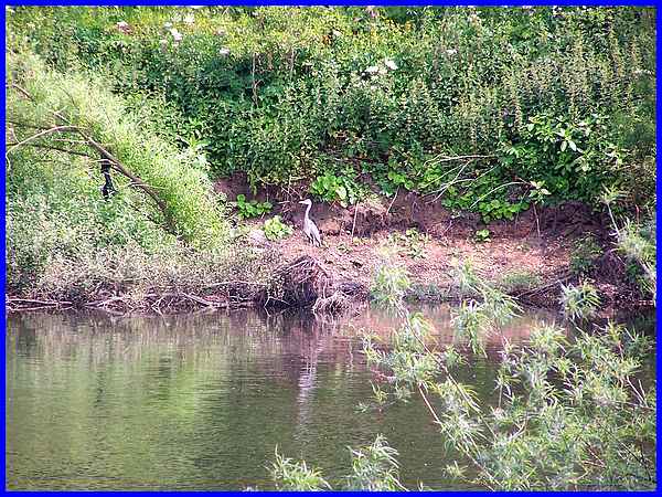
As we walked along the riverside the growth of bushes, trees
and other vegetation between the path and the river increased
and permitted only sporadic views across the water but through
one gap we spotted another heron - or it could have been the
same one that had flown over from the canal that we had seen
earlier.
|
The route we followed is described in a booklet and it says that
the path can be quite muddy and although it was dry on this occasion,
there were parts of it where the newly laid surface had been
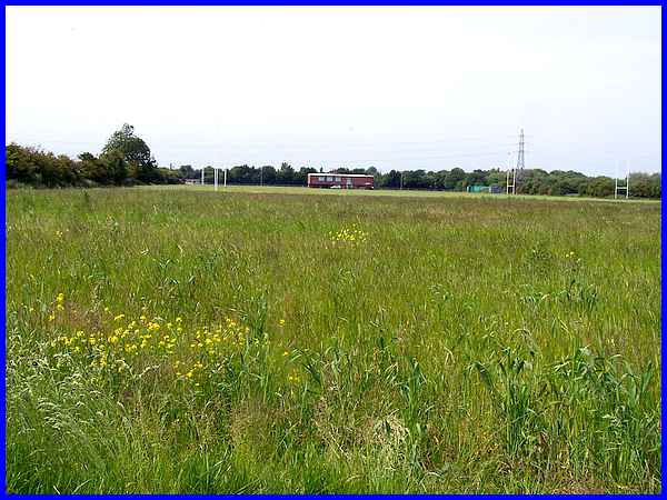
washed away. The description also says to continue along the
path through a sports field with a pavilion - which can be seen
here in the distance on the far side of the field close to the
canal.
|
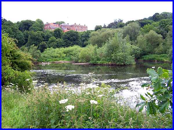
As we continued along the path from the sports field the river
is only seen intermittently through gaps in the flora but through
one of them the imposing sight of Clifton Hall on the far side
also came into view. At the time of publication of the booklet
Clifton Hall was part of Nottingham Trent University but it was
sold into private hands in the early 2000s and has changed hands
again since then.
|
From the view of the Hall, the river's meandering turned it towards
the canal and we lost sight of it altogether due to the dense
growth between the path and the river until we reached the Weir
Fields Recreation Ground. Although we couldn't see it along this
stretch we could however hear a muffled roar that gradually increased
in volume as we walked.
|
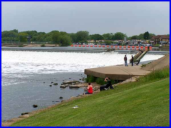
At the recreation ground the cause of the sound appeared - the
Beeston Weir. The orange barricade across the river guides vessels
approaching the weir into the canal which takes them through
Beeston and Nottingham to rejoin the Trent beyond the weir and
the shallows on this part of the river.
|
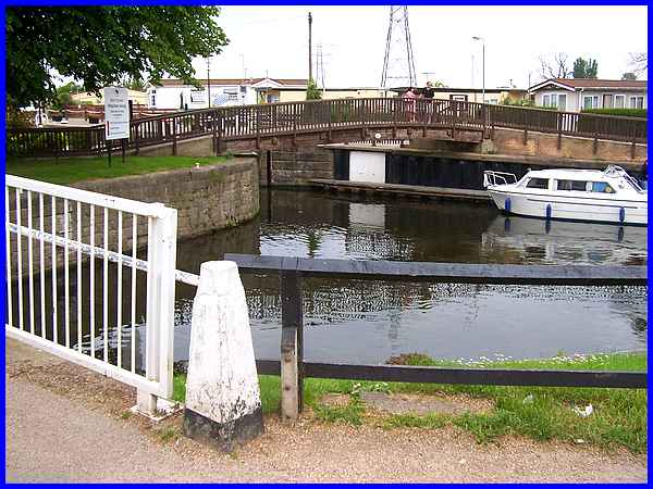
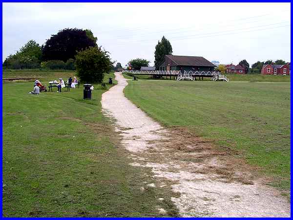
Since the start of the walk the sky had clouded over and the
temperature risen and it had really become quite humid but passing
through the recreation ground we crossed two bridges over the
canal, both of which can be seen here, to reach Beeston Lock.
|
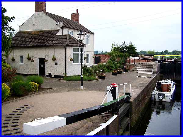
The Lock Keeper's Cottage at Beeston Lock is well cared for but
other adjacent cottages are in need of renovation. All is not
lost though as I understand that funding has been secured by
the Canalside Heritage Centre project from the
Heritage Lottery Fund to help prepare plans for a full grant
application by March 2014. A successful bid would enable the
cottages to be restored where it is hoped to create a Canal Museum.
|
From Beeston Lock there is a connecting path by the Trent to
link up with another walk in the booklet around Attenborough
Nature Reserve, a place we have visited several times previously
but to complete this Beeston Rylands Circular we turned the opposite
way to walk along Canal Side back to where we had parked.
|
