The Dragonfly Trail - Part 01
w/e 07 March 2010
All this week's pictures were taken
with a Kodak DX6490
The Dragonfly Trail is the seventeenth in a series
of leaflets of Country Walks in and around Erewash. It is approximately
four and a half miles in length and is described as "a gentle
stroll along the canals around Ilkeston" that takes two
and a half to three hours to complete. It is a circular route
that starts and ends at Gallows Inn Playing Fields and can be
split into three distinct sections. The outward leg is along
the Erewash Canal with the middle third through Cossall Village
before returning along the Nottingham Canal. As I covered the
Erewash Canal in some detail last year in the "Lock to Lock"
series and the return along the Nottingham Canal in a 2008 "Sentimental
Journey" I do not intend to repeat those parts of the route
but will include links to those pages so that the complete route
of the Dragonfly Trail can be followed. The images on this page
and in Part 02 will concentrate on the middle section of the
walk.
Leaving the Gallows Inn Playing Field the route follows Nottingham
Road to join the Erewash Canal at Gallows Inn Lock where it heads
north along the towpath as far as Station Road. That part of
the route can be seen on these pages each of which will open
in a new window or tab:
Gallows
Inn to Green's Lock
Green's
Lock to Potter's Lock
Potter's
Lock to Station Road
So on a bright and frosty morning we pick up the Trail on Station
Road at the top of the steps from the canal and turn right to
head towards Ilkeston Junction, Awsworth and Cossall.
|
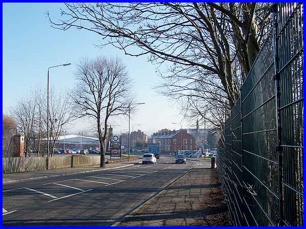
After passing over the River Erewash the road rises up
and over the railway lines at Ilkeston Junction. This is where
one of Ilkeston's former railway stations was situated and although
the town has not had one since 1967 there is currently a campaign
to to bring a train station back to Ilkeston
|
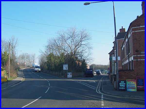
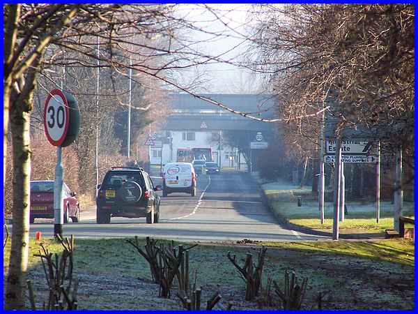
When the Dragonfly Trail leaflet was first published the map
showing the route indicated that it continued in a straight line
from the railway bridge along Coronation Road but since that
initial publication the Awsworth Bypass and Millership Way, the
new link road into Ilkeston, have been constructed and Coronation
Road has been diverted to a new traffic island seen here on the
extreme left. This area has now been landscaped but the line
of the old road is still visible.
|
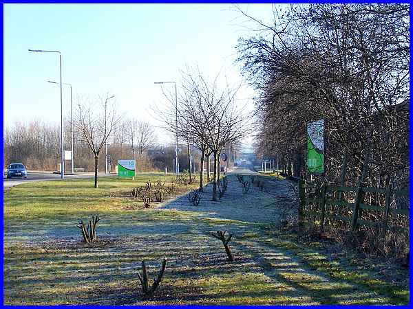
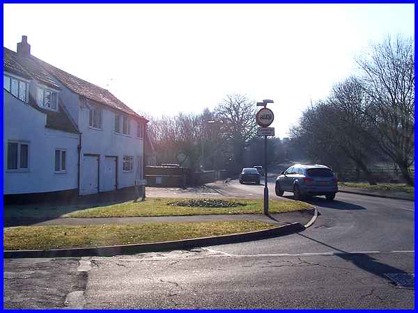
The safest way to access Coronation Road is via the pedestrian
refuges at the island but from a similar position to the previous
image, this zoomed shot foreshortens the whole length of the
road and also shows the double bridge where the Nottingham Canal
crosses at the far end. The right hand side of the road is now
an industrial estate but was formerly the site of Cossall Colliery.
|
At the end of Coronation Road our route is to turn right to follow
Church Lane up the hill towards Cossall Village. This area is
known as Cossall Marsh.
|
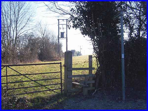
About two hundred yards up Church Lane and just before the houses
in the village start, there is a signpost indicating a footpath
and a stile in the hedgerow leads into the fields behind the
houses.
|
The footpath across the fields is not very well defined so it
is a case of heading diagonally across three fields and looking
for the next stile, taking care not to disturb the horses on
the way. Another aid to navigation is the church spire in the
centre of the village.
|
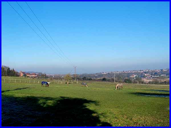
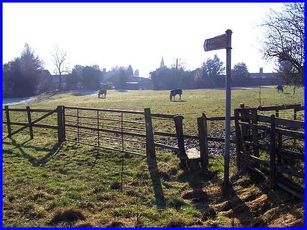
As I reached the village I paused to look back across the fields.
The line of the path is directly across this field to the electricity
pole in the corner but heeding my own advice about the horses,
I actually walked around the edge of the field but they showed
little interest in me anyway.
|
